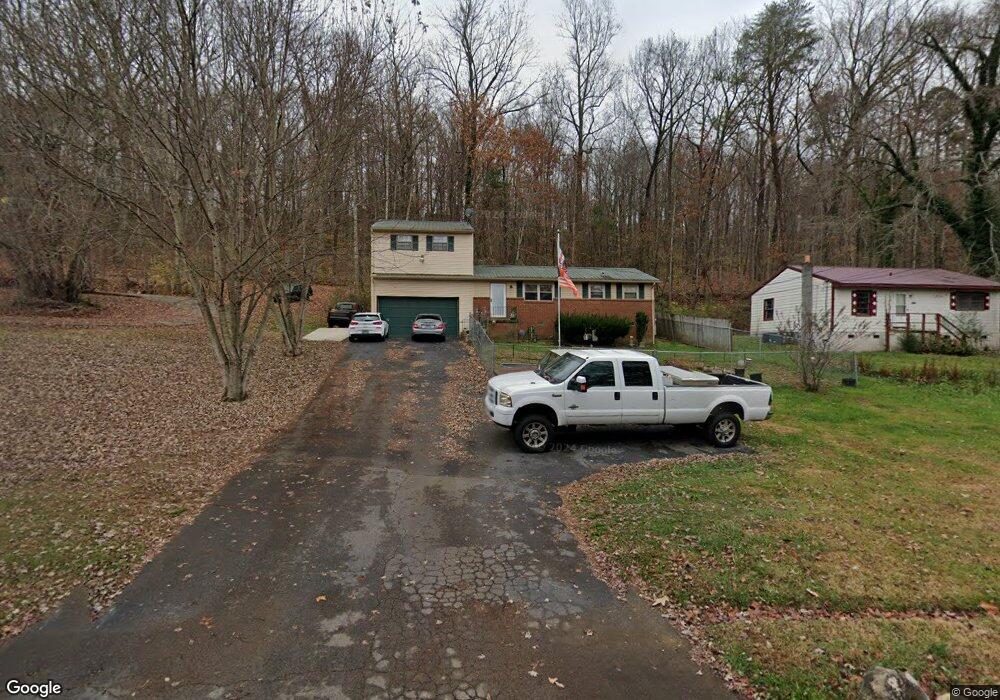
2300 Rifle Range Rd Knoxville, TN 37918
Uptown Knoxville NeighborhoodEstimated Value: $244,000 - $312,000
3
Beds
1
Bath
1,550
Sq Ft
$176/Sq Ft
Est. Value
About This Home
This home is located at 2300 Rifle Range Rd, Knoxville, TN 37918 and is currently estimated at $272,188, approximately $175 per square foot. 2300 Rifle Range Rd is a home located in Knox County with nearby schools including Adrian Burnett Elementary School, Halls Middle School, and St Joseph School.
Ownership History
Date
Name
Owned For
Owner Type
Purchase Details
Closed on
Aug 27, 2018
Sold by
Gdp Properties Llc
Bought by
Sexton Jessica B and Wakely Carl L
Current Estimated Value
Home Financials for this Owner
Home Financials are based on the most recent Mortgage that was taken out on this home.
Original Mortgage
$95,950
Outstanding Balance
$83,502
Interest Rate
4.5%
Mortgage Type
New Conventional
Estimated Equity
$188,686
Purchase Details
Closed on
Jul 16, 2018
Sold by
Mcginnis Patricia Dine
Bought by
Gdp Properties Llc
Home Financials for this Owner
Home Financials are based on the most recent Mortgage that was taken out on this home.
Original Mortgage
$95,950
Outstanding Balance
$83,502
Interest Rate
4.5%
Mortgage Type
New Conventional
Estimated Equity
$188,686
Purchase Details
Closed on
May 3, 2018
Sold by
Mcginnis Gregory Lee
Bought by
Mcginnis Patricia Diane
Create a Home Valuation Report for This Property
The Home Valuation Report is an in-depth analysis detailing your home's value as well as a comparison with similar homes in the area
Home Values in the Area
Average Home Value in this Area
Purchase History
| Date | Buyer | Sale Price | Title Company |
|---|---|---|---|
| Sexton Jessica B | $101,000 | Admiral Title Inc | |
| Gdp Properties Llc | $68,700 | Admiral Title Inc | |
| Mcginnis Patricia Diane | -- | None Available |
Source: Public Records
Mortgage History
| Date | Status | Borrower | Loan Amount |
|---|---|---|---|
| Open | Sexton Jessica B | $95,950 |
Source: Public Records
Tax History Compared to Growth
Tax History
| Year | Tax Paid | Tax Assessment Tax Assessment Total Assessment is a certain percentage of the fair market value that is determined by local assessors to be the total taxable value of land and additions on the property. | Land | Improvement |
|---|---|---|---|---|
| 2024 | $646 | $41,575 | $0 | $0 |
| 2023 | $646 | $41,575 | $0 | $0 |
| 2022 | $646 | $41,575 | $0 | $0 |
| 2021 | $438 | $20,650 | $0 | $0 |
| 2020 | $438 | $20,650 | $0 | $0 |
| 2019 | $438 | $20,650 | $0 | $0 |
| 2018 | $438 | $20,650 | $0 | $0 |
| 2017 | $438 | $20,650 | $0 | $0 |
| 2016 | $441 | $0 | $0 | $0 |
| 2015 | $441 | $0 | $0 | $0 |
| 2014 | $441 | $0 | $0 | $0 |
Source: Public Records
Map
Nearby Homes
- 6025 Medlin Heights Rd
- 2601 Rifle Range Rd
- 6112 Northcrest Cir NE
- 6009 Medlin Heights Rd
- 0 NE Snowood Dr Unit 1303936
- 2705 Rifle Range Dr
- 5855 Fairhill Ln
- 5821 Fountain Rd
- 6018 Nottingham Rd
- 2024 Bernhurst Dr
- 826 Gresham Rd
- 320 Dahlia Dr
- 314 Dahlia Dr
- 2510 Bernhurst Dr
- 2839 Rifle Range Dr
- 5610 Radnor Rd
- 2601 Fenwood Dr
- 1636 Cabernet Ln
- 2400 Fenwood Dr
- 1716 Doningham Dr
- 2300 Rifle Range Dr
- 2296 Rifle Range Rd
- 2308 Rifle Range Rd
- 2216 Rifle Range Rd
- 2212 Rifle Range Dr
- 2212 Rifle Range Rd
- 2312 Rifle Range Rd
- 2208 Rifle Range Rd
- 2316 Rifle Range Rd
- 2206 Rifle Range Dr
- 2206 Rifle Range Rd
- 2320 Rifle Range Rd
- 2204 Rifle Range Dr
- 2204 Rifle Range Rd
- 2324 Rifle Range Rd
- 2313 Belcaro Dr
- 2309 Belcaro Dr
- 2305 Belcaro Dr
- 2328 Rifle Range Rd
- 2301 Belcaro Dr