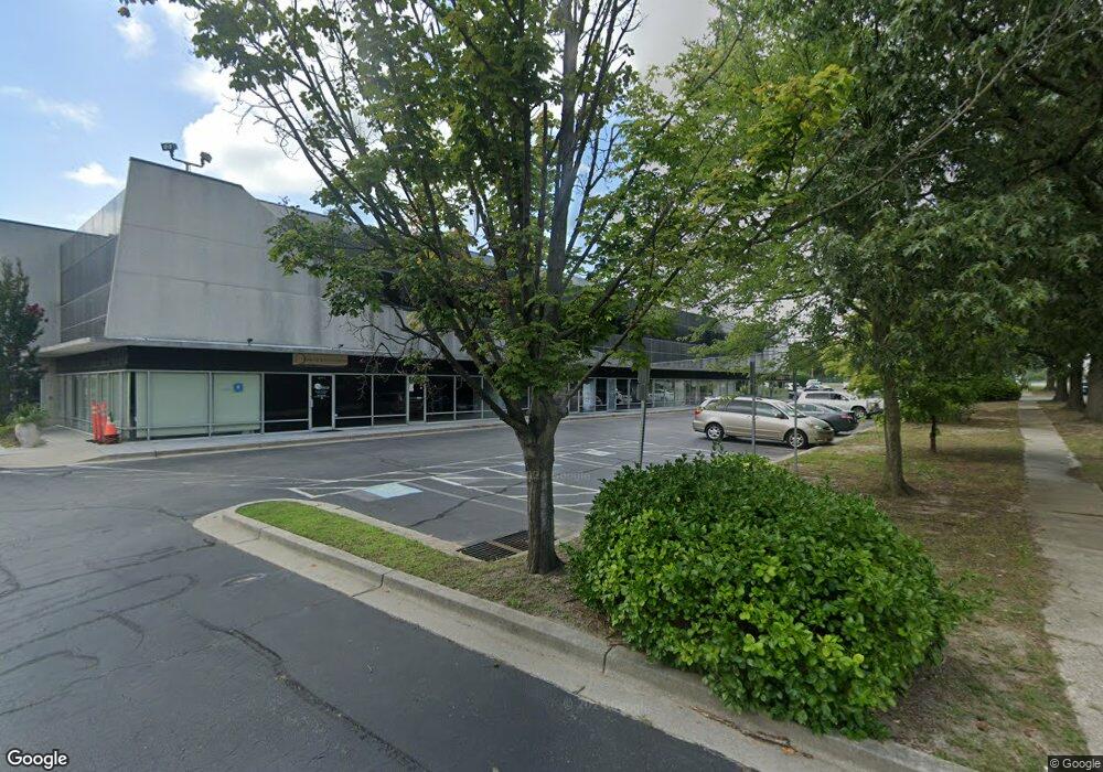
2301 Dorsey Rd Glen Burnie, MD 21061
--
Bed
--
Bath
34,364
Sq Ft
5.66
Acres
About This Home
This home is located at 2301 Dorsey Rd, Glen Burnie, MD 21061. 2301 Dorsey Rd is a home located in Anne Arundel County with nearby schools including Richard Henry Lee Elementary School, Corkran Middle School, and Glen Burnie High School.
Ownership History
Date
Name
Owned For
Owner Type
Purchase Details
Closed on
Aug 25, 1992
Sold by
Empire Corp
Bought by
Airport South Corp
Home Financials for this Owner
Home Financials are based on the most recent Mortgage that was taken out on this home.
Original Mortgage
$550,000
Interest Rate
7.87%
Purchase Details
Closed on
Nov 18, 1987
Sold by
Geico Corp
Bought by
Empire Corp
Home Financials for this Owner
Home Financials are based on the most recent Mortgage that was taken out on this home.
Original Mortgage
$1,600,000
Interest Rate
10.66%
Create a Home Valuation Report for This Property
The Home Valuation Report is an in-depth analysis detailing your home's value as well as a comparison with similar homes in the area
Home Values in the Area
Average Home Value in this Area
Purchase History
| Date | Buyer | Sale Price | Title Company |
|---|---|---|---|
| Airport South Corp | $950,000 | -- | |
| Empire Corp | $2,300,000 | -- |
Source: Public Records
Mortgage History
| Date | Status | Borrower | Loan Amount |
|---|---|---|---|
| Closed | Airport South Corp | $550,000 | |
| Previous Owner | Empire Corp | $1,600,000 |
Source: Public Records
Tax History Compared to Growth
Tax History
| Year | Tax Paid | Tax Assessment Tax Assessment Total Assessment is a certain percentage of the fair market value that is determined by local assessors to be the total taxable value of land and additions on the property. | Land | Improvement |
|---|---|---|---|---|
| 2025 | $50,731 | $4,245,500 | $1,471,600 | $2,773,900 |
| 2024 | $50,731 | $4,138,967 | $0 | $0 |
| 2023 | $49,185 | $4,032,433 | $0 | $0 |
| 2022 | $45,932 | $3,925,900 | $1,471,600 | $2,454,300 |
| 2021 | $95,723 | $4,110,567 | $0 | $0 |
| 2020 | $47,012 | $4,020,233 | $0 | $0 |
| 2019 | $43,432 | $3,929,900 | $1,698,000 | $2,231,900 |
| 2018 | $42,178 | $4,159,600 | $0 | $0 |
| 2017 | $45,353 | $4,237,333 | $0 | $0 |
| 2016 | -- | $3,582,200 | $0 | $0 |
| 2015 | -- | $3,420,700 | $0 | $0 |
| 2014 | -- | $4,306,167 | $0 | $0 |
Source: Public Records
Map
Nearby Homes
- 2421 Peppermill Dr
- 535 Arundel Ave
- 0 Jeffrey Ave Unit MDAA2115638
- 672 Queenstown Rd
- 771 Queenstown Rd
- 7560 Old Telegraph Rd
- 7633 Amos Ave
- 7406 Locust Dr
- 511 Jones Rd
- 7317 Musical Way
- 0 Musical Way
- 479 Cedar Ln
- 911 S Wieker Rd
- 7534 Honey Locust Ln
- 7715 Pecan Leaf Rd
- 1102 Bayberry Ln
- 1010 Tuscany Ln
- 7735 Venice Ln
- 911 Meadowbrook Rd
- 7871 Chestnut Leaf Rd
- 2301 Dorsey Rd Unit 213
- 2301 Dorsey Rd Unit 106 B
- 2301 Dorsey Rd Unit 106 A
- 2301 Dorsey Rd Unit 216
- 2301 Dorsey Rd Unit 110-111
- 2301 Dorsey Rd Unit 106C
- 2301 Dorsey Rd Unit 106 E
- 2301 Dorsey Rd Unit 106D
- 2301 Dorsey Rd Unit 102-103-106
- 2301 Dorsey Rd Unit 102-01
- 2301 Dorsey Rd Unit 102-10
- 2301 Dorsey Rd Unit 104
- 2301 Dorsey Rd Unit 201
- 2301 Dorsey Rd Unit 102-09
- 2301 Dorsey Rd Unit 102-110
- 2301 Dorsey Rd Unit 102-04
- 2301 Dorsey Rd Unit 106-AA
- 2301 Dorsey Rd Unit 102-07
- 2301 Dorsey Rd Unit 102-02
- 2301 Dorsey Rd Unit 110