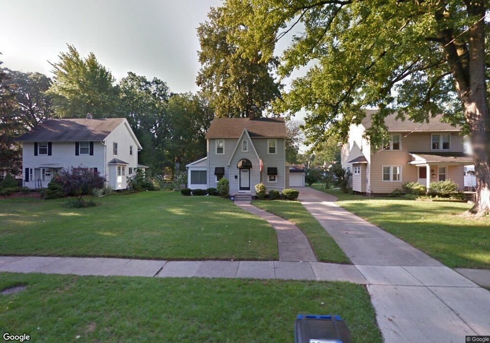
2303 Westbrook Dr Toledo, OH 43613
DeVeaux NeighborhoodEstimated Value: $182,207 - $209,000
4
Beds
1
Bath
1,609
Sq Ft
$121/Sq Ft
Est. Value
About This Home
This home is located at 2303 Westbrook Dr, Toledo, OH 43613 and is currently estimated at $195,302, approximately $121 per square foot. 2303 Westbrook Dr is a home located in Lucas County with nearby schools including DeVeaux Elementary School, Start High School, and Horizon Science Academy - Toledo High School.
Ownership History
Date
Name
Owned For
Owner Type
Purchase Details
Closed on
Jul 25, 2014
Sold by
Matthews Joseph P and Matthews Joseph Patrick
Bought by
Tressler Robert S and Tressler Marci L
Current Estimated Value
Home Financials for this Owner
Home Financials are based on the most recent Mortgage that was taken out on this home.
Original Mortgage
$99,900
Interest Rate
4.2%
Mortgage Type
Future Advance Clause Open End Mortgage
Create a Home Valuation Report for This Property
The Home Valuation Report is an in-depth analysis detailing your home's value as well as a comparison with similar homes in the area
Home Values in the Area
Average Home Value in this Area
Purchase History
| Date | Buyer | Sale Price | Title Company |
|---|---|---|---|
| Tressler Robert S | $111,000 | Perrysburg Title |
Source: Public Records
Mortgage History
| Date | Status | Borrower | Loan Amount |
|---|---|---|---|
| Closed | Tressler Robert S | $99,900 |
Source: Public Records
Tax History Compared to Growth
Tax History
| Year | Tax Paid | Tax Assessment Tax Assessment Total Assessment is a certain percentage of the fair market value that is determined by local assessors to be the total taxable value of land and additions on the property. | Land | Improvement |
|---|---|---|---|---|
| 2024 | $1,446 | $47,495 | $7,385 | $40,110 |
| 2023 | $2,588 | $40,635 | $7,000 | $33,635 |
| 2022 | $2,596 | $40,635 | $7,000 | $33,635 |
| 2021 | $2,662 | $40,635 | $7,000 | $33,635 |
| 2020 | $2,576 | $34,720 | $6,020 | $28,700 |
| 2019 | $2,506 | $34,720 | $6,020 | $28,700 |
| 2018 | $2,552 | $34,720 | $6,020 | $28,700 |
| 2017 | $2,617 | $34,440 | $6,335 | $28,105 |
| 2016 | $2,612 | $98,400 | $18,100 | $80,300 |
| 2015 | $2,588 | $98,400 | $18,100 | $80,300 |
| 2014 | $2,166 | $34,450 | $6,340 | $28,110 |
| 2013 | $2,166 | $34,450 | $6,340 | $28,110 |
Source: Public Records
Map
Nearby Homes
- 2316 Westbrook Dr
- 4318 Bellevue Rd
- 2149 Westbrook Dr
- 2409 Lambert Dr
- 2408 Lambert Dr
- 2227 Castlewood Dr
- 4220 Douglas Rd
- 2513 Grantwood Dr
- 4015 Roanoke Rd
- 4128 Douglas Rd
- 2285 Fitkin St
- 2310 Tremainsville Rd
- 2344 Mellwood Ave
- 2640 Westbrook Dr
- 2645 Grantwood Dr
- 1861 Tremainsville Rd
- 2002 Brame Place
- 2224 Olin Dr
- 2447 Portsmouth Ave
- 4440 Woodmont Rd
- 2309 Westbrook Dr
- 2261 Westbrook Dr
- 2311 Westbrook Dr
- 2255 Westbrook Dr
- 2315 Westbrook Dr
- 2319 Westbrook Dr
- 2249 Westbrook Dr
- 2306 Grantwood Dr
- 2314 Grantwood Dr
- 2302 Grantwood Dr
- 2320 Grantwood Dr
- 2266 Grantwood Dr
- 2325 Westbrook Dr
- 2326 Grantwood Dr
- 2332 Grantwood Dr
- 2260 Grantwood Dr
- 2245 Westbrook Dr
- 2306 Westbrook Dr
- 2264 Westbrook Dr
- 2310 Westbrook Dr