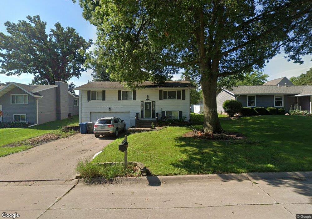
2304 W Grove Blvd Muscatine, IA 52761
Estimated Value: $247,000 - $255,000
3
Beds
3
Baths
1,260
Sq Ft
$199/Sq Ft
Est. Value
About This Home
This home is located at 2304 W Grove Blvd, Muscatine, IA 52761 and is currently estimated at $251,319, approximately $199 per square foot. 2304 W Grove Blvd is a home located in Muscatine County with nearby schools including Mulberry Elementary School, Susan Clark Junior High School, and Muscatine High School.
Ownership History
Date
Name
Owned For
Owner Type
Purchase Details
Closed on
Jun 7, 2011
Sold by
Meyers Sheila D
Bought by
Whitlock Judy L
Current Estimated Value
Purchase Details
Closed on
Jun 28, 2007
Sold by
Norton Jason K and Norton Suzanne M
Bought by
Meyers Sheila D
Home Financials for this Owner
Home Financials are based on the most recent Mortgage that was taken out on this home.
Original Mortgage
$108,675
Interest Rate
6.26%
Mortgage Type
New Conventional
Create a Home Valuation Report for This Property
The Home Valuation Report is an in-depth analysis detailing your home's value as well as a comparison with similar homes in the area
Home Values in the Area
Average Home Value in this Area
Purchase History
| Date | Buyer | Sale Price | Title Company |
|---|---|---|---|
| Whitlock Judy L | $150,000 | None Available | |
| Meyers Sheila D | $145,000 | None Available |
Source: Public Records
Mortgage History
| Date | Status | Borrower | Loan Amount |
|---|---|---|---|
| Previous Owner | Meyers Sheila D | $108,675 |
Source: Public Records
Tax History Compared to Growth
Tax History
| Year | Tax Paid | Tax Assessment Tax Assessment Total Assessment is a certain percentage of the fair market value that is determined by local assessors to be the total taxable value of land and additions on the property. | Land | Improvement |
|---|---|---|---|---|
| 2025 | $3,968 | $237,160 | $32,240 | $204,920 |
| 2024 | $3,968 | $237,570 | $32,240 | $205,330 |
| 2023 | $3,792 | $236,910 | $32,288 | $204,622 |
| 2022 | $3,670 | $200,930 | $30,460 | $170,470 |
| 2021 | $3,670 | $179,830 | $30,460 | $149,370 |
| 2020 | $3,698 | $179,830 | $30,460 | $149,370 |
| 2019 | $3,572 | $161,690 | $0 | $0 |
| 2018 | $3,524 | $161,690 | $0 | $0 |
| 2017 | $3,524 | $154,400 | $0 | $0 |
| 2016 | $3,492 | $154,400 | $0 | $0 |
| 2015 | $3,492 | $150,450 | $0 | $0 |
| 2014 | $3,424 | $150,450 | $0 | $0 |
Source: Public Records
Map
Nearby Homes
- 2106 Clarabek St
- 2108 Clarabek St
- 2018 W Bay Dr
- 35 Colony Dr
- CEDAR Plaza Parcel
- 3 Wilson Dr
- 1617 W Acre Dr
- 1619 Devitt Ave
- 2109 Americana Ave
- 297 Burnside Ave
- PARCEL ID 0834280023 Dillaway St
- LOT 6 Fridley Subdivision
- 602 W Fulliam Ave
- 1506 Buell St
- 1604 Duncan Dr
- 310 Wood Creek Ln
- 1507 Duncan Dr
- 1416 Duncan Dr
- 3103 Ginkgo Ln
- 205 Amherst Ave
- 2302 W Grove Blvd
- 2306 W Grove Blvd
- 2224 Forest Pkwy
- 2225 Imperial Oaks Dr
- 2221 Imperial Oaks Dr
- 2305 W Grove Blvd
- 2220 Forest Pkwy
- 2301 W Grove Blvd
- 2309 W Grove Blvd
- 2217 Imperial Oaks Dr
- 2231 Forest Pkwy
- 2227 Forest Pkwy
- 2216 Forest Pkwy
- 2306 Forest Pkwy
- 2305 Imperial Oaks Dr
- 2223 Forest Pkwy
- 2301 Forest Pkwy
- 2213 Imperial Oaks Dr
- 2219 Forest Pkwy
- 2230 Imperial Oaks Dr