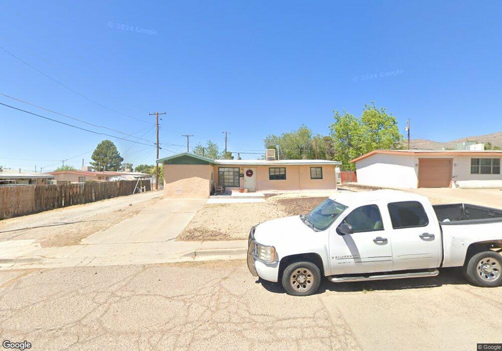
2305 Rolland Ave Alamogordo, NM 88310
Estimated Value: $138,823 - $172,000
3
Beds
2
Baths
1,360
Sq Ft
$115/Sq Ft
Est. Value
About This Home
This home is located at 2305 Rolland Ave, Alamogordo, NM 88310 and is currently estimated at $155,956, approximately $114 per square foot. 2305 Rolland Ave is a home located in Otero County with nearby schools including Yucca Elementary School, Sunset Hills Elementary, and Mountain View Middle School.
Ownership History
Date
Name
Owned For
Owner Type
Purchase Details
Closed on
Jan 23, 2023
Sold by
Reese Elaine N
Bought by
Lawhorn Jeanette
Current Estimated Value
Purchase Details
Closed on
Aug 31, 2007
Sold by
Darrow Kevin B
Bought by
Crabbe Beth R
Home Financials for this Owner
Home Financials are based on the most recent Mortgage that was taken out on this home.
Original Mortgage
$58,050
Interest Rate
6.72%
Mortgage Type
Purchase Money Mortgage
Purchase Details
Closed on
Jul 25, 2000
Sold by
Darrow April Dee
Bought by
Darrow Kevin B
Create a Home Valuation Report for This Property
The Home Valuation Report is an in-depth analysis detailing your home's value as well as a comparison with similar homes in the area
Home Values in the Area
Average Home Value in this Area
Purchase History
| Date | Buyer | Sale Price | Title Company |
|---|---|---|---|
| Lawhorn Jeanette | -- | -- | |
| Crabbe Beth R | -- | None Available | |
| Darrow Kevin B | -- | None Available |
Source: Public Records
Mortgage History
| Date | Status | Borrower | Loan Amount |
|---|---|---|---|
| Previous Owner | Crabbe Beth R | $58,050 |
Source: Public Records
Tax History Compared to Growth
Tax History
| Year | Tax Paid | Tax Assessment Tax Assessment Total Assessment is a certain percentage of the fair market value that is determined by local assessors to be the total taxable value of land and additions on the property. | Land | Improvement |
|---|---|---|---|---|
| 2025 | $706 | $27,677 | $4,193 | $23,484 |
| 2024 | $682 | $26,871 | $3,916 | $22,955 |
| 2023 | $674 | $26,089 | $3,667 | $22,422 |
| 2022 | $633 | $24,310 | $3,643 | $20,667 |
| 2021 | $622 | $23,602 | $3,643 | $19,959 |
| 2020 | $622 | $23,602 | $3,643 | $19,959 |
| 2019 | $613 | $23,139 | $3,571 | $19,568 |
| 2018 | $597 | $22,910 | $3,536 | $19,372 |
| 2017 | $549 | $22,461 | $3,466 | $18,992 |
| 2016 | $535 | $22,021 | $0 | $0 |
| 2015 | $524 | $21,589 | $0 | $0 |
| 2014 | -- | $21,166 | $3,267 | $17,899 |
Source: Public Records
Map
Nearby Homes
- 600 Boyce Ave
- 403 Spruce Ave
- 2100 Stardust Ct
- 1708 Mountain View Ave
- 600 Adams Ave
- 1702 Mountain View Ave
- 1603 Bellamah Ave
- 1007 Bellamah Dr
- 909 Cedar Ave
- 1804 E 8th St
- 1003 Scenic Dr
- 2511 Eastridge Dr
- 1105 Hendrix Ave
- 609 Sunrise Ave Unit 1
- 1503 Wilson Ave
- 2100 E 12th St
- 1206 Bellamah Dr
- 215 Shadow Mountain Dr
- 1201 Maple Dr
- 1201 Juniper Dr
- 2307 Rolland Ave
- 2307 Rolland Ave Unit 1
- 502 Boyce Ave
- 504 Boyce Ave
- 2304 Telles Ave
- 2309 Rolland Ave
- 2306 Telles Ave
- 2304 Rolland Ave
- 508 Boyce Ave
- 2306 Rolland Ave
- 406 Boyce Ave
- 406 Boyce Ave Unit 1
- 2308 Telles Ave
- 2308 Rolland Ave
- 2310 Telles Ave
- 2310 Rolland Ave
- 404 Boyce Ave
- 503 Boyce Ave
- 2313 Rolland Ave
- 505 Boyce Ave