Estimated Value: $328,932 - $361,000
Studio
3
Baths
2,662
Sq Ft
$128/Sq Ft
Est. Value
About This Home
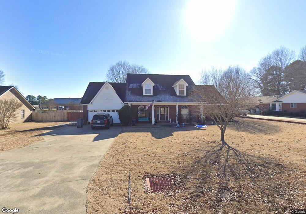
This home is located at 2307 Aaron Rd, Beebe, AR 72012 and is currently estimated at $341,733, approximately $128 per square foot. 2307 Aaron Rd is a home located in White County with nearby schools including Beebe Elementary School, Beebe Junior High School, and Beebe Middle School.
Ownership History
Date
Name
Owned For
Owner Type
Purchase Details
Closed on
Oct 30, 2009
Sold by
Gillett Denman L and Gillett Hazel S
Bought by
Guthrie David D and Guthrie Liane
Current Estimated Value
Home Financials for this Owner
Home Financials are based on the most recent Mortgage that was taken out on this home.
Original Mortgage
$205,567
Outstanding Balance
$134,433
Interest Rate
5.03%
Mortgage Type
VA
Estimated Equity
$207,300
Purchase Details
Closed on
May 21, 2002
Bought by
Gillett Denman L and Gillett Hazel S
Purchase Details
Closed on
Feb 12, 1999
Bought by
Deaton Michael C and Deaton Sharon L
Purchase Details
Closed on
Nov 1, 1992
Bought by
Long Ii Everette J and Long Mary C
Create a Home Valuation Report for This Property
The Home Valuation Report is an in-depth analysis detailing your home's value as well as a comparison with similar homes in the area
Purchase History
| Date | Buyer | Sale Price | Title Company |
|---|---|---|---|
| Guthrie David D | $199,000 | -- | |
| Gillett Denman L | $159,000 | -- | |
| Deaton Michael C | $143,000 | -- | |
| Long Ii Everette J | $115,000 | -- |
Source: Public Records
Mortgage History
| Date | Status | Borrower | Loan Amount |
|---|---|---|---|
| Open | Guthrie David D | $205,567 |
Source: Public Records
Tax History
| Year | Tax Paid | Tax Assessment Tax Assessment Total Assessment is a certain percentage of the fair market value that is determined by local assessors to be the total taxable value of land and additions on the property. | Land | Improvement |
|---|---|---|---|---|
| 2025 | $1,975 | $50,670 | $7,680 | $42,990 |
| 2024 | $2,061 | $50,670 | $7,680 | $42,990 |
| 2023 | $1,550 | $50,670 | $7,680 | $42,990 |
| 2022 | $1,515 | $50,670 | $7,680 | $42,990 |
| 2021 | $1,429 | $50,670 | $7,680 | $42,990 |
| 2020 | $1,343 | $40,420 | $4,840 | $35,580 |
| 2019 | $1,343 | $40,420 | $4,840 | $35,580 |
| 2018 | $1,368 | $40,420 | $4,840 | $35,580 |
| 2017 | $1,633 | $40,420 | $4,840 | $35,580 |
| 2016 | $1,633 | $38,420 | $4,840 | $33,580 |
| 2015 | $1,555 | $36,590 | $5,400 | $31,190 |
| 2014 | -- | $36,590 | $5,400 | $31,190 |
Source: Public Records
Map
Nearby Homes
- 000 Offspring Pineview
- 00 Offspring Pineview
- 404 Galina St
- 115 James Dr
- 106 Prairie Dr
- 127 Dugger Rd
- 6126 Hwy 367 Unit W. Dewitt Henry
- 00 Duane Dr
- 108 Hunter Cir
- 152 Pine View Dr
- 314-320 Campbell Dr
- 322 Campbell Dr
- 101 Jasmine Ct
- 2080 W Dewitt Henry Dr
- 111 Jasmine Ct
- 103 Jasmine Ct
- 104 Jasmine Ct
- 105 Jasmine Ct
- 107 Jasmine Ct
- 235 Dugger Rd
Your Personal Tour Guide
Ask me questions while you tour the home.