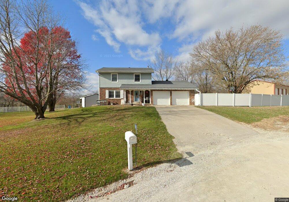
23079 206th Ave Sigourney, IA 52591
Estimated Value: $265,000 - $278,107
4
Beds
4
Baths
2,072
Sq Ft
$131/Sq Ft
Est. Value
About This Home
This home is located at 23079 206th Ave, Sigourney, IA 52591 and is currently estimated at $271,027, approximately $130 per square foot. 23079 206th Ave is a home located in Keokuk County with nearby schools including Sigourney Elementary School and Sigourney Junior/Senior High School.
Ownership History
Date
Name
Owned For
Owner Type
Purchase Details
Closed on
Aug 16, 2021
Sold by
Wilson Michael D and Wilson Morgan
Bought by
Northup Logan M and Northup Mary Kay
Current Estimated Value
Home Financials for this Owner
Home Financials are based on the most recent Mortgage that was taken out on this home.
Original Mortgage
$150,000
Outstanding Balance
$136,396
Interest Rate
2.9%
Mortgage Type
New Conventional
Estimated Equity
$134,631
Create a Home Valuation Report for This Property
The Home Valuation Report is an in-depth analysis detailing your home's value as well as a comparison with similar homes in the area
Home Values in the Area
Average Home Value in this Area
Purchase History
| Date | Buyer | Sale Price | Title Company |
|---|---|---|---|
| Northup Logan M | $190,000 | None Listed On Document |
Source: Public Records
Mortgage History
| Date | Status | Borrower | Loan Amount |
|---|---|---|---|
| Open | Northup Logan M | $150,000 |
Source: Public Records
Tax History Compared to Growth
Tax History
| Year | Tax Paid | Tax Assessment Tax Assessment Total Assessment is a certain percentage of the fair market value that is determined by local assessors to be the total taxable value of land and additions on the property. | Land | Improvement |
|---|---|---|---|---|
| 2025 | $3,330 | $331,890 | $35,980 | $295,910 |
| 2024 | $3,330 | $285,190 | $22,900 | $262,290 |
| 2023 | $2,958 | $285,190 | $22,900 | $262,290 |
| 2022 | $2,844 | $211,070 | $22,900 | $188,170 |
| 2021 | $2,844 | $211,070 | $22,900 | $188,170 |
| 2020 | $2,764 | $199,760 | $19,630 | $180,130 |
| 2019 | $2,826 | $199,760 | $0 | $0 |
| 2018 | $2,676 | $183,090 | $0 | $0 |
| 2017 | $2,676 | $183,080 | $0 | $0 |
| 2016 | $2,714 | $183,080 | $0 | $0 |
| 2015 | $2,714 | $183,290 | $0 | $0 |
| 2014 | $2,810 | $183,290 | $0 | $0 |
Source: Public Records
Map
Nearby Homes
- 908 S Main St
- 614 W Skillman St
- 616 S Stone St
- 118 W Hickory St
- 603 W Pleasant Valley St
- 415 S Main St
- 318 E Pleasant Valley St
- 404 S East St
- 707 E Pleasant Valley St
- 105 1/2 W Washington St
- 220 W Washington St
- 409 E Washington St
- 320 E Washington St
- 215 E Elm St
- 202 N West St
- 907 E South St
- 516 E Elm St
- 315 E Jackson St
- 319 E Jackson St
- 19149 Highway 92
- 20607 231st St
- 23076 206th Ave
- 23100 206th Ave
- 20697 231st St
- 23075 207th Ave
- 20650 231st St
- 20608 231st St
- 20698 231st St
- 23019 Highway 149
- 23071 207th Ave
- 20702 231st St
- 23183 207th Ave
- 23169 206th Ave
- 23193 206th Ave
- 23184 207th Ave
- 1213 S Stuart St
- 23186 207th Ave
- 20628 232nd St
- 1211 S Stuart St
- 1208 S Main St