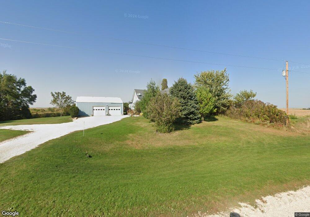
23095 Highway 128 Elkader, IA 52043
Estimated Value: $211,000 - $254,000
3
Beds
3
Baths
2,442
Sq Ft
$95/Sq Ft
Est. Value
About This Home
This home is located at 23095 Highway 128, Elkader, IA 52043 and is currently estimated at $232,213, approximately $95 per square foot. 23095 Highway 128 is a home located in Clayton County with nearby schools including Central Elementary School and Central Middle School/High School.
Ownership History
Date
Name
Owned For
Owner Type
Purchase Details
Closed on
Jan 13, 2017
Sold by
Hansel Dwight and Hansel Linda
Bought by
Mueller Nicholas J
Current Estimated Value
Home Financials for this Owner
Home Financials are based on the most recent Mortgage that was taken out on this home.
Original Mortgage
$135,850
Outstanding Balance
$111,808
Interest Rate
4.16%
Mortgage Type
New Conventional
Estimated Equity
$120,405
Create a Home Valuation Report for This Property
The Home Valuation Report is an in-depth analysis detailing your home's value as well as a comparison with similar homes in the area
Home Values in the Area
Average Home Value in this Area
Purchase History
| Date | Buyer | Sale Price | Title Company |
|---|---|---|---|
| Mueller Nicholas J | $143,000 | None Available |
Source: Public Records
Mortgage History
| Date | Status | Borrower | Loan Amount |
|---|---|---|---|
| Open | Mueller Nicholas J | $135,850 |
Source: Public Records
Tax History Compared to Growth
Tax History
| Year | Tax Paid | Tax Assessment Tax Assessment Total Assessment is a certain percentage of the fair market value that is determined by local assessors to be the total taxable value of land and additions on the property. | Land | Improvement |
|---|---|---|---|---|
| 2025 | $2,314 | $234,933 | $52,383 | $182,550 |
| 2024 | $2,368 | $198,202 | $45,550 | $152,652 |
| 2023 | $2,246 | $198,202 | $45,550 | $152,652 |
| 2022 | $2,166 | $161,489 | $40,450 | $121,039 |
| 2021 | $2,100 | $161,489 | $40,450 | $121,039 |
| 2020 | $2,100 | $151,894 | $35,400 | $116,494 |
| 2019 | $2,122 | $151,894 | $35,400 | $116,494 |
| 2018 | $2,122 | $149,109 | $35,400 | $113,709 |
| 2017 | $2,006 | $149,109 | $35,400 | $113,709 |
| 2015 | $2,038 | $170,213 | $24,300 | $145,913 |
| 2014 | $2,018 | $156,797 | $18,180 | $138,617 |
Source: Public Records
Map
Nearby Homes
- 0 13 Hwy Unit NBR20255145
- 0 E Bridge St
- 249 Franzen Ridge Rd
- 247 Franzen Ridge Rd
- 302 N 3rd St
- 117 S Main St
- 702 N Main St
- 209 2nd St SW
- 301 N 1st St
- 707 N Main St
- 710 Woodland Dr NW
- 26642 Iowa 13
- 27455 Harbor Rd
- 27766 Highway 13
- 305 S Russell St
- 108 Adams Ct
- 306 S Monroe St
- 502 S Monroe St
- 0 Grandview Rd
- TBD Country Rd
- 23228 Highway 128
- 23257 Highway 128
- 22781 Highway 128
- 23509 Highway 128
- 23260 Highway 128
- 23526 Granite Ave
- 22559 Highway 128
- 22484 Highway 128
- 23822 Highway 128
- 23822 Highway 128
- 23494 Highway 13
- 23071 250th St
- 23915 Highway 128
- 22237 Highway 128
- 22264 Highway 128
- 24033 Iowa 128
- 24033 Highway 128
- 23597 Hickory Ave
- 22467 250th St
- 22467 250th St