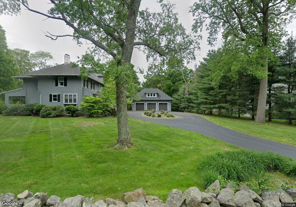
231 Atherton St Milton, MA 02186
Brush Hill NeighborhoodEstimated Value: $1,975,000 - $2,308,000
9
Beds
5
Baths
4,232
Sq Ft
$500/Sq Ft
Est. Value
About This Home
This home is located at 231 Atherton St, Milton, MA 02186 and is currently estimated at $2,117,073, approximately $500 per square foot. 231 Atherton St is a home located in Norfolk County with nearby schools including Milton High School, Boston Renaissance Charter Public School, and Delphi Academy of Boston.
Ownership History
Date
Name
Owned For
Owner Type
Purchase Details
Closed on
Aug 2, 1999
Sold by
Primrose Richard M and Primrose Susan
Bought by
Mccallum Patricia M and Mccallum Mary M
Current Estimated Value
Home Financials for this Owner
Home Financials are based on the most recent Mortgage that was taken out on this home.
Original Mortgage
$400,000
Interest Rate
7.61%
Mortgage Type
Purchase Money Mortgage
Purchase Details
Closed on
Nov 30, 1992
Sold by
Chatterjee Martha F
Bought by
Primrose Richard M and G Susan Primrose B
Create a Home Valuation Report for This Property
The Home Valuation Report is an in-depth analysis detailing your home's value as well as a comparison with similar homes in the area
Home Values in the Area
Average Home Value in this Area
Purchase History
| Date | Buyer | Sale Price | Title Company |
|---|---|---|---|
| Mccallum Patricia M | $600,000 | -- | |
| Primrose Richard M | $285,000 | -- |
Source: Public Records
Mortgage History
| Date | Status | Borrower | Loan Amount |
|---|---|---|---|
| Closed | Primrose Richard M | $286,000 | |
| Closed | Primrose Richard M | $400,000 | |
| Previous Owner | Primrose Richard M | $220,000 |
Source: Public Records
Tax History Compared to Growth
Tax History
| Year | Tax Paid | Tax Assessment Tax Assessment Total Assessment is a certain percentage of the fair market value that is determined by local assessors to be the total taxable value of land and additions on the property. | Land | Improvement |
|---|---|---|---|---|
| 2025 | $17,847 | $1,609,300 | $662,400 | $946,900 |
| 2024 | $17,242 | $1,578,900 | $632,000 | $946,900 |
| 2023 | $16,700 | $1,464,900 | $602,600 | $862,300 |
| 2022 | $15,877 | $1,273,200 | $602,600 | $670,600 |
| 2021 | $16,068 | $1,223,800 | $585,100 | $638,700 |
| 2020 | $15,871 | $1,209,700 | $580,100 | $629,600 |
| 2019 | $15,483 | $1,174,700 | $563,300 | $611,400 |
| 2018 | $18,389 | $1,331,600 | $734,100 | $597,500 |
| 2017 | $16,837 | $1,241,700 | $699,100 | $542,600 |
| 2016 | $15,436 | $1,143,400 | $611,700 | $531,700 |
| 2015 | $14,500 | $1,040,200 | $524,400 | $515,800 |
Source: Public Records
Map
Nearby Homes
- 1421 Canton Ave
- 375 Atherton St
- 1386 Canton Ave
- 589 Brush Hill Rd
- 16 Prospect St
- 200 Robbins St
- 1255 Brush Hill Rd
- 350 Blue Hill Ave
- 5 Kinsale Ln
- 6 Kinsale Ln
- 7 Preacher Rd
- 49 Summit St
- 55 Badger Rd
- 18 Pond St
- 136 Dana Ave
- 35 Garfield Ave
- 40 Lafayette St
- 405 Blue Hill Ave
- 114 Dana Ave
- 61 Wolcott Woods Ln Unit 61
- 239 Atherton St
- 230 Atherton St
- 227 Atherton St
- 245 Atherton St
- 900 Blue Hill Ave
- 224 Atherton St
- 942 Blue Hill Ave
- 788 Blue Hill Ave
- 1253 Canton Ave
- 1253 Canton Ave Unit 1253
- 216 Atherton St
- 956 Blue Hill Ave
- 956 Blue Hill Ave
- 1269 Canton Ave
- 1237 Canton Ave
- 919 Blue Hill Ave
- 943 Blue Hill Ave
- 778 Blue Hill Ave
- 1303 Canton Ave
- 175 Atherton St