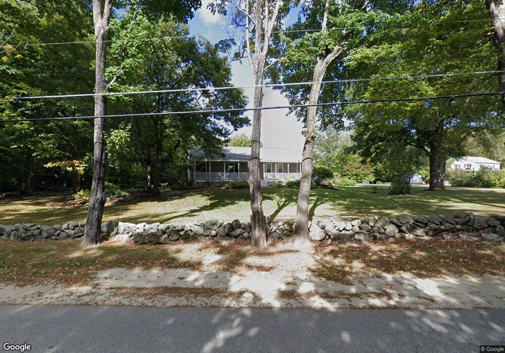
231 Bennett Rd New Gloucester, ME 04260
Estimated Value: $348,000 - $603,000
3
Beds
2
Baths
1,680
Sq Ft
$293/Sq Ft
Est. Value
About This Home
This home is located at 231 Bennett Rd, New Gloucester, ME 04260 and is currently estimated at $492,501, approximately $293 per square foot. 231 Bennett Rd is a home located in Cumberland County with nearby schools including Gray-New Gloucester High School.
Ownership History
Date
Name
Owned For
Owner Type
Purchase Details
Closed on
Aug 19, 2005
Sold by
Hurdle E H
Bought by
Spurling Leander P
Current Estimated Value
Purchase Details
Closed on
May 3, 2005
Sold by
Locke Evelyn
Bought by
Spurling Leander
Create a Home Valuation Report for This Property
The Home Valuation Report is an in-depth analysis detailing your home's value as well as a comparison with similar homes in the area
Home Values in the Area
Average Home Value in this Area
Purchase History
| Date | Buyer | Sale Price | Title Company |
|---|---|---|---|
| Spurling Leander P | -- | -- | |
| Spurling Leander | -- | -- |
Source: Public Records
Tax History
| Year | Tax Paid | Tax Assessment Tax Assessment Total Assessment is a certain percentage of the fair market value that is determined by local assessors to be the total taxable value of land and additions on the property. | Land | Improvement |
|---|---|---|---|---|
| 2025 | $4,858 | $314,012 | $74,442 | $239,570 |
| 2024 | $4,676 | $314,012 | $74,442 | $239,570 |
| 2023 | $4,487 | $314,012 | $74,442 | $239,570 |
| 2022 | $4,333 | $314,012 | $74,442 | $239,570 |
| 2021 | $4,333 | $314,012 | $74,442 | $239,570 |
| 2020 | $4,242 | $310,794 | $74,442 | $236,352 |
| 2019 | $4,222 | $249,800 | $55,800 | $194,000 |
| 2018 | $3,947 | $249,800 | $55,800 | $194,000 |
| 2017 | $3,897 | $249,800 | $55,800 | $194,000 |
| 2016 | $3,672 | $249,800 | $55,800 | $194,000 |
| 2015 | $3,660 | $249,800 | $55,800 | $194,000 |
| 2014 | $3,622 | $249,800 | $55,800 | $194,000 |
| 2013 | $3,360 | $249,800 | $55,800 | $194,000 |
Source: Public Records
Map
Nearby Homes
- 155 & 151 Gloucester Hill Rd
- 86 Skips Way
- 65 Blueberry Ln
- 14 Golden Way
- TBD Emmaus Rd
- 26 Hemlock Ln
- Lot 21-29 Weymouth Rd
- 270 Mayall Rd
- 3 First Mill Dr
- 0 Mayall
- 224 Shaker Rd
- 4 Chelsey Ln
- Bowdoin Way
- 10-56 C&E Bowdoin Way
- 27 Bull Run
- 17 Callaway Dr Unit 17
- 52 Colley Hill Rd
- 0 Colley Hill Rd
- 25 Yarmouth Rd
- 13 Yarmouth Rd
Your Personal Tour Guide
Ask me questions while you tour the home.