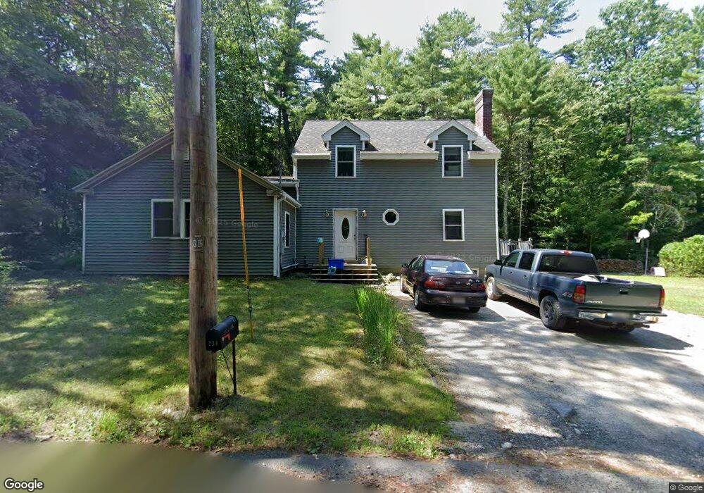
231 East Rd Orange, MA 01364
Estimated Value: $280,000 - $384,000
3
Beds
2
Baths
1,629
Sq Ft
$192/Sq Ft
Est. Value
About This Home
This home is located at 231 East Rd, Orange, MA 01364 and is currently estimated at $312,662, approximately $191 per square foot. 231 East Rd is a home located in Franklin County with nearby schools including Fisher Hill and Ralph C Mahar Regional School.
Ownership History
Date
Name
Owned For
Owner Type
Purchase Details
Closed on
Mar 24, 2015
Sold by
Jillson Donald C and Jillson Melanie L
Bought by
Jillson Melanie L
Current Estimated Value
Purchase Details
Closed on
Aug 24, 1999
Sold by
Whaley Robert E and Whaley Linda M
Bought by
Jillson Donald C and Jillson Melanie L
Home Financials for this Owner
Home Financials are based on the most recent Mortgage that was taken out on this home.
Original Mortgage
$45,000
Interest Rate
7.6%
Mortgage Type
Purchase Money Mortgage
Purchase Details
Closed on
Dec 29, 1988
Sold by
Powell Lois L
Bought by
Whaley Robert E
Home Financials for this Owner
Home Financials are based on the most recent Mortgage that was taken out on this home.
Original Mortgage
$22,000
Interest Rate
10.26%
Mortgage Type
Purchase Money Mortgage
Create a Home Valuation Report for This Property
The Home Valuation Report is an in-depth analysis detailing your home's value as well as a comparison with similar homes in the area
Home Values in the Area
Average Home Value in this Area
Purchase History
| Date | Buyer | Sale Price | Title Company |
|---|---|---|---|
| Jillson Melanie L | -- | -- | |
| Jillson Donald C | $45,000 | -- | |
| Whaley Robert E | $52,500 | -- |
Source: Public Records
Mortgage History
| Date | Status | Borrower | Loan Amount |
|---|---|---|---|
| Previous Owner | Whaley Robert E | $45,000 | |
| Previous Owner | Whaley Robert E | $20,000 | |
| Previous Owner | Whaley Robert E | $22,000 |
Source: Public Records
Tax History
| Year | Tax Paid | Tax Assessment Tax Assessment Total Assessment is a certain percentage of the fair market value that is determined by local assessors to be the total taxable value of land and additions on the property. | Land | Improvement |
|---|---|---|---|---|
| 2025 | $40 | $240,400 | $25,700 | $214,700 |
| 2024 | $3,805 | $218,200 | $25,700 | $192,500 |
| 2023 | $3,429 | $190,900 | $25,700 | $165,200 |
| 2022 | $3,117 | $163,000 | $25,700 | $137,300 |
| 2021 | $3,713 | $185,200 | $44,600 | $140,600 |
| 2020 | $3,609 | $177,500 | $44,200 | $133,300 |
| 2019 | $3,542 | $157,300 | $38,600 | $118,700 |
| 2018 | $3,137 | $143,000 | $35,900 | $107,100 |
| 2017 | $3,036 | $143,000 | $35,900 | $107,100 |
| 2016 | $3,001 | $138,300 | $35,900 | $102,400 |
| 2015 | $2,872 | $138,300 | $35,900 | $102,400 |
| 2014 | $2,979 | $150,900 | $35,900 | $115,000 |
Source: Public Records
Map
Nearby Homes
- 51 East Rd
- 549 E Main St
- 113 New Athol Rd Unit 35
- 15 Tully Rd
- 330 N Orange Rd
- 23 E Howe St
- 23 Mount Pleasant St
- 660 Pinedale Ave
- 116 New Athal Rd
- 85 Roosevelt Ave
- 0 Brickyard Rd
- 58 E Main St
- 50 E Main St
- 990 S Main St
- 55 South St
- 36 Summit St Unit A
- 36 Summit St Unit B
- 12-14 E Main St
- 212 South St
- 31 Freedom St
Your Personal Tour Guide
Ask me questions while you tour the home.