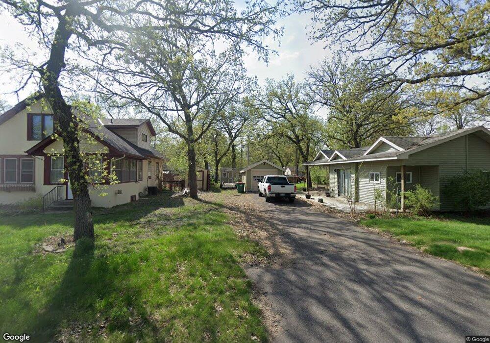
231 Euclid Ave Big Lake, MN 55309
Estimated Value: $216,000 - $243,000
2
Beds
1
Bath
800
Sq Ft
$281/Sq Ft
Est. Value
About This Home
This home is located at 231 Euclid Ave, Big Lake, MN 55309 and is currently estimated at $224,997, approximately $281 per square foot. 231 Euclid Ave is a home located in Sherburne County with nearby schools including Liberty Elementary School, Independence Elementary School, and Big Lake Middle School.
Ownership History
Date
Name
Owned For
Owner Type
Purchase Details
Closed on
Jul 24, 2009
Sold by
Reagan Peggy Lee
Bought by
Fischer Lee J
Current Estimated Value
Purchase Details
Closed on
Aug 3, 2007
Sold by
Reagan Peggy L
Bought by
Anderson Fischer Jena and Fischer Lee J
Home Financials for this Owner
Home Financials are based on the most recent Mortgage that was taken out on this home.
Original Mortgage
$92,500
Interest Rate
6.5%
Mortgage Type
Land Contract Argmt. Of Sale
Purchase Details
Closed on
Oct 30, 2003
Sold by
Wirgau Ronda D
Bought by
Reagan Peggy Lee
Purchase Details
Closed on
Apr 15, 1996
Sold by
Seehafer Darold D and Seehafer Lynne L
Bought by
Taylor William and Taylor Mabel H
Create a Home Valuation Report for This Property
The Home Valuation Report is an in-depth analysis detailing your home's value as well as a comparison with similar homes in the area
Home Values in the Area
Average Home Value in this Area
Purchase History
| Date | Buyer | Sale Price | Title Company |
|---|---|---|---|
| Fischer Lee J | $92,500 | -- | |
| Anderson Fischer Jena | $92,500 | -- | |
| Reagan Peggy Lee | $60,000 | -- | |
| Taylor William | $22,800 | -- | |
| Snell Nathan Nathan | $195,000 | -- |
Source: Public Records
Mortgage History
| Date | Status | Borrower | Loan Amount |
|---|---|---|---|
| Previous Owner | Anderson Fischer Jena | $92,500 | |
| Closed | Snell Nathan Nathan | $195,000 |
Source: Public Records
Tax History Compared to Growth
Tax History
| Year | Tax Paid | Tax Assessment Tax Assessment Total Assessment is a certain percentage of the fair market value that is determined by local assessors to be the total taxable value of land and additions on the property. | Land | Improvement |
|---|---|---|---|---|
| 2025 | $2,202 | $175,000 | $32,400 | $142,600 |
| 2024 | $2,508 | $176,200 | $32,400 | $143,800 |
| 2023 | $2,486 | $205,800 | $64,600 | $141,200 |
| 2022 | $1,850 | $196,200 | $55,000 | $141,200 |
| 2020 | $1,658 | $137,300 | $33,500 | $103,800 |
| 2019 | $1,822 | $127,200 | $30,900 | $96,300 |
| 2018 | $1,772 | $112,900 | $28,500 | $84,400 |
| 2017 | $1,694 | $105,000 | $26,100 | $78,900 |
| 2016 | $1,700 | $96,600 | $23,200 | $73,400 |
| 2015 | $1,584 | $97,500 | $27,900 | $69,600 |
| 2014 | $2,180 | $95,300 | $27,900 | $67,400 |
| 2013 | -- | $83,500 | $27,700 | $55,800 |
Source: Public Records
Map
Nearby Homes
- 491 Highland Ave
- 241 Leighton Dr
- TBD Highway 10 NW
- 679 Lakeshore Dr
- 20050 County Road 81 NW
- 20311 Gordon Ln
- TBD Manitou St
- 240 Wyoming Ave
- 3300 Lake View Ln
- 637 Norwood Ln
- 4637 Pond View Cir
- 4265 Lake Ridge Dr
- 5008 Bluff Rd
- 20189 Esther Pkwy
- 3250 Lake Ridge Dr
- 20172 Truman Dr
- 874 Independence Dr NW
- 110 Powell Cir E
- 541 William St
- 18585 Arctic Ave