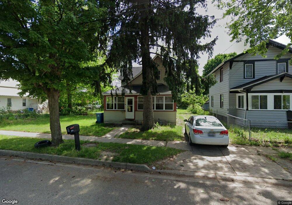
231 Graves Ave Battle Creek, MI 49037
North Central NeighborhoodEstimated Value: $43,000 - $110,000
3
Beds
1
Bath
768
Sq Ft
$105/Sq Ft
Est. Value
About This Home
This home is located at 231 Graves Ave, Battle Creek, MI 49037 and is currently estimated at $80,776, approximately $105 per square foot. 231 Graves Ave is a home located in Calhoun County with nearby schools including Ann J. Kellogg School, Northwestern Middle School, and Battle Creek Central High School.
Ownership History
Date
Name
Owned For
Owner Type
Purchase Details
Closed on
Sep 7, 2007
Sold by
Farr Penny K
Bought by
Vasquez Hermenegildo L
Current Estimated Value
Purchase Details
Closed on
Apr 19, 2002
Bought by
Mooring Tax Assets
Purchase Details
Closed on
Sep 15, 2001
Bought by
Phoenix Properties L L C
Purchase Details
Closed on
Oct 15, 1999
Bought by
Mooring Tax Asset Group Llc
Create a Home Valuation Report for This Property
The Home Valuation Report is an in-depth analysis detailing your home's value as well as a comparison with similar homes in the area
Home Values in the Area
Average Home Value in this Area
Purchase History
| Date | Buyer | Sale Price | Title Company |
|---|---|---|---|
| Vasquez Hermenegildo L | -- | None Available | |
| Mooring Tax Assets | -- | -- | |
| Phoenix Properties L L C | -- | -- | |
| Mooring Tax Asset Group Llc | $600 | -- |
Source: Public Records
Tax History Compared to Growth
Tax History
| Year | Tax Paid | Tax Assessment Tax Assessment Total Assessment is a certain percentage of the fair market value that is determined by local assessors to be the total taxable value of land and additions on the property. | Land | Improvement |
|---|---|---|---|---|
| 2025 | -- | $26,600 | $0 | $0 |
| 2024 | $652 | $21,979 | $0 | $0 |
| 2023 | $830 | $18,697 | $0 | $0 |
| 2022 | $589 | $16,306 | $0 | $0 |
| 2021 | $788 | $12,149 | $0 | $0 |
| 2020 | $885 | $12,810 | $0 | $0 |
| 2019 | $888 | $13,194 | $0 | $0 |
| 2018 | $888 | $13,677 | $660 | $13,017 |
| 2017 | $886 | $14,633 | $0 | $0 |
| 2016 | $884 | $15,525 | $0 | $0 |
| 2015 | $867 | $17,434 | $3,275 | $14,159 |
| 2014 | $867 | $13,486 | $3,275 | $10,211 |
Source: Public Records
Map
Nearby Homes
- 89 Somerset Ave
- 629 Van Buren St W
- 69 Jordan St
- 60 Graves Ave
- 253 Greenwood Ave
- 636 Hamblin Ave W
- 167 Hubbard St
- 562 Van Buren St W
- 0 W Vanburen 027 St Unit 22040287
- 0 W Vanburen 025 St Unit 22040286
- 224 Hubbard St
- 0 W Michigan 011 Ave Unit 22040285
- 0 W Michigan 010 Ave Unit 22040284
- 0 W Ave Unit 22040282
- 0 W Vanburen 032 St Unit 22040288
- 35 Hubbard St
- 0 W Michigan 005 Ave Unit 22040281
- 9 Thorne St
- 188 Roseneath Ave
- 1111 Michigan Ave W
- 235 Graves Ave
- 227 Graves Ave
- 237 Graves Ave
- 221 Graves Ave
- 54 Limit St
- 782 Van Buren St W
- 778 Van Buren St W
- 240 Graves Ave
- 234 Graves Ave
- 774 Van Buren St W
- 217 Graves Ave
- 255 Graves Ave
- 250 Graves Ave
- 766 Van Buren St W
- 218 Graves Ave
- 493 Parkway Dr
- 762 Van Buren St W
- 777 Van Buren St W
- 769 Van Buren St W
- 214 Graves Ave