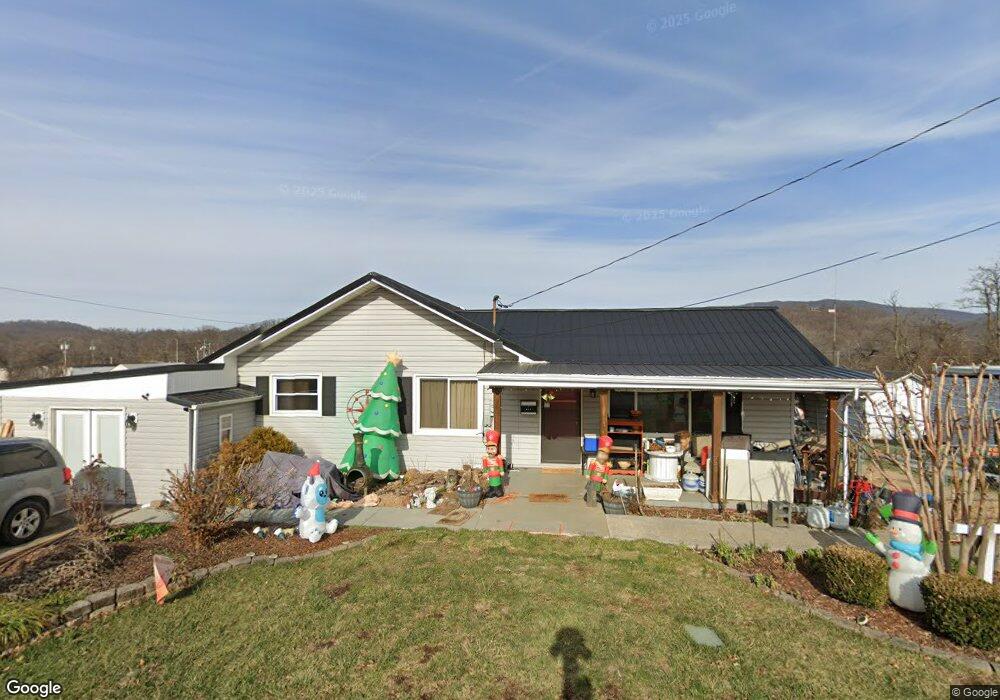
231 W Doe Ave Elizabethton, TN 37643
Estimated Value: $136,000 - $325,000
3
Beds
2
Baths
1,556
Sq Ft
$146/Sq Ft
Est. Value
About This Home
This home is located at 231 W Doe Ave, Elizabethton, TN 37643 and is currently estimated at $227,881, approximately $146 per square foot. 231 W Doe Ave is a home located in Carter County with nearby schools including Elizabethton High School and East Tn Christian Home & Academy.
Ownership History
Date
Name
Owned For
Owner Type
Purchase Details
Closed on
Feb 14, 2025
Sold by
Broyles Sonja
Bought by
Broyles Joshua and Broyles Brianna
Current Estimated Value
Purchase Details
Closed on
May 5, 2014
Sold by
Us Bank National Associati
Bought by
Broyles Joshua and Broyles Brianna
Purchase Details
Closed on
Aug 1, 2013
Sold by
Pitsenbarger Robin
Bought by
Us Bank National Association T
Purchase Details
Closed on
Dec 3, 2001
Sold by
Home Equity Trust
Bought by
Carty Robin
Purchase Details
Closed on
Aug 10, 2001
Bought by
Carty Robin B
Purchase Details
Closed on
Jul 8, 1991
Bought by
Hilbert Bonnie D Honeycutt
Purchase Details
Closed on
Nov 5, 1990
Bought by
Hilbert John H and Hilbert Bonnie
Purchase Details
Closed on
Apr 30, 1987
Bought by
Hilbert John H and Hilbert Bonnie
Purchase Details
Closed on
Jul 24, 1986
Bought by
Lewis Paul D and Teresa Diane
Create a Home Valuation Report for This Property
The Home Valuation Report is an in-depth analysis detailing your home's value as well as a comparison with similar homes in the area
Home Values in the Area
Average Home Value in this Area
Purchase History
| Date | Buyer | Sale Price | Title Company |
|---|---|---|---|
| Broyles Joshua | -- | None Listed On Document | |
| Broyles Joshua | -- | None Listed On Document | |
| Broyles Joshua | $55,000 | -- | |
| Us Bank National Association T | $84,043 | -- | |
| Carty Robin | $40,500 | -- | |
| Carty Robin B | $49,900 | -- | |
| Hilbert Bonnie D Honeycutt | -- | -- | |
| Hilbert John H | -- | -- | |
| Hilbert John H | $12,000 | -- | |
| Lewis Paul D | -- | -- |
Source: Public Records
Tax History Compared to Growth
Tax History
| Year | Tax Paid | Tax Assessment Tax Assessment Total Assessment is a certain percentage of the fair market value that is determined by local assessors to be the total taxable value of land and additions on the property. | Land | Improvement |
|---|---|---|---|---|
| 2024 | $1,288 | $39,025 | $4,250 | $34,775 |
| 2023 | $1,288 | $39,025 | $0 | $0 |
| 2022 | $1,348 | $37,450 | $4,250 | $33,200 |
| 2021 | $760 | $37,450 | $4,250 | $33,200 |
| 2020 | $1,368 | $37,450 | $4,250 | $33,200 |
| 2019 | $1,368 | $31,675 | $4,250 | $27,425 |
| 2018 | $1,349 | $31,675 | $4,250 | $27,425 |
| 2017 | $1,309 | $31,675 | $4,250 | $27,425 |
| 2016 | $1,303 | $30,725 | $4,250 | $26,475 |
| 2015 | $1,349 | $31,750 | $4,250 | $27,500 |
| 2014 | $1,422 | $33,300 | $4,250 | $29,050 |
Source: Public Records
Map
Nearby Homes
- 229 W Doe Ave
- 115 W F St
- 621 Mcarthur Ave
- 210 E Cottage Ave
- 116 E G St
- 112 S Watauga Ave
- 304 Merry Dr
- 308 E Cottage Ave
- 309 Elm St
- 304 E H St
- 700 W Riverside Dr
- 404 Allen Ave
- 511 S Watauga Ave
- TBD E Elk Ave
- 201 Ridgecrest Dr
- 398 River Island Ln
- 304 Ridgecrest Dr
- 612 S Lynn Ave
- 405 Brandon St
- 705 Holston Ave