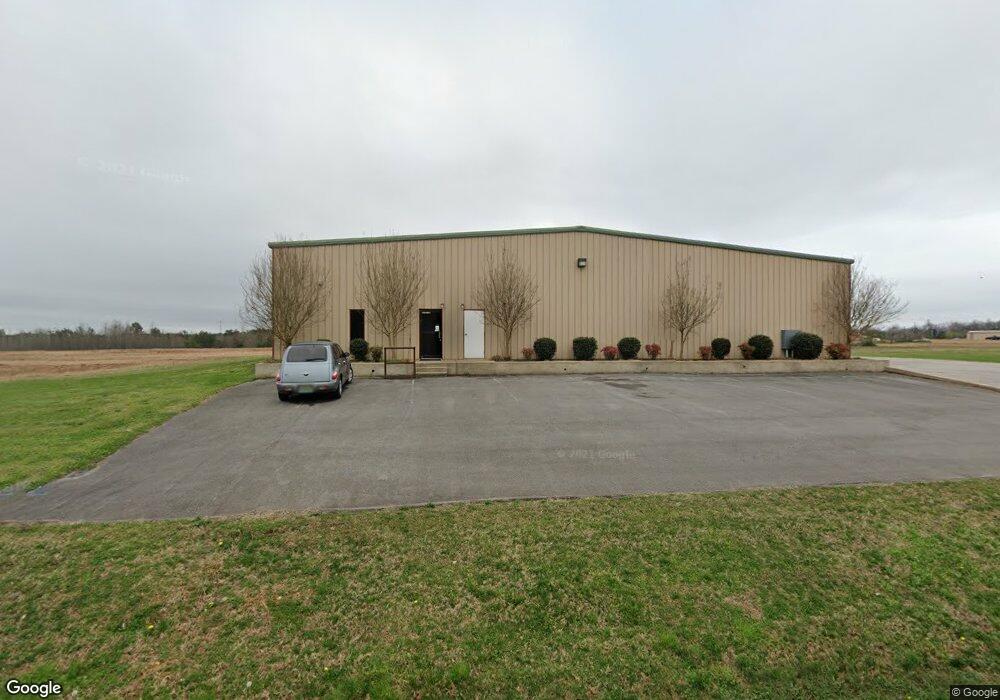
23100 Austin Whitt Rd Ardmore, TN 38449
Estimated Value: $605,333
--
Bed
2
Baths
15,300
Sq Ft
$40/Sq Ft
Est. Value
About This Home
This home is located at 23100 Austin Whitt Rd, Ardmore, TN 38449 and is currently estimated at $605,333, approximately $39 per square foot. 23100 Austin Whitt Rd is a home located in Giles County with nearby schools including Elkton Elementary School and Giles County High School.
Ownership History
Date
Name
Owned For
Owner Type
Purchase Details
Closed on
Aug 5, 2024
Sold by
T-Sharp Llc
Bought by
J & W Holdings
Current Estimated Value
Purchase Details
Closed on
Oct 24, 2012
Bought by
T-Sharp Llc
Purchase Details
Closed on
Sep 11, 2001
Bought by
Ardmore Tn Industrial Devel Bd
Home Financials for this Owner
Home Financials are based on the most recent Mortgage that was taken out on this home.
Original Mortgage
$400,000
Interest Rate
6.89%
Mortgage Type
Commercial
Create a Home Valuation Report for This Property
The Home Valuation Report is an in-depth analysis detailing your home's value as well as a comparison with similar homes in the area
Home Values in the Area
Average Home Value in this Area
Purchase History
| Date | Buyer | Sale Price | Title Company |
|---|---|---|---|
| J & W Holdings | $593,700 | Title And Escrow Llc | |
| J & W Holdings | $593,700 | Title And Escrow Llc | |
| T-Sharp Llc | $205,100 | -- | |
| T Sharp Llc | $205,147 | -- | |
| Ardmore Tn Industrial Devel Bd | $37,000 | -- |
Source: Public Records
Mortgage History
| Date | Status | Borrower | Loan Amount |
|---|---|---|---|
| Previous Owner | Ardmore Tn Industrial Devel Bd | $400,000 |
Source: Public Records
Tax History Compared to Growth
Tax History
| Year | Tax Paid | Tax Assessment Tax Assessment Total Assessment is a certain percentage of the fair market value that is determined by local assessors to be the total taxable value of land and additions on the property. | Land | Improvement |
|---|---|---|---|---|
| 2025 | $4,217 | $196,480 | $0 | $0 |
| 2024 | $4,217 | $196,480 | $58,600 | $137,880 |
| 2023 | $4,217 | $196,480 | $58,600 | $137,880 |
| 2022 | $4,217 | $196,480 | $58,600 | $137,880 |
| 2021 | $4,388 | $143,160 | $14,640 | $128,520 |
| 2020 | $4,388 | $143,160 | $14,640 | $128,520 |
| 2019 | $4,044 | $143,160 | $14,640 | $128,520 |
| 2018 | $4,384 | $143,160 | $14,640 | $128,520 |
| 2017 | $4,384 | $143,160 | $14,640 | $128,520 |
| 2016 | $4,487 | $139,760 | $14,360 | $125,400 |
| 2015 | $4,208 | $139,760 | $14,360 | $125,400 |
| 2014 | $4,208 | $139,748 | $0 | $0 |
Source: Public Records
Map
Nearby Homes
- 25668 Main St
- 0 Union Hill Rd Unit RTC3066715
- 0 Union Hill Rd Unit RTC3066716
- 0 Union Hill Rd Unit RTC3066714
- 0 Union Hill Rd Unit RTC3066717
- 26081 Pheasant Run
- 30740 Mill Race Dr
- 30065 Bankston Rd
- 30679 Ardmore Ridge Rd
- 26210 Stateline Rd
- 25230 Union Hill Rd
- 26651 1st St
- 29847 1st Ave W
- 30518 Fort Hampton St
- 30176 Highway 110
- 29385 Mooresville Rd
- 30A Stevenson Rd
- 30acres Stevenson Rd
- 29238 1st Ave W
- 24994 7th St
- 23000 Austin Whitt Rd
- 23057 Austin Whitt Rd
- 23055 Austin Whitt Rd
- 22089 Austin Whitt Rd
- 22091 Austin Whitt Rd
- 22059 Austin Whitt Rd
- 24470 Union Hill Rd
- 24464 Union Hill Rd
- 22055 Austin Whitt Rd
- 22051 Austin Whitt Rd
- 26333 Austin Whitt Rd
- 22045 Austin Whitt Rd
- 23230 Austin Whitt Rd
- 25993 Main St
- 24584 Union Hill Rd
- 25997 Main St
- 23333 Austin Whitt Rd
- 30729 Quail Trail
- 25425 Main St
- 25385 Main St