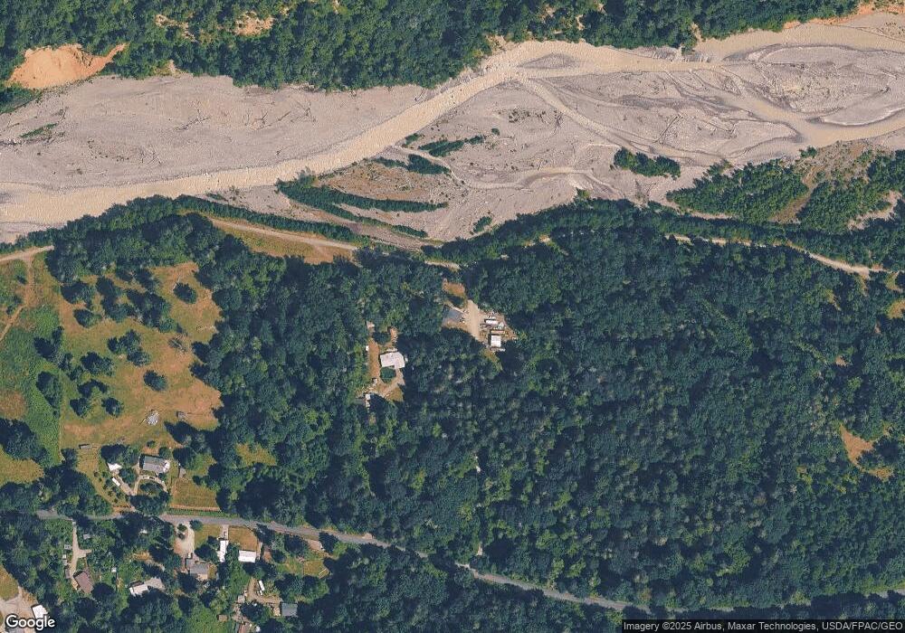
23119 177th St E Orting, WA 98360
Estimated Value: $463,000 - $766,000
3
Beds
2
Baths
1,464
Sq Ft
$431/Sq Ft
Est. Value
About This Home
This home is located at 23119 177th St E, Orting, WA 98360 and is currently estimated at $630,273, approximately $430 per square foot. 23119 177th St E is a home located in Pierce County with nearby schools including Orting Elementary School, Ptarmigan Ridge Elementary School, and Orting Middle School.
Ownership History
Date
Name
Owned For
Owner Type
Purchase Details
Closed on
Dec 5, 1994
Sold by
Cox Kenneth Ray
Bought by
Stewart Mark J and Peavler Stewart Deborah
Current Estimated Value
Home Financials for this Owner
Home Financials are based on the most recent Mortgage that was taken out on this home.
Original Mortgage
$98,250
Interest Rate
9.08%
Mortgage Type
FHA
Create a Home Valuation Report for This Property
The Home Valuation Report is an in-depth analysis detailing your home's value as well as a comparison with similar homes in the area
Purchase History
| Date | Buyer | Sale Price | Title Company |
|---|---|---|---|
| Stewart Mark J | $87,500 | -- |
Source: Public Records
Mortgage History
| Date | Status | Borrower | Loan Amount |
|---|---|---|---|
| Closed | Stewart Mark J | $98,250 |
Source: Public Records
Tax History
| Year | Tax Paid | Tax Assessment Tax Assessment Total Assessment is a certain percentage of the fair market value that is determined by local assessors to be the total taxable value of land and additions on the property. | Land | Improvement |
|---|---|---|---|---|
| 2025 | $4,213 | $515,400 | $284,100 | $231,300 |
| 2024 | $4,213 | $529,200 | $287,700 | $241,500 |
| 2023 | $4,213 | $491,600 | $269,500 | $222,100 |
| 2022 | $3,883 | $493,800 | $291,300 | $202,500 |
| 2021 | $4,036 | $340,200 | $180,400 | $159,800 |
| 2019 | $3,796 | $325,700 | $163,800 | $161,900 |
| 2018 | $3,852 | $300,500 | $149,900 | $150,600 |
| 2017 | $3,399 | $253,500 | $123,500 | $130,000 |
| 2016 | $3,191 | $196,800 | $90,000 | $106,800 |
| 2014 | $3,378 | $187,500 | $92,800 | $94,700 |
| 2013 | $3,378 | $173,200 | $90,300 | $82,900 |
Source: Public Records
Map
Nearby Homes
- 17011 226th Ave E
- 23119 164th St E
- 18406 229th Ave E
- 17612 219th Ave E
- 20524 165th St E
- 20532 165th St E
- 18313 Patterson Rd E
- 23915 158th St E
- 18920 217th Ave E
- 16706 254th Avenue Ct E
- 25323 182nd St E
- 0 164th St E Unit NWM2471952
- 16004 210th Ave E Unit 308
- 15706 210th Ave E Unit 312
- 15706 210th Ave E
- 15710 210th Ave E
- 15710 210th Ave E Unit 311
- 15602 210th Ave E
- 15814 210th Ave E
- 15814 210th Ave E Unit 310
- 23011 177th St E
- 22915 177th St E
- 22911 177th St E
- 0 230th Ave E Unit NWM1090254
- 0 Carbon River Heights Unit 29042998
- 0 Carbon River Heights Unit 29043063
- 0 Carbon River Heights Unit 29043110
- 0 Carbon River Heights Unit 29043084
- 0 Carbon River Heights Unit 29043121
- 0 Carbon River Heights Unit 29043088
- 0 Carbon River Heights Unit 29043153
- 0 Carbon River Heights Unit 29043131
- 0 Carbon River Heights Unit 29043055
- 0 Carbon River Heights Unit 29043068
- 0 Carbon River Heights Unit 29043029
- 0 Carbon River Heights Unit 29043047
- 0 Carbon River Heights Unit 29043026
- 0 Carbon River Heights Unit 29043095
- 0 Carbon River Heights Unit 29043044
- 0 Carbon River Heights Unit 29043120
Your Personal Tour Guide
Ask me questions while you tour the home.
