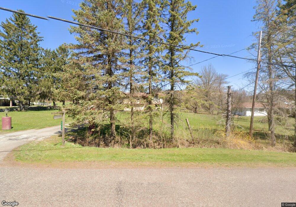
2313 Milwaukee Rd Clarks Summit, PA 18411
Estimated Value: $211,289 - $317,000
3
Beds
1
Bath
1,742
Sq Ft
$146/Sq Ft
Est. Value
About This Home
This home is located at 2313 Milwaukee Rd, Clarks Summit, PA 18411 and is currently estimated at $254,072, approximately $145 per square foot. 2313 Milwaukee Rd is a home located in Lackawanna County with nearby schools including Abington Heights High School.
Ownership History
Date
Name
Owned For
Owner Type
Purchase Details
Closed on
Sep 25, 2025
Sold by
Gorrick John J
Bought by
S Walsh Properties Llc
Current Estimated Value
Purchase Details
Closed on
Apr 10, 2025
Sold by
Gorrick John J and Gorrick Dawn
Bought by
Gorrick John J
Purchase Details
Closed on
Nov 8, 2016
Sold by
Bilardi Jacqueline
Bought by
Carr Corey and Carr Maria
Purchase Details
Closed on
Mar 21, 2007
Sold by
Tomko Paul and Tomko Laurie
Bought by
Gorrick John J and Gorrick Dawn
Home Financials for this Owner
Home Financials are based on the most recent Mortgage that was taken out on this home.
Original Mortgage
$185,000
Interest Rate
6.33%
Mortgage Type
New Conventional
Purchase Details
Closed on
May 18, 2005
Sold by
Bank One National Assn
Bought by
Tomko Paul S and Tomko Laurie
Home Financials for this Owner
Home Financials are based on the most recent Mortgage that was taken out on this home.
Original Mortgage
$104,000
Interest Rate
5.82%
Mortgage Type
New Conventional
Create a Home Valuation Report for This Property
The Home Valuation Report is an in-depth analysis detailing your home's value as well as a comparison with similar homes in the area
Home Values in the Area
Average Home Value in this Area
Purchase History
| Date | Buyer | Sale Price | Title Company |
|---|---|---|---|
| S Walsh Properties Llc | $222,000 | Landmarc Abstract And Settleme | |
| Gorrick John J | -- | None Listed On Document | |
| Carr Corey | $160,000 | None Available | |
| Gorrick John J | $185,000 | None Available | |
| Tomko Paul S | $130,000 | None Available |
Source: Public Records
Mortgage History
| Date | Status | Borrower | Loan Amount |
|---|---|---|---|
| Previous Owner | Gorrick John J | $185,000 | |
| Previous Owner | Tomko Paul S | $104,000 |
Source: Public Records
Tax History
| Year | Tax Paid | Tax Assessment Tax Assessment Total Assessment is a certain percentage of the fair market value that is determined by local assessors to be the total taxable value of land and additions on the property. | Land | Improvement |
|---|---|---|---|---|
| 2025 | $4,138 | $17,000 | $1,000 | $16,000 |
| 2024 | $3,417 | $17,000 | $1,000 | $16,000 |
| 2023 | $3,417 | $17,000 | $1,000 | $16,000 |
| 2022 | $3,346 | $17,000 | $1,000 | $16,000 |
| 2021 | $3,346 | $17,000 | $1,000 | $16,000 |
| 2020 | $3,346 | $17,000 | $1,000 | $16,000 |
| 2019 | $3,236 | $17,000 | $1,000 | $16,000 |
| 2018 | $3,206 | $17,000 | $1,000 | $16,000 |
| 2017 | $3,189 | $17,000 | $1,000 | $16,000 |
| 2016 | $1,918 | $17,000 | $1,000 | $16,000 |
| 2015 | -- | $17,000 | $1,000 | $16,000 |
| 2014 | -- | $17,000 | $1,000 | $16,000 |
Source: Public Records
Map
Nearby Homes
- 2225 Cherry Hill Rd
- 1677 Beaver Pond Rd
- 10 Bald Mt Rd
- 2607 Ransom Rd
- 0 Summit Lake Rd Unit GSBSC260069
- 9119 Valley View Dr
- 162 Highland Rd
- 2694 Ransom Rd
- 9109 Valley View Dr
- 0 Kimberly Cir
- 3501 Sullivans Trail
- 1208 Country Club Rd
- 374 Country Rd
- 0 Gravel Pond Rd Unit GSBSC260622
- 2352 Newton Ransom Blvd
- 108 W Mountain Rd
- 3018 Main St
- 0 Spring & Red Oak Dr Unit GSBSC1753
- 314 Terrace Ave
- 3061 Main St
- 2315 Milwaukee Rd
- 2311 Milwaukee Rd
- 2312 Milwaukee Rd
- 2306 Milwaukee Rd
- 13057 Maple Dr
- 2337 Milwaukee Rd
- 2322 Milwaukee Rd
- 2300 Milwaukee Rd
- 13057 Lower Maple Dr
- 1903 Newton Ransom Blvd
- 0 Rt 440 Newton Center Unit GSB23281
- 0 Rt 440 Newton Center Unit GSBSC1624
- 1597 Newton Ransom Blvd
- 1905 Newton Ransom Blvd
- 1902 Newton Ransom Blvd
- 1892 Newton Ransom Blvd
- 1907 Newton Ransom Blvd
- 1907 Newton Ransom Blvd
- 13070 Maple Dr
- 1912 Newton Ransom Blvd
Your Personal Tour Guide
Ask me questions while you tour the home.
