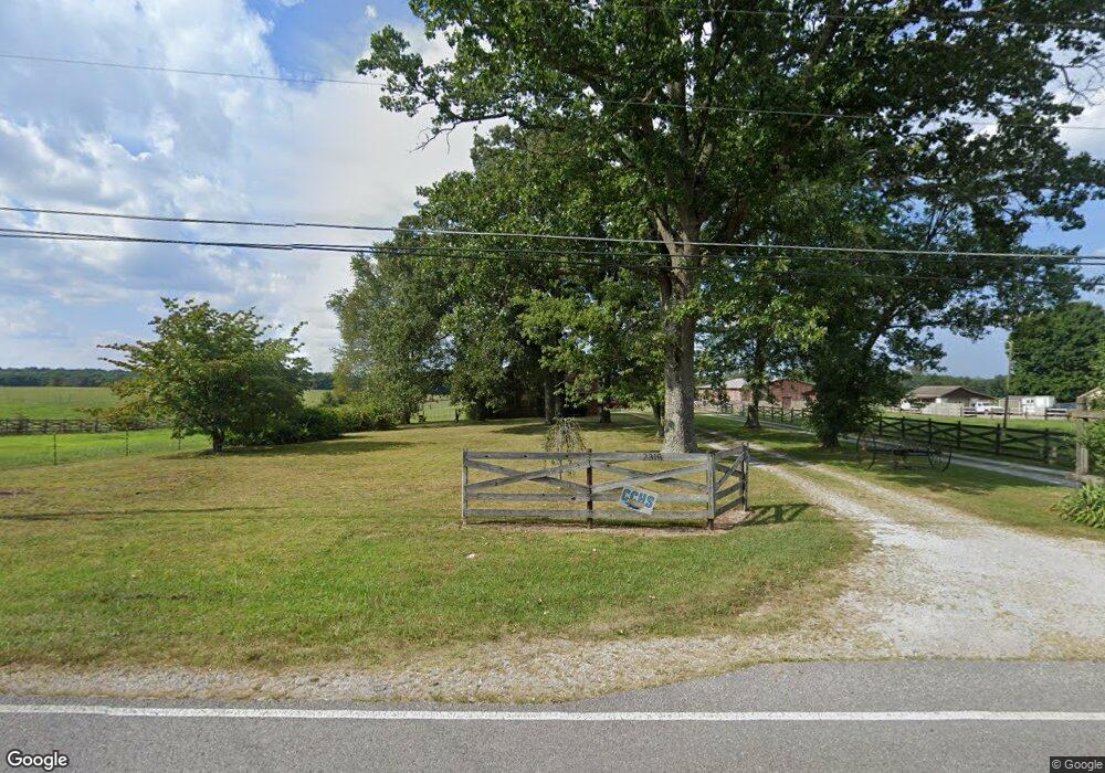
2315 Deep Draw Rd Crossville, TN 38555
Estimated Value: $267,000 - $408,000
--
Bed
2
Baths
2,026
Sq Ft
$160/Sq Ft
Est. Value
About This Home
This home is located at 2315 Deep Draw Rd, Crossville, TN 38555 and is currently estimated at $323,499, approximately $159 per square foot. 2315 Deep Draw Rd is a home located in Cumberland County with nearby schools including Cumberland County High School.
Ownership History
Date
Name
Owned For
Owner Type
Purchase Details
Closed on
Nov 24, 2021
Sold by
Colton Hood
Bought by
Tabor Makenzie B and Tabor Ty L
Current Estimated Value
Home Financials for this Owner
Home Financials are based on the most recent Mortgage that was taken out on this home.
Original Mortgage
$317,065
Outstanding Balance
$290,777
Interest Rate
3.05%
Mortgage Type
Construction
Estimated Equity
$32,722
Purchase Details
Closed on
Oct 28, 2019
Sold by
Hood Gindy G and Tabor Kim Lewis
Bought by
Hood Colton
Create a Home Valuation Report for This Property
The Home Valuation Report is an in-depth analysis detailing your home's value as well as a comparison with similar homes in the area
Home Values in the Area
Average Home Value in this Area
Purchase History
| Date | Buyer | Sale Price | Title Company |
|---|---|---|---|
| Tabor Makenzie B | $175,000 | Thompson James E | |
| Tabor Makenzie B | $175,000 | None Listed On Document | |
| Hood Colton | -- | None Available |
Source: Public Records
Mortgage History
| Date | Status | Borrower | Loan Amount |
|---|---|---|---|
| Open | Tabor Makenzie B | $317,065 | |
| Closed | Tabor Makenzie B | $317,065 |
Source: Public Records
Tax History Compared to Growth
Tax History
| Year | Tax Paid | Tax Assessment Tax Assessment Total Assessment is a certain percentage of the fair market value that is determined by local assessors to be the total taxable value of land and additions on the property. | Land | Improvement |
|---|---|---|---|---|
| 2024 | $605 | $53,300 | $7,275 | $46,025 |
| 2023 | $0 | $53,300 | $0 | $0 |
| 2022 | $605 | $53,300 | $7,275 | $46,025 |
| 2021 | $511 | $32,675 | $6,950 | $25,725 |
| 2020 | $495 | $31,625 | $6,950 | $24,675 |
| 2019 | $493 | $31,625 | $6,950 | $24,675 |
| 2018 | $493 | $31,500 | $6,825 | $24,675 |
| 2017 | $493 | $31,500 | $6,825 | $24,675 |
| 2016 | $459 | $30,075 | $6,900 | $23,175 |
| 2015 | $450 | $30,075 | $6,900 | $23,175 |
| 2014 | $450 | $30,077 | $0 | $0 |
Source: Public Records
Map
Nearby Homes
- 0 Eugene Ct Unit RTC2939742
- 0 Eugene Ct Unit RTC2939741
- 0 Eugene Ct Unit 1113217
- 0 Eugene Ct Unit 1113216
- 5 Eugene Ct
- Lot 5 Eugene Ct
- 1819 Highway 68
- 211 Chestnut Ct
- 0 Cascade Ln Unit RTC2939740
- 0 Cascade Ln Unit 1117565
- 130 Chestnut Ct
- 1230 Deep Draw Rd
- 2636 York St
- 233 Copper Point
- 0 Keating Loop Unit RTC2939739
- 0 Keating Loop Unit 1172390
- 1355 Highland Ln
- 0 York Cir Unit 1302979
- 1343 Highland Ln
- 0 York Ln
- 2351 Deep Draw Rd
- 2320 Deep Draw Rd
- 2354 Deep Draw Rd
- 2306 Deep Draw Rd
- 934 Turkey Oak Rd
- 2402 Deep Draw Rd
- 2463 Deep Draw Rd
- 2161 Deep Draw Rd
- 869 Turkey Oak Rd
- 2496 Deep Draw Rd
- 858 Turkey Oak Rd
- 912 Turkey Oak Rd
- 2078 Deep Draw Rd
- 2043 Deep Draw Rd
- 2600 Deep Draw Rd
- 196 Eugene Ct
- 767 Turkey Oak Rd
- 743 Turkey Oak Rd
- 0 Eugene Ct Unit 1230833
- 0 Eugene Ct Unit 595274
