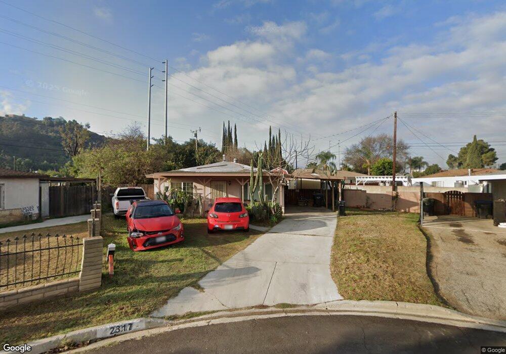
2317 Holford St Whittier, CA 90601
Avocado Heights NeighborhoodEstimated Value: $665,000 - $724,975
3
Beds
1
Bath
940
Sq Ft
$731/Sq Ft
Est. Value
About This Home
This home is located at 2317 Holford St, Whittier, CA 90601 and is currently estimated at $686,744, approximately $730 per square foot. 2317 Holford St is a home located in Los Angeles County with nearby schools including Wallen L. Andrews Elementary School, Pioneer High School, and Epiphany Catholic School.
Ownership History
Date
Name
Owned For
Owner Type
Purchase Details
Closed on
Nov 30, 2009
Sold by
Alcantar Irma
Bought by
Kang Akiko Sato
Current Estimated Value
Purchase Details
Closed on
Apr 12, 2000
Sold by
Bradley John David and Bradley Family Trust
Bought by
Alcantar Irma
Home Financials for this Owner
Home Financials are based on the most recent Mortgage that was taken out on this home.
Original Mortgage
$139,070
Interest Rate
8.08%
Mortgage Type
FHA
Purchase Details
Closed on
May 31, 1995
Sold by
Bradley David and Bradley Valeria
Bought by
Bradley David D and Bradley Valeria A
Create a Home Valuation Report for This Property
The Home Valuation Report is an in-depth analysis detailing your home's value as well as a comparison with similar homes in the area
Home Values in the Area
Average Home Value in this Area
Purchase History
| Date | Buyer | Sale Price | Title Company |
|---|---|---|---|
| Kang Akiko Sato | $308,000 | Old Republic Title Company | |
| Kang Akiko Sato | -- | Ortc | |
| Alcantar Irma | $140,000 | American Title Co | |
| Bradley David D | -- | -- |
Source: Public Records
Mortgage History
| Date | Status | Borrower | Loan Amount |
|---|---|---|---|
| Previous Owner | Alcantar Irma | $139,070 | |
| Closed | Alcantar Irma | $7,000 |
Source: Public Records
Tax History
| Year | Tax Paid | Tax Assessment Tax Assessment Total Assessment is a certain percentage of the fair market value that is determined by local assessors to be the total taxable value of land and additions on the property. | Land | Improvement |
|---|---|---|---|---|
| 2025 | $4,922 | $397,558 | $306,047 | $91,511 |
| 2024 | $4,922 | $389,764 | $300,047 | $89,717 |
| 2023 | $4,832 | $382,122 | $294,164 | $87,958 |
| 2022 | $4,812 | $374,631 | $288,397 | $86,234 |
| 2021 | $4,638 | $367,287 | $282,743 | $84,544 |
| 2020 | $4,600 | $363,522 | $279,844 | $83,678 |
| 2019 | $4,556 | $356,395 | $274,357 | $82,038 |
| 2018 | $4,414 | $349,408 | $268,978 | $80,430 |
| 2016 | $4,240 | $335,841 | $258,534 | $77,307 |
| 2015 | $4,151 | $330,797 | $254,651 | $76,146 |
| 2014 | $4,094 | $324,318 | $249,663 | $74,655 |
Source: Public Records
Map
Nearby Homes
- 13009 Camino Del Rey
- 1548 Lacewood Dr
- 11413 Broadmead St
- 1536 Adson Place
- 2354 Silverbay Ave
- 11368 Byways St
- 2227 Burkett Rd
- 1511 Durfee Ave
- 2361 Parkway Dr
- 2354 Valwood Ave
- 2306 Burkett Rd
- 11219 Farndon St
- 925 Bunbury Dr
- 2435 Burkett Rd
- 12700 Elliott Ave Unit 119
- 12700 Elliott Ave Unit 512
- 12700 Elliott Ave Unit 10
- 12700 Elliott Ave Unit 98
- 12700 Elliott Ave Unit 406
- 12700 Elliott Ave Unit 35
Your Personal Tour Guide
Ask me questions while you tour the home.