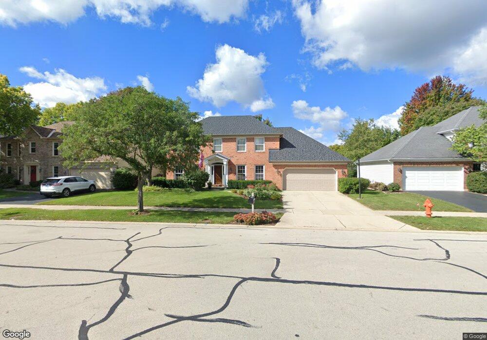
2317 Keim Rd Naperville, IL 60565
Walnut Ridge NeighborhoodEstimated Value: $714,000 - $832,000
4
Beds
3
Baths
3,053
Sq Ft
$255/Sq Ft
Est. Value
About This Home
This home is located at 2317 Keim Rd, Naperville, IL 60565 and is currently estimated at $778,876, approximately $255 per square foot. 2317 Keim Rd is a home located in Will County with nearby schools including River Woods Elementary School, Madison Jr High School, and Naperville Central High School.
Ownership History
Date
Name
Owned For
Owner Type
Purchase Details
Closed on
Apr 6, 1996
Sold by
Liebtag Thomas W and Liebtag Deborah H
Bought by
Roth John C and Roth Kim M
Current Estimated Value
Home Financials for this Owner
Home Financials are based on the most recent Mortgage that was taken out on this home.
Original Mortgage
$153,000
Interest Rate
7.97%
Purchase Details
Closed on
Feb 6, 1987
Bought by
Roth John C Kim
Create a Home Valuation Report for This Property
The Home Valuation Report is an in-depth analysis detailing your home's value as well as a comparison with similar homes in the area
Home Values in the Area
Average Home Value in this Area
Purchase History
| Date | Buyer | Sale Price | Title Company |
|---|---|---|---|
| Roth John C | $273,000 | -- | |
| Roth John C Kim | $210,000 | -- |
Source: Public Records
Mortgage History
| Date | Status | Borrower | Loan Amount |
|---|---|---|---|
| Previous Owner | Roth John C | $153,000 |
Source: Public Records
Tax History
| Year | Tax Paid | Tax Assessment Tax Assessment Total Assessment is a certain percentage of the fair market value that is determined by local assessors to be the total taxable value of land and additions on the property. | Land | Improvement |
|---|---|---|---|---|
| 2024 | $12,752 | $205,657 | $49,815 | $155,842 |
| 2023 | $12,752 | $185,043 | $44,822 | $140,221 |
| 2022 | $12,233 | $166,825 | $40,409 | $126,416 |
| 2021 | $9,863 | $149,295 | $37,783 | $111,512 |
| 2020 | $10,010 | $151,985 | $38,464 | $113,521 |
| 2019 | $9,667 | $151,232 | $36,632 | $114,600 |
| 2018 | $9,325 | $156,561 | $35,061 | $121,500 |
| 2017 | $10,090 | $148,399 | $33,233 | $115,166 |
| 2016 | $10,281 | $148,700 | $33,300 | $115,400 |
| 2015 | $10,190 | $142,600 | $31,900 | $110,700 |
| 2014 | $10,190 | $142,600 | $31,900 | $110,700 |
| 2013 | $10,190 | $138,500 | $31,000 | $107,500 |
Source: Public Records
Map
Nearby Homes
- 2408 Barkdoll Rd
- 2250 Lisson Rd
- 2103 Primrose Ln
- 460 Springwood Ln
- 2243 Aster Ct
- 25 W 500 Royce Rd
- 191 Cassin Rd
- 4 Ridge Ct Unit 1
- 1406 River Oak Dr
- 1333 Purdue Ave
- 44 Oak Bluff Ct
- 15 Pinnacle Ct
- 845 Barclay Dr
- 1042 Churchill Dr Unit 12
- 307 Leeds Ct
- 321 Carriage Hill Rd
- 1909 Montclair Dr
- 2206 Worthing Dr
- 34 Glencoe Ct Unit 202B
- 51 Ford Ln
- 2313 Keim Rd
- 2321 Keim Rd Unit 3B
- 769 Alexandria Dr
- 773 Alexandria Dr
- 2309 Keim Rd
- 2325 Keim Rd
- 765 Alexandria Dr
- 777 Alexandria Dr Unit 6
- 1003 Caroline Ct
- 1004 Caroline Ct
- 2312 Keim Rd
- 2329 Keim Rd
- 2305 Keim Rd
- 761 Alexandria Dr
- 2308 Keim Rd
- 2324 Keim Rd
- 748 Arlington Ave
- 2333 Keim Rd
- 2330 Keim Rd
- 1007 Caroline Ct
Your Personal Tour Guide
Ask me questions while you tour the home.