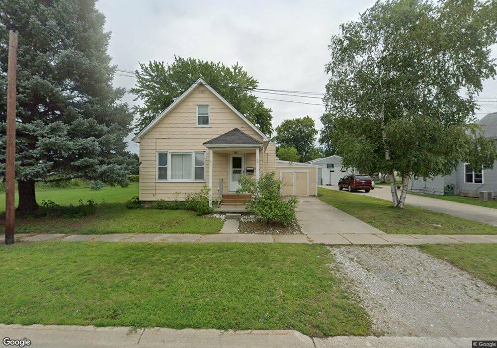
2318 15th St Port Huron, MI 48060
Estimated Value: $119,000 - $140,000
2
Beds
1
Bath
1,268
Sq Ft
$100/Sq Ft
Est. Value
About This Home
This home is located at 2318 15th St, Port Huron, MI 48060 and is currently estimated at $126,433, approximately $99 per square foot. 2318 15th St is a home located in St. Clair County with nearby schools including Michigamme Elementary School, Central Middle School, and Port Huron High School.
Ownership History
Date
Name
Owned For
Owner Type
Purchase Details
Closed on
Jan 11, 2018
Sold by
St Clair County Sheriff
Bought by
Wilmington Savings Fund Society Fsb
Current Estimated Value
Purchase Details
Closed on
Jan 27, 2006
Sold by
Mackay Stephen Alberto
Bought by
Thielman Julianne M
Home Financials for this Owner
Home Financials are based on the most recent Mortgage that was taken out on this home.
Original Mortgage
$53,315
Interest Rate
6.46%
Mortgage Type
New Conventional
Create a Home Valuation Report for This Property
The Home Valuation Report is an in-depth analysis detailing your home's value as well as a comparison with similar homes in the area
Home Values in the Area
Average Home Value in this Area
Purchase History
| Date | Buyer | Sale Price | Title Company |
|---|---|---|---|
| Wilmington Savings Fund Society Fsb | $43,000 | -- | |
| Thielman Julianne M | $57,600 | None Available |
Source: Public Records
Mortgage History
| Date | Status | Borrower | Loan Amount |
|---|---|---|---|
| Previous Owner | Thielman Julianne M | $53,315 |
Source: Public Records
Tax History Compared to Growth
Tax History
| Year | Tax Paid | Tax Assessment Tax Assessment Total Assessment is a certain percentage of the fair market value that is determined by local assessors to be the total taxable value of land and additions on the property. | Land | Improvement |
|---|---|---|---|---|
| 2025 | $1,429 | $50,700 | $0 | $0 |
| 2024 | $1,049 | $48,000 | $0 | $0 |
| 2023 | $991 | $43,000 | $0 | $0 |
| 2022 | $980 | $35,900 | $0 | $0 |
| 2021 | $1,510 | $32,700 | $0 | $0 |
| 2020 | $941 | $28,800 | $28,800 | $0 |
| 2019 | $924 | $20,300 | $0 | $0 |
| 2018 | $904 | $20,300 | $0 | $0 |
| 2017 | $809 | $19,000 | $0 | $0 |
| 2016 | $681 | $19,000 | $0 | $0 |
| 2015 | $706 | $19,000 | $19,000 | $0 |
| 2014 | $706 | $19,700 | $19,700 | $0 |
| 2013 | -- | $20,800 | $0 | $0 |
Source: Public Records
Map
Nearby Homes
- 1414 Beard St
- 1403 Catherine McAuley Dr
- 1319 Minnie St
- 2411 10th St
- 1322 Division St
- 2718 Electric Ave
- 1112 Minnie St
- 2710 Electric Ave
- 1325 Division St
- 1309 Division St
- 1127 Minnie St
- 1624 15th St
- 1535 Oak St
- 2815 Military St
- 913 Tunnel St
- 1610 16th St
- 823 Beard St
- 2704 Military St
- 2724 Military St
- 2203 VL Railroad St
- 2312 15th St
- 2315 15th St
- 1425 Beard St
- 2317 15th St Unit 2319
- 2324 15th St
- 2321 15th St Unit 2323
- 1511 Beard St
- 1421 Beard St
- 1503 Beard St
- 1505 Beard St
- 2311 14th St
- 1417 Beard St
- 1517 Beard St
- 1433 Beard St
- 1500 Beard St
- 1500 Beard St Unit 1535
- 1500 Beard St
- 2317 14th St
- 2319 14th St
- 1504 Beard St