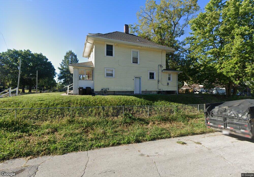
2318 N 12th St Kansas City, KS 66104
Northeast Kansas City NeighborhoodEstimated Value: $136,679 - $178,000
3
Beds
2
Baths
1,494
Sq Ft
$104/Sq Ft
Est. Value
About This Home
This home is located at 2318 N 12th St, Kansas City, KS 66104 and is currently estimated at $154,670, approximately $103 per square foot. 2318 N 12th St is a home located in Wyandotte County with nearby schools including Bertram Caruthers Elementary School, Carl B. Bruce Middle School, and Wyandotte High School.
Ownership History
Date
Name
Owned For
Owner Type
Purchase Details
Closed on
Sep 23, 2010
Sold by
Capital Equity Partners Llc
Bought by
Llewellyn Holdings Llc
Current Estimated Value
Purchase Details
Closed on
Sep 10, 2010
Sold by
Deutsche Bank National Trust Company
Bought by
Capital Equity Partners Llc
Purchase Details
Closed on
Jun 10, 2010
Sold by
Brown Elnora C
Bought by
Deutsche Bank National Trust Company
Create a Home Valuation Report for This Property
The Home Valuation Report is an in-depth analysis detailing your home's value as well as a comparison with similar homes in the area
Home Values in the Area
Average Home Value in this Area
Purchase History
| Date | Buyer | Sale Price | Title Company |
|---|---|---|---|
| Llewellyn Holdings Llc | -- | Cornerstone Title Svcs Llc | |
| Capital Equity Partners Llc | -- | Insight Title Company Llc | |
| Deutsche Bank National Trust Company | $25,075 | None Available |
Source: Public Records
Tax History Compared to Growth
Tax History
| Year | Tax Paid | Tax Assessment Tax Assessment Total Assessment is a certain percentage of the fair market value that is determined by local assessors to be the total taxable value of land and additions on the property. | Land | Improvement |
|---|---|---|---|---|
| 2024 | $1,235 | $9,062 | $1,996 | $7,066 |
| 2023 | $1,190 | $6,003 | $1,640 | $4,363 |
| 2022 | $638 | $4,382 | $1,265 | $3,117 |
| 2021 | $546 | $3,531 | $378 | $3,153 |
| 2020 | $468 | $3,066 | $307 | $2,759 |
| 2019 | $358 | $2,413 | $307 | $2,106 |
| 2018 | $286 | $1,951 | $270 | $1,681 |
| 2017 | $289 | $1,947 | $253 | $1,694 |
| 2016 | $324 | $2,163 | $253 | $1,910 |
| 2015 | $328 | $2,163 | $253 | $1,910 |
| 2014 | $725 | $3,468 | $250 | $3,218 |
Source: Public Records
Map
Nearby Homes
- 1134 Haskell Ave
- 1133 Cleveland Ave
- 2518 N 12th St
- 1137 Greeley Ave
- 1049 Cleveland Ave
- 1333 Waverly Ave
- 1341 Rowland Ave
- 1336 Rowland Ave
- 1500 Waverly Ave
- 1342 Georgia Ave
- 1527 Haskell Ave
- 1009 Quindaro Blvd
- 2213 N 10th St
- 932 Greeley Ave
- 1060 Kimball Ave
- 2837 Parkwood Blvd
- 2928 Roosevelt St
- 1228 Richmond Ave
- 823 Greeley Ave
- 3005 N 10th St
- 2312 N 12th St
- 1213 Haskell Ave
- 1215 Haskell Ave
- 2404 N 12th St
- 1210 Haskell Ave
- 1219 Haskell Ave
- 1214 Haskell Ave
- 1210 Waverly Ave
- 2406 N 12th St
- 2300 N 12th St
- 1214 Waverly Ave
- 2313 N 12th St
- 1221 Haskell Ave
- 1216 Haskell Ave
- 2309 N 12th St
- 2307 N 12th St
- 1223 Haskell Ave
- 1218 Haskell Ave
- 2403 N 12th St
- 2305 N 12th St