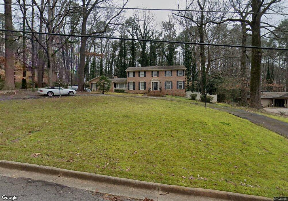
2319 Flintlock Dr Unit XVIII Stone Mountain, GA 30087
Estimated Value: $465,646 - $536,000
4
Beds
3
Baths
2,730
Sq Ft
$183/Sq Ft
Est. Value
About This Home
This home is located at 2319 Flintlock Dr Unit XVIII, Stone Mountain, GA 30087 and is currently estimated at $500,162, approximately $183 per square foot. 2319 Flintlock Dr Unit XVIII is a home located in DeKalb County with nearby schools including Smoke Rise Elementary School, Tucker Middle School, and Tucker High School.
Ownership History
Date
Name
Owned For
Owner Type
Purchase Details
Closed on
Sep 18, 2002
Sold by
Wilson Omia L and Wilson Franklin H
Bought by
Goodson Ronald N and Goodson Constance
Current Estimated Value
Home Financials for this Owner
Home Financials are based on the most recent Mortgage that was taken out on this home.
Original Mortgage
$256,500
Outstanding Balance
$36,454
Interest Rate
6.19%
Mortgage Type
New Conventional
Estimated Equity
$463,708
Create a Home Valuation Report for This Property
The Home Valuation Report is an in-depth analysis detailing your home's value as well as a comparison with similar homes in the area
Home Values in the Area
Average Home Value in this Area
Purchase History
| Date | Buyer | Sale Price | Title Company |
|---|---|---|---|
| Goodson Ronald N | $285,000 | -- |
Source: Public Records
Mortgage History
| Date | Status | Borrower | Loan Amount |
|---|---|---|---|
| Open | Goodson Ronald N | $256,500 |
Source: Public Records
Tax History Compared to Growth
Tax History
| Year | Tax Paid | Tax Assessment Tax Assessment Total Assessment is a certain percentage of the fair market value that is determined by local assessors to be the total taxable value of land and additions on the property. | Land | Improvement |
|---|---|---|---|---|
| 2025 | $5,227 | $174,720 | $34,000 | $140,720 |
| 2024 | $5,130 | $165,640 | $34,000 | $131,640 |
| 2023 | $5,130 | $168,400 | $34,000 | $134,400 |
| 2022 | $4,174 | $129,240 | $24,000 | $105,240 |
| 2021 | $3,929 | $115,800 | $24,000 | $91,800 |
| 2020 | $3,189 | $93,760 | $50,040 | $43,720 |
| 2019 | $3,729 | $111,320 | $50,040 | $61,280 |
| 2018 | $3,226 | $92,680 | $50,040 | $42,640 |
| 2017 | $3,411 | $97,120 | $50,040 | $47,080 |
| 2016 | $3,394 | $99,120 | $50,040 | $49,080 |
| 2014 | $2,886 | $85,120 | $50,040 | $35,080 |
Source: Public Records
Map
Nearby Homes
- 2350 Oxbow Cir
- 5363 Rosser Rd
- 127 Roe Hampton Ln
- 353 Old Rosser Rd
- 5401 Smoke Rise Dr
- 292 Old Rosser Rd
- 507 Castleaire Dr Unit 1
- 507 Castlearie Dr
- 5169 Oxbow Rd
- 5211 Hugh Howell Rd
- 483 Rollingwood Dr
- 2174 Deer Ridge Dr
- 5632 Stillwater Ct
- 5523 Bahia Mar Cir
- 2037 Stoneleigh Dr
- 2023 Stoneleigh Dr
- 2598 Bloom Cir
- 164 Thorncrest Ct
- 2331 Flintlock Dr
- 2307 Flintlock Dr Unit 18
- 2312 Flintlock Dr
- 2343 Flintlock Dr
- 5518 Rosser Rd
- 0 Flintlock Dr Unit 7333294
- 0 Flintlock Dr Unit 7111428
- 0 Flintlock Dr Unit 8816989
- 0 Flintlock Dr Unit 8515773
- 5532 Rosser Rd
- 2326 Flintlock Dr
- 2291 Flintlock Dr
- 2300 Flintlock Dr
- 5428 Oxbow Rd
- 5502 Rosser Rd
- 5546 Rosser Rd
- 2340 Flintlock Dr
- 2355 Flintlock Dr
- 5390 Oxbow Rd Unit XVI
- 5379 Antelope Ln