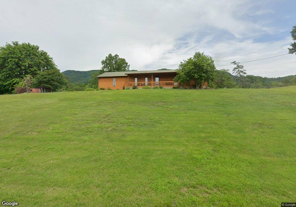
232 Clifford Price Loop Unit S/D LAWSON & TRENT P Mooresburg, TN 37811
Estimated Value: $423,000 - $512,000
3
Beds
2
Baths
1,400
Sq Ft
$336/Sq Ft
Est. Value
About This Home
This home is located at 232 Clifford Price Loop Unit S/D LAWSON & TRENT P, Mooresburg, TN 37811 and is currently estimated at $469,710, approximately $335 per square foot. 232 Clifford Price Loop Unit S/D LAWSON & TRENT P is a home located in Hawkins County with nearby schools including Mooresburg Elementary School, Rogersville Middle School, and Cherokee High School.
Ownership History
Date
Name
Owned For
Owner Type
Purchase Details
Closed on
Sep 19, 2019
Sold by
Brown Amy Dawn Williams
Bought by
Brown Phillip L
Current Estimated Value
Purchase Details
Closed on
Apr 29, 1989
Bought by
Brown Phillip and Brown Valerie
Create a Home Valuation Report for This Property
The Home Valuation Report is an in-depth analysis detailing your home's value as well as a comparison with similar homes in the area
Home Values in the Area
Average Home Value in this Area
Purchase History
| Date | Buyer | Sale Price | Title Company |
|---|---|---|---|
| Brown Phillip L | -- | None Available | |
| Brown Phillip | $15,000 | -- |
Source: Public Records
Tax History Compared to Growth
Tax History
| Year | Tax Paid | Tax Assessment Tax Assessment Total Assessment is a certain percentage of the fair market value that is determined by local assessors to be the total taxable value of land and additions on the property. | Land | Improvement |
|---|---|---|---|---|
| 2024 | $1,353 | $52,975 | $9,500 | $43,475 |
| 2023 | $1,232 | $52,975 | $0 | $0 |
| 2022 | $1,393 | $60,100 | $16,625 | $43,475 |
| 2021 | $1,303 | $60,100 | $16,625 | $43,475 |
| 2020 | $1,224 | $60,100 | $16,625 | $43,475 |
| 2019 | $1,224 | $48,350 | $16,325 | $32,025 |
| 2018 | $1,079 | $48,350 | $16,325 | $32,025 |
| 2017 | $1,079 | $42,625 | $16,325 | $26,300 |
| 2016 | $1,079 | $42,625 | $16,325 | $26,300 |
| 2015 | $1,051 | $42,625 | $16,325 | $26,300 |
| 2014 | $1,198 | $48,600 | $17,925 | $30,675 |
Source: Public Records
Map
Nearby Homes
- 0 Lovin Rd
- 185 Lovin Rd
- 743 Jim Town Rd
- 751 Jim Town Rd
- 246 Boat Dock (3 6 Acres ) Ln
- 117 Grigsby Rd
- 156 Pyne Hills Dr
- 246 Rd
- LOT 34 5 Oaks Cir
- Lot 35 Five Oaks Cir
- Lot 36 Five Oaks Cir
- Lot 49 Hickory Knoll Cir
- Lot 30 Walnut Bend Dr
- Lot 11 Walnut Bend Dr
- 0 Cloud Creek Rd
- 30 Walnut Bend Dr
- Lot 4 Walnut Bend Dr
- 669 Choptack Rd
- 232 Clifford Price Loop
- 238 Clifford Price Loop
- 242 Clifford Price Loop
- 239 Clifford Price Loop
- 9126 Highway 11 W
- 206 Clifford Price Loop
- 220 Clifford Price Loop
- 241 Clifford Price Loop
- 139 Rough House Hollow Rd
- 139 Rough House Hollow Rd Unit 1
- 292 Clifford Price Loop
- 175 Rough House Hollow Rd
- 108 Clifford Price Loop
- 9094 Highway 11 W
- 151 Rough House Hollow Rd
- 136 Lovin Rd
- 9183 Highway 11 W
- 9192 Highway 11 W
- 9006 Highway 11 W
- 171 Lovin Rd