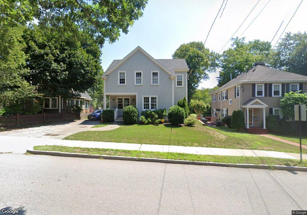
232 Grove St Auburndale, MA 02466
Auburndale NeighborhoodEstimated Value: $1,533,000 - $1,779,155
3
Beds
4
Baths
2,502
Sq Ft
$670/Sq Ft
Est. Value
About This Home
This home is located at 232 Grove St, Auburndale, MA 02466 and is currently estimated at $1,675,789, approximately $669 per square foot. 232 Grove St is a home located in Middlesex County with nearby schools including Williams Elementary School, Charles E Brown Middle School, and Newton South High School.
Ownership History
Date
Name
Owned For
Owner Type
Purchase Details
Closed on
Aug 29, 2018
Sold by
Granese Sherren M
Bought by
Sherren M Granese T
Current Estimated Value
Purchase Details
Closed on
Jul 29, 2011
Sold by
Granese Anthony J and Granese Marian L
Bought by
Granese Sherren M
Purchase Details
Closed on
Sep 19, 1989
Sold by
Reed Susan H
Bought by
Granese Sherren M
Home Financials for this Owner
Home Financials are based on the most recent Mortgage that was taken out on this home.
Original Mortgage
$135,000
Interest Rate
9.58%
Mortgage Type
Purchase Money Mortgage
Create a Home Valuation Report for This Property
The Home Valuation Report is an in-depth analysis detailing your home's value as well as a comparison with similar homes in the area
Home Values in the Area
Average Home Value in this Area
Purchase History
| Date | Buyer | Sale Price | Title Company |
|---|---|---|---|
| Sherren M Granese T | -- | -- | |
| Granese Sherren M | -- | -- | |
| Granese Sherren M | $200,000 | -- |
Source: Public Records
Mortgage History
| Date | Status | Borrower | Loan Amount |
|---|---|---|---|
| Previous Owner | Granese Sherren M | $275,000 | |
| Previous Owner | Granese Sherren M | $135,000 | |
| Previous Owner | Granese Sherren M | $135,000 |
Source: Public Records
Tax History Compared to Growth
Tax History
| Year | Tax Paid | Tax Assessment Tax Assessment Total Assessment is a certain percentage of the fair market value that is determined by local assessors to be the total taxable value of land and additions on the property. | Land | Improvement |
|---|---|---|---|---|
| 2025 | $14,156 | $1,444,500 | $890,000 | $554,500 |
| 2024 | $13,687 | $1,402,400 | $864,100 | $538,300 |
| 2023 | $13,057 | $1,282,600 | $663,400 | $619,200 |
| 2022 | $12,494 | $1,187,600 | $614,300 | $573,300 |
| 2021 | $12,056 | $1,120,400 | $579,500 | $540,900 |
| 2020 | $11,697 | $1,120,400 | $579,500 | $540,900 |
| 2019 | $11,368 | $1,087,800 | $562,600 | $525,200 |
| 2018 | $10,849 | $1,002,700 | $510,200 | $492,500 |
| 2017 | $10,518 | $945,900 | $481,300 | $464,600 |
| 2016 | $10,060 | $884,000 | $449,800 | $434,200 |
| 2015 | $9,592 | $826,200 | $420,400 | $405,800 |
Source: Public Records
Map
Nearby Homes
- 27 Oakwood Rd
- 17 Lasell St
- 283 Woodland Rd
- 224 Auburn St Unit 224
- 224 Auburn St Unit A
- 17 Deforest Rd
- 283 Melrose St
- 226 Auburn St Unit 226
- 2202 Commonwealth Ave Unit 2
- 2202 Commonwealth Ave Unit 1
- 1754 Washington St
- 2084 Washington St
- 1639 Washington St
- 13 Weir St
- 62-64 Rowe St Unit B
- 17 Gilbert St
- 10 Lorraine Cir
- 51 Bourne St
- 1640 Commonwealth Ave
- 45 Moulton St
- 236 Grove St Unit 238
- 228 Grove St
- 238 Grove St Unit 2
- 238 Grove St Unit 238
- 242 Grove St Unit 244
- 222 Grove St
- 248 Grove St
- 233 Grove St
- 225 Grove St
- 225 Grove St Unit 3
- 225 Grove St
- 225 Grove St Unit 1
- 216 Grove St
- 24 Robin Dell St
- 245 Grove St
- 221 Grove St
- 221 Grove St Unit 2
- 221 Grove St Unit 1
- 215 Grove St
- 18 Norumbega Ct