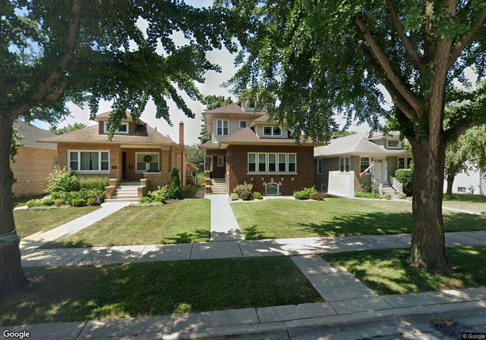
232 Lathrop Ave River Forest, IL 60305
Estimated Value: $447,000 - $593,000
2
Beds
1
Bath
1,382
Sq Ft
$389/Sq Ft
Est. Value
About This Home
This home is located at 232 Lathrop Ave, River Forest, IL 60305 and is currently estimated at $537,339, approximately $388 per square foot. 232 Lathrop Ave is a home located in Cook County with nearby schools including Lincoln Elementary School, Roosevelt Middle School, and Oak Park and River Forest High School.
Ownership History
Date
Name
Owned For
Owner Type
Purchase Details
Closed on
Jan 14, 2011
Sold by
Lennon Gary and Lennon Kim
Bought by
Lennon Gary Alan and The Gary Alan Lennon Declaration Of Trus
Current Estimated Value
Purchase Details
Closed on
Oct 14, 2010
Sold by
Sims Violet G and Kluttz Violet R
Bought by
Lennon Gary and Lennon Kim
Create a Home Valuation Report for This Property
The Home Valuation Report is an in-depth analysis detailing your home's value as well as a comparison with similar homes in the area
Home Values in the Area
Average Home Value in this Area
Purchase History
| Date | Buyer | Sale Price | Title Company |
|---|---|---|---|
| Lennon Gary Alan | -- | Chicago Title Insurance Co | |
| Lennon Gary | $200,000 | Chicago Title Insurance Co |
Source: Public Records
Tax History
| Year | Tax Paid | Tax Assessment Tax Assessment Total Assessment is a certain percentage of the fair market value that is determined by local assessors to be the total taxable value of land and additions on the property. | Land | Improvement |
|---|---|---|---|---|
| 2025 | $10,138 | $43,000 | $7,394 | $35,606 |
| 2024 | $10,138 | $43,000 | $7,394 | $35,606 |
| 2023 | $9,609 | $43,000 | $7,394 | $35,606 |
| 2022 | $9,609 | $35,912 | $6,362 | $29,550 |
| 2021 | $9,304 | $35,912 | $6,362 | $29,550 |
| 2020 | $9,216 | $35,912 | $6,362 | $29,550 |
| 2019 | $10,500 | $37,254 | $5,846 | $31,408 |
| 2018 | $9,939 | $37,254 | $5,846 | $31,408 |
| 2017 | $9,921 | $37,254 | $5,846 | $31,408 |
| 2016 | $8,507 | $28,942 | $4,814 | $24,128 |
| 2015 | $8,318 | $28,942 | $4,814 | $24,128 |
| 2014 | $7,635 | $28,942 | $4,814 | $24,128 |
| 2013 | $4,901 | $20,000 | $4,814 | $15,186 |
Source: Public Records
Map
Nearby Homes
- 215 Rockford Ave
- 310 Lathrop Ave Unit P52
- 210 Des Plaines Ave Unit D
- 7521 Brown Ave Unit G
- 314 Lathrop Ave Unit 502
- 314 Lathrop Ave Unit 407
- 314 Lathrop Ave Unit 402
- 314 Lathrop Ave Unit 503
- 314 Lathrop Ave Unit 604
- 314 Lathrop Ave Unit 507
- 7449 Washington St Unit 206
- 7449 Washington St Unit 207
- 315 Des Plaines Ave Unit 406
- 411 Ashland Ave Unit 1A
- 7443 Washington St Unit 307
- 7415 Dixon St
- 17 Ashland Ave
- 7421 Washington St
- 17 Franklin Ave
- 7428 Washington St Unit 602
- 228 Lathrop Ave
- 234 Lathrop Ave
- 224 Lathrop Ave
- 238 Lathrop Ave
- 222 Lathrop Ave
- 242 Lathrop Ave
- 218 Lathrop Ave
- 216 Lathrop Ave
- 124 Lathrop Ave Unit 2
- 124 Lathrop Ave
- 126 Lathrop Ave Unit 1F
- 126 Lathrop Ave
- 229 Ashland Ave
- 235 Ashland Ave
- 120 Lathrop Ave
- 120 Lathrop Ave Unit 2
- 120 Lathrop Ave Unit 1
- 302 Lathrop Ave
- 239 Ashland Ave
- 225 Ashland Ave
Your Personal Tour Guide
Ask me questions while you tour the home.