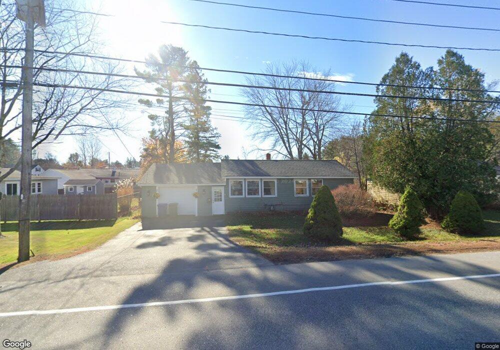
232 New Gorham Rd Westbrook, ME 04092
Estimated Value: $334,891 - $379,000
2
Beds
1
Bath
851
Sq Ft
$419/Sq Ft
Est. Value
About This Home
This home is located at 232 New Gorham Rd, Westbrook, ME 04092 and is currently estimated at $356,223, approximately $418 per square foot. 232 New Gorham Rd is a home located in Cumberland County with nearby schools including Westbrook High School, The Little Dolphin School Foundation, and Breakwater School.
Ownership History
Date
Name
Owned For
Owner Type
Purchase Details
Closed on
Feb 28, 2008
Sold by
Wells Fargo Bank Na Tr
Bought by
Smith Terrence A
Current Estimated Value
Home Financials for this Owner
Home Financials are based on the most recent Mortgage that was taken out on this home.
Original Mortgage
$110,567
Interest Rate
5.8%
Mortgage Type
FHA
Purchase Details
Closed on
Oct 17, 2007
Sold by
Letarte Robin K and Wells Frago Bank Na
Bought by
Wells Frago Bank Na
Create a Home Valuation Report for This Property
The Home Valuation Report is an in-depth analysis detailing your home's value as well as a comparison with similar homes in the area
Home Values in the Area
Average Home Value in this Area
Purchase History
| Date | Buyer | Sale Price | Title Company |
|---|---|---|---|
| Smith Terrence A | $1,001 | -- | |
| Wells Frago Bank Na | -- | -- |
Source: Public Records
Mortgage History
| Date | Status | Borrower | Loan Amount |
|---|---|---|---|
| Open | Wells Frago Bank Na | $112,000 | |
| Closed | Wells Frago Bank Na | $110,567 |
Source: Public Records
Tax History Compared to Growth
Tax History
| Year | Tax Paid | Tax Assessment Tax Assessment Total Assessment is a certain percentage of the fair market value that is determined by local assessors to be the total taxable value of land and additions on the property. | Land | Improvement |
|---|---|---|---|---|
| 2023 | $3,029 | $181,600 | $81,300 | $100,300 |
| 2022 | $2,739 | $151,300 | $67,700 | $83,600 |
| 2021 | $2,698 | $151,300 | $67,700 | $83,600 |
| 2020 | $2,702 | $151,300 | $67,700 | $83,600 |
| 2019 | $2,702 | $151,300 | $67,700 | $83,600 |
| 2018 | $2,717 | $136,200 | $58,900 | $77,300 |
| 2017 | $2,571 | $136,200 | $58,900 | $77,300 |
| 2016 | $2,506 | $136,200 | $58,900 | $77,300 |
| 2015 | $2,446 | $136,200 | $58,900 | $77,300 |
| 2014 | $2,343 | $136,200 | $58,900 | $77,300 |
| 2013 | $2,343 | $136,200 | $58,900 | $77,300 |
Source: Public Records
Map
Nearby Homes
- 280 Longfellow St Unit 9
- 280 Longfellow St Unit 17
- 280 Longfellow St Unit 21
- 30 Palmer St
- 8 Freedom Rd
- 316 New Portland Rd
- 68 Huntress Ave Unit 2
- 11 New Gorham Rd
- 115 Saco St Unit 2
- 87 Mill Ln
- 16 Nicklaus Ln
- 77 Mechanic St
- 17 Mechanic St
- 345 Saco St Unit 35
- 31 Cross St
- 26 Cross St
- 186 Central St
- 13 Lucille St
- 96 Brackett St
- 124 Brackett St
- 236 New Gorham Rd
- 3 Longfellow Dr
- 9 Longfellow Dr
- 5 Longfellow Dr
- 126 (Lot 1) New Portland Rd
- 126 New Portland
- 235 New Gorham Rd
- 10 Longfellow Dr
- 7 Longfellow Dr
- 17 Longfellow Dr
- 364 New Portland Rd
- 4 Longfellow Dr
- 16 Longfellow Dr
- 12 Longfellow Dr
- 8 Longfellow Dr
- 21 Longfellow Dr
- 362 New Portland Rd
- 20 Longfellow Dr
- 223 New Gorham Rd
- 216 New Gorham Rd