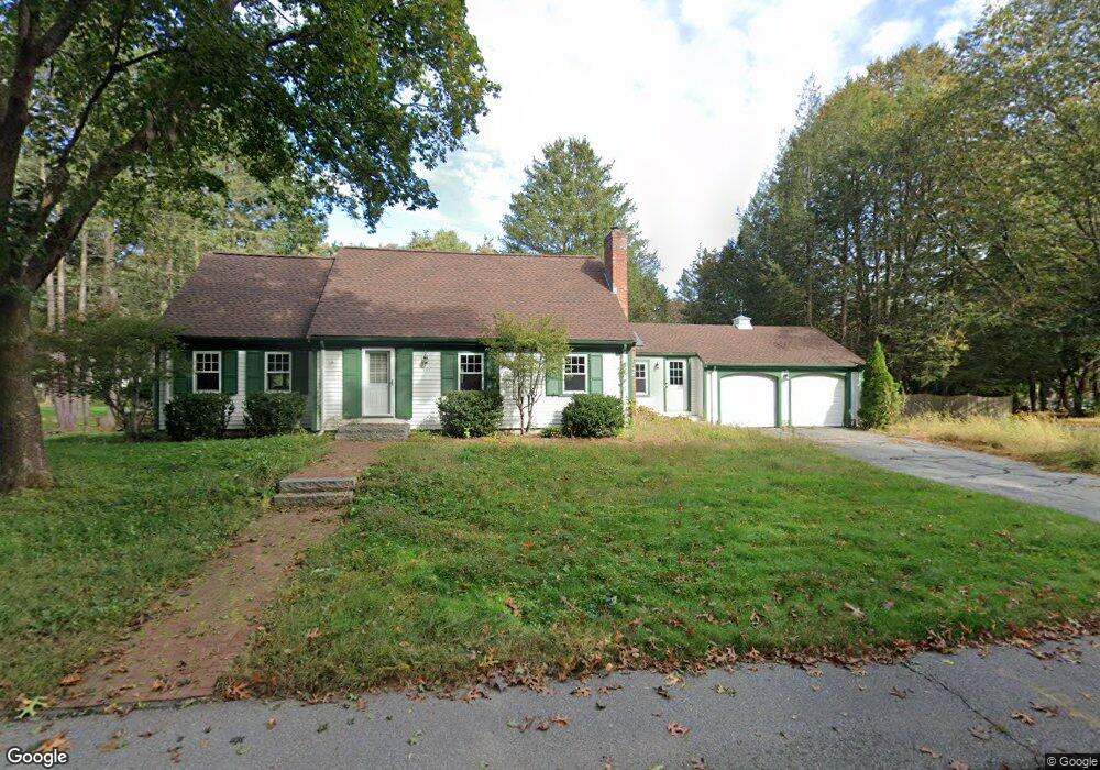
232 Powder Mill Rd Concord, MA 01742
Estimated Value: $1,365,000 - $1,758,000
3
Beds
2
Baths
2,236
Sq Ft
$677/Sq Ft
Est. Value
About This Home
This home is located at 232 Powder Mill Rd, Concord, MA 01742 and is currently estimated at $1,514,638, approximately $677 per square foot. 232 Powder Mill Rd is a home located in Middlesex County with nearby schools including Willard School, Concord Middle School, and Corwin-Russell School at Broccoli Hall.
Ownership History
Date
Name
Owned For
Owner Type
Purchase Details
Closed on
Sep 5, 2025
Sold by
Herman Roberta H and Herman Douglas C
Bought by
Roberta Herlich Herman T and Roberta Herman
Current Estimated Value
Purchase Details
Closed on
Sep 30, 1997
Sold by
Lantz George H and Lantz Maureen D
Bought by
Herman Roberta H and Herman Douglas C
Home Financials for this Owner
Home Financials are based on the most recent Mortgage that was taken out on this home.
Original Mortgage
$379,000
Interest Rate
7.47%
Mortgage Type
Purchase Money Mortgage
Purchase Details
Closed on
Jun 23, 1993
Sold by
Higgins Donald I and Higgins Marjorie L
Bought by
Lantz George H and Lantz Maureen D
Create a Home Valuation Report for This Property
The Home Valuation Report is an in-depth analysis detailing your home's value as well as a comparison with similar homes in the area
Home Values in the Area
Average Home Value in this Area
Purchase History
| Date | Buyer | Sale Price | Title Company |
|---|---|---|---|
| Roberta Herlich Herman T | -- | -- | |
| Herman Roberta H | $479,000 | -- | |
| Lantz George H | $316,000 | -- |
Source: Public Records
Mortgage History
| Date | Status | Borrower | Loan Amount |
|---|---|---|---|
| Previous Owner | Lantz George H | $379,000 | |
| Previous Owner | Lantz George H | $75,000 |
Source: Public Records
Tax History Compared to Growth
Tax History
| Year | Tax Paid | Tax Assessment Tax Assessment Total Assessment is a certain percentage of the fair market value that is determined by local assessors to be the total taxable value of land and additions on the property. | Land | Improvement |
|---|---|---|---|---|
| 2025 | $16,828 | $1,269,100 | $609,500 | $659,600 |
| 2024 | $16,663 | $1,269,100 | $609,500 | $659,600 |
| 2023 | $14,513 | $1,119,800 | $580,400 | $539,400 |
| 2022 | $13,685 | $927,200 | $464,300 | $462,900 |
| 2021 | $13,560 | $921,200 | $464,300 | $456,900 |
| 2020 | $12,911 | $907,300 | $464,300 | $443,000 |
| 2019 | $12,608 | $888,500 | $450,900 | $437,600 |
| 2018 | $11,705 | $819,100 | $409,900 | $409,200 |
| 2017 | $11,643 | $827,500 | $418,300 | $409,200 |
| 2016 | $11,284 | $810,600 | $418,300 | $392,300 |
| 2015 | $10,292 | $720,200 | $361,500 | $358,700 |
Source: Public Records
Map
Nearby Homes
- 40 Rookery Ln Unit 5
- 72 Rookery Ln Unit 3
- 24 Rookery Ln Unit 6
- 56 Rookery Ln Unit 4
- 121 White Pond Way Unit 121
- 401 Emery Ln Unit 304
- 37 Wolf Pine Way
- 497 Old Road to 9 Acre Corner
- 42 Dakin Rd
- 12 S Meadow Ridge Unit 12
- 12 S Meadow Ridge
- 114 Upland Rd
- 16 Blacksmith Dr
- 49 Birchwood Ln Unit 49
- Lot 5 Sailaway Ln
- 45 N Crescent Cir
- Lot 4 Sailaway Ln
- 2 Betts Way
- 8 Mina Way
- 0 Elm Unit 73282184
- 244 Powder Mill Rd
- 210 Powder Mill Rd
- 243 Powder Mill Rd
- 258 Powder Mill Rd
- 28 Peter Bulkeley Rd
- 43 Peter Bulkeley Rd
- 29 Paul Revere Rd
- 263 Powder Mill Rd
- 42 Peter Bulkeley Rd
- 276 Powder Mill Rd
- 49 Paul Revere Rd
- 39 Plainfield Rd
- 56 Peter Bulkeley Rd
- 290 Powder Mill Rd
- 63 Peter Bulkeley Rd
- 28 Paul Revere Rd
- 51 Plainfield Rd
- 67 Paul Revere Rd
- 70 Peter Bulkeley Rd
- 42 Paul Revere Rd