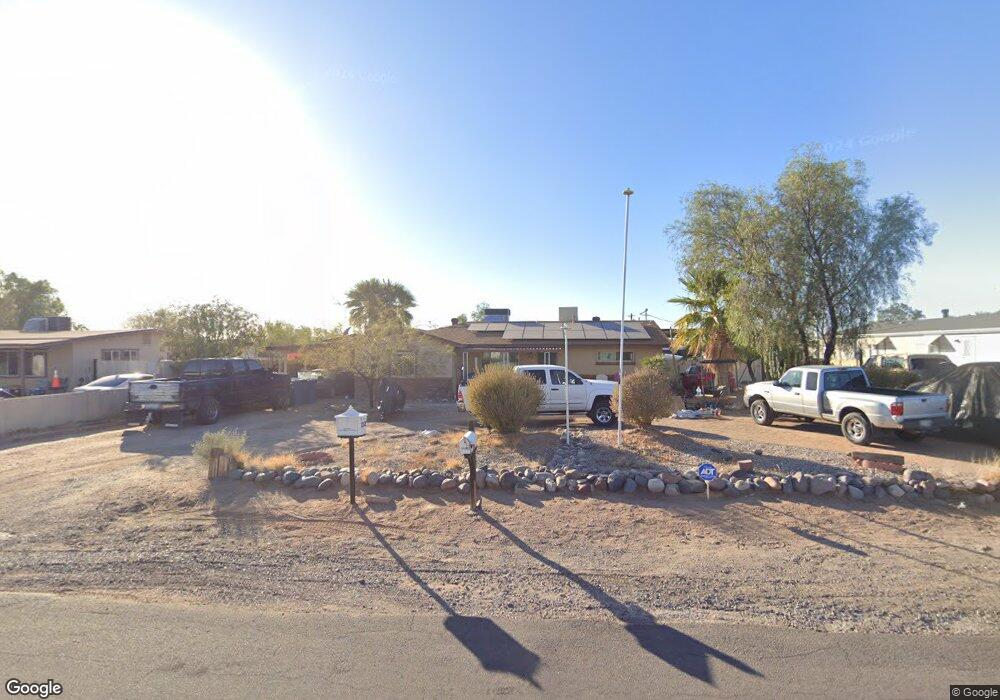
232 S Malcolm Dr Apache Junction, AZ 85120
Northeast Mesa NeighborhoodEstimated Value: $346,000 - $390,105
3
Beds
2
Baths
1,342
Sq Ft
$273/Sq Ft
Est. Value
About This Home
This home is located at 232 S Malcolm Dr, Apache Junction, AZ 85120 and is currently estimated at $367,026, approximately $273 per square foot. 232 S Malcolm Dr is a home located in Maricopa County with nearby schools including Brinton Elementary School, Franklin at Brimhall Elementary School, and Franklin West Elementary School.
Ownership History
Date
Name
Owned For
Owner Type
Purchase Details
Closed on
Jun 14, 2016
Sold by
Bostwick Laurence E and Bostwick Betty L
Bought by
Bostwick Keith
Current Estimated Value
Home Financials for this Owner
Home Financials are based on the most recent Mortgage that was taken out on this home.
Original Mortgage
$87,387
Outstanding Balance
$69,853
Interest Rate
3.87%
Mortgage Type
FHA
Estimated Equity
$297,173
Purchase Details
Closed on
Dec 10, 2010
Sold by
Hsbc Bank Usa National Association
Bought by
Bostwick Laurence E and Bostwick Betty L
Home Financials for this Owner
Home Financials are based on the most recent Mortgage that was taken out on this home.
Original Mortgage
$51,600
Interest Rate
4.35%
Mortgage Type
New Conventional
Purchase Details
Closed on
Sep 2, 2010
Sold by
Granillo Felix
Bought by
Hsbc Mortgage Services Inc
Purchase Details
Closed on
Jul 12, 2006
Sold by
Granillo Maria Guadalupe
Bought by
Granillo Felix
Home Financials for this Owner
Home Financials are based on the most recent Mortgage that was taken out on this home.
Original Mortgage
$200,000
Interest Rate
9.59%
Mortgage Type
Purchase Money Mortgage
Purchase Details
Closed on
Jul 10, 2006
Sold by
Long Robert and Long Amy
Bought by
Granillo Felix
Home Financials for this Owner
Home Financials are based on the most recent Mortgage that was taken out on this home.
Original Mortgage
$200,000
Interest Rate
9.59%
Mortgage Type
Purchase Money Mortgage
Purchase Details
Closed on
Jan 10, 2003
Sold by
Brechbiel Harry R and Brechbiel Gloria J
Bought by
Long Robert and Long Amy
Home Financials for this Owner
Home Financials are based on the most recent Mortgage that was taken out on this home.
Original Mortgage
$91,000
Interest Rate
8.5%
Mortgage Type
New Conventional
Purchase Details
Closed on
Jul 11, 1994
Sold by
Brechbiel Harry R and Brechbiel Gloria J
Bought by
Brechbiel Harry R and Brechbiel Gloria J
Create a Home Valuation Report for This Property
The Home Valuation Report is an in-depth analysis detailing your home's value as well as a comparison with similar homes in the area
Home Values in the Area
Average Home Value in this Area
Purchase History
| Date | Buyer | Sale Price | Title Company |
|---|---|---|---|
| Bostwick Keith | $89,000 | Equity Title Agency Inc | |
| Bostwick Laurence E | $64,500 | Security Title Agency | |
| Hsbc Mortgage Services Inc | $56,569 | Accommodation | |
| Granillo Felix | -- | Camelback Title Agency Llc | |
| Granillo Felix | $200,000 | Camelback Title Agency Llc | |
| Long Robert | $113,750 | Capital Title Agency Inc | |
| Brechbiel Harry R | -- | -- |
Source: Public Records
Mortgage History
| Date | Status | Borrower | Loan Amount |
|---|---|---|---|
| Open | Bostwick Keith | $87,387 | |
| Closed | Bostwick Laurence E | $51,600 | |
| Previous Owner | Granillo Felix | $200,000 | |
| Previous Owner | Long Robert | $91,000 |
Source: Public Records
Tax History
| Year | Tax Paid | Tax Assessment Tax Assessment Total Assessment is a certain percentage of the fair market value that is determined by local assessors to be the total taxable value of land and additions on the property. | Land | Improvement |
|---|---|---|---|---|
| 2025 | $659 | $8,842 | -- | -- |
| 2024 | $673 | $8,421 | -- | -- |
| 2023 | $673 | $28,070 | $5,610 | $22,460 |
| 2022 | $656 | $19,430 | $3,880 | $15,550 |
| 2021 | $664 | $17,260 | $3,450 | $13,810 |
| 2020 | $659 | $14,560 | $2,910 | $11,650 |
| 2019 | $603 | $12,810 | $2,560 | $10,250 |
| 2018 | $587 | $11,510 | $2,300 | $9,210 |
| 2017 | $565 | $10,250 | $2,050 | $8,200 |
| 2016 | $553 | $9,650 | $1,930 | $7,720 |
Source: Public Records
Map
Nearby Homes
- 301 S Elmont Dr
- 11311 E 6th Ave
- 143 S Mountain Rd
- 724 S Emerald Dr
- 744 S Emerald Dr
- 434 S 113th Way
- 11263 E Crescent Ave
- 11203 E Crescent Ave
- 11451 E Broadway Rd
- 11529 E 4th Ave
- 11066 E Abilene Ave
- 11435 E Apache Trail Unit 48
- 11435 E Apache Trail Unit 84
- 155 S Parkwood
- 11100 E Apache Trail Unit 37
- 11100 E Apache Trail
- 11100 E Apache Trail Unit 8
- 11100 E Apache Trail Unit 16
- 11100 E Apache Trail Unit 48
- 609 S 111th Place
- 240 S Malcolm Dr
- 220 S Malcolm Dr
- 231 S Elmont Dr
- 11303 E 5th Ave
- 11303 E 5th Ave
- 233 S Elmont Dr
- 212 S Malcom St
- 212 S Malcolm Dr
- 304 S Malcolm Dr
- 221 S Elmont Dr
- 241 S Malcolm Dr
- 221 S Elmont Dr
- 11302 E 5th Ave
- 247 S Elmont Dr
- 11311 E 5th Ave
- 213 S Elmont Dr
- 11312 E 5th Ave
- 202 S Malcolm Dr
- 202 S Malcolm Dr
- 11217 E 4th Ave
Your Personal Tour Guide
Ask me questions while you tour the home.