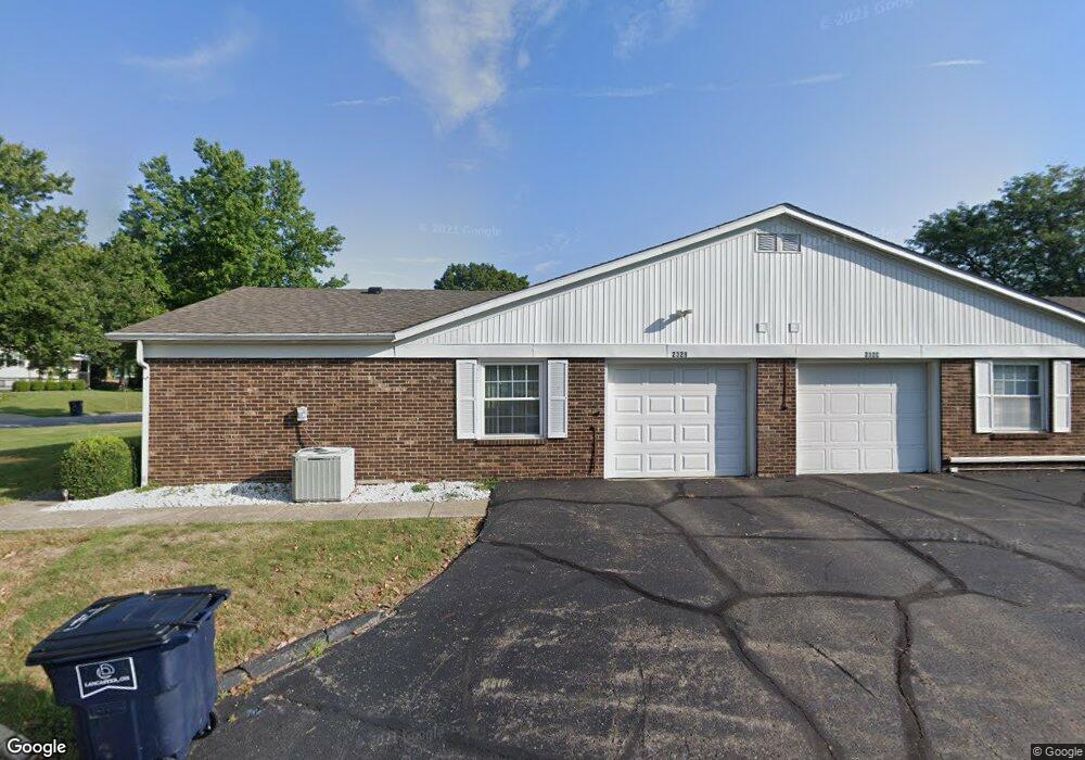
232 Trace Dr Unit 6B Lancaster, OH 43130
Estimated Value: $178,727 - $205,000
2
Beds
2
Baths
1,019
Sq Ft
$189/Sq Ft
Est. Value
About This Home
This home is located at 232 Trace Dr Unit 6B, Lancaster, OH 43130 and is currently estimated at $192,682, approximately $189 per square foot. 232 Trace Dr Unit 6B is a home located in Fairfield County with nearby schools including General Sherman Junior High School, Lancaster High School, and St Mary Elementary School.
Ownership History
Date
Name
Owned For
Owner Type
Purchase Details
Closed on
Aug 13, 2020
Sold by
Medhurst Richard D Daubenmire and Estate Of Richard D Daubenmire
Bought by
Dillie Justin A
Current Estimated Value
Home Financials for this Owner
Home Financials are based on the most recent Mortgage that was taken out on this home.
Original Mortgage
$130,050
Outstanding Balance
$114,092
Interest Rate
2.9%
Mortgage Type
New Conventional
Estimated Equity
$78,590
Purchase Details
Closed on
Jun 21, 2010
Sold by
Dingus Marian F
Bought by
Daubenmire Richard D
Home Financials for this Owner
Home Financials are based on the most recent Mortgage that was taken out on this home.
Original Mortgage
$80,000
Interest Rate
5.05%
Mortgage Type
New Conventional
Purchase Details
Closed on
Aug 4, 2008
Sold by
Dingus Steven Michael and Dingus Mary Hempe
Bought by
Dingus Marian F and The Restatement Of Trust Agreement Of Ma
Purchase Details
Closed on
Jul 7, 2008
Sold by
Dingus Marian F
Bought by
Dingus Steven Michael
Purchase Details
Closed on
Feb 17, 1994
Sold by
Leffel Mary M
Bought by
Figgins Carol L
Purchase Details
Closed on
Aug 1, 1986
Create a Home Valuation Report for This Property
The Home Valuation Report is an in-depth analysis detailing your home's value as well as a comparison with similar homes in the area
Home Values in the Area
Average Home Value in this Area
Purchase History
| Date | Buyer | Sale Price | Title Company |
|---|---|---|---|
| Dillie Justin A | $148,000 | None Available | |
| Dillie Justin A | $148,000 | None Available | |
| Daubenmire Richard D | $90,000 | Valmer Land Title Agency | |
| Daubenmire Richard D | $90,000 | Valmer Land Title Agency | |
| Dingus Marian F | -- | Attorney | |
| Dingus Marian F | -- | Attorney | |
| Dingus Steven Michael | -- | Attorney | |
| Dingus Steven Michael | -- | Attorney | |
| Figgins Carol L | $67,000 | -- | |
| Figgins Carol L | $67,000 | -- | |
| -- | $54,000 | -- | |
| -- | $54,000 | -- |
Source: Public Records
Mortgage History
| Date | Status | Borrower | Loan Amount |
|---|---|---|---|
| Open | Dillie Justin A | $130,050 | |
| Previous Owner | Daubenmire Richard D | $80,000 |
Source: Public Records
Tax History
| Year | Tax Paid | Tax Assessment Tax Assessment Total Assessment is a certain percentage of the fair market value that is determined by local assessors to be the total taxable value of land and additions on the property. | Land | Improvement |
|---|---|---|---|---|
| 2025 | $3,436 | $55,530 | $14,000 | $41,530 |
| 2024 | $3,436 | $38,220 | $7,000 | $31,220 |
| 2023 | $1,390 | $38,220 | $7,000 | $31,220 |
| 2022 | $1,396 | $38,220 | $7,000 | $31,220 |
| 2021 | $1,224 | $31,390 | $7,000 | $24,390 |
| 2020 | $887 | $31,390 | $7,000 | $24,390 |
| 2019 | $804 | $31,390 | $7,000 | $24,390 |
| 2018 | $1,011 | $25,370 | $7,000 | $18,370 |
| 2017 | $1,011 | $27,040 | $7,000 | $20,040 |
| 2016 | $985 | $27,040 | $7,000 | $20,040 |
| 2015 | $981 | $26,150 | $7,000 | $19,150 |
| 2014 | $935 | $26,150 | $7,000 | $19,150 |
| 2013 | $935 | $26,150 | $7,000 | $19,150 |
Source: Public Records
Map
Nearby Homes
- 435 Alison Ct
- 219 Peters Ave
- 114-116 S Cedar Ave
- 772 Pennsylvania Ave
- 1414 Cedar Hill Rd
- 738 Maryland Ave
- 1511 Cedar Hill Rd
- 729 Pennsylvania Ave
- 453 Bren Dr
- 104 S Pierce Ave
- 132 N Pierce Ave
- 157 Cedar Hill Rd
- 0 Highland Ave
- 233 N Pierce Ave
- 215 Summitview Dr
- 520 W Wheeling St
- 1829 Shoshone Dr
- 113 N George St
- 461 N Shoshone Dr
- 529 W Mulberry St
- 232 Trace Dr
- 232 Trace Dr Unit C
- 232 Trace Dr Unit B
- 250 Trace Dr
- 250 Trace Dr C
- 0 Canterbury Ct Unit 438A
- 951 Canterbury Ct
- 951 Canterbury Ct Unit 5B
- 951 Canterbury Ct Unit 5A
- 951 Canterbury Ct Unit 5D
- 951 Canterbury Ct Unit D
- 951 Canterbury Ct Unit A
- 951 Canterbury Ct Unit C
- 951 Canterbury Ct
- 250 Trace Dr
- 250 Trace Dr
- 250 Trace Dr
- 250 Trace Dr Unit 7D
- 250 Trace Dr Unit D
- 250 Trace Dr Unit B
Your Personal Tour Guide
Ask me questions while you tour the home.