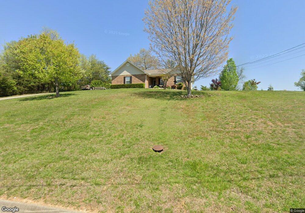
2320 Katie Ln Unit S/D MAPLE RIDGE Morristown, TN 37814
Estimated Value: $295,000 - $349,000
3
Beds
2
Baths
1,314
Sq Ft
$238/Sq Ft
Est. Value
About This Home
This home is located at 2320 Katie Ln Unit S/D MAPLE RIDGE, Morristown, TN 37814 and is currently estimated at $313,248, approximately $238 per square foot. 2320 Katie Ln Unit S/D MAPLE RIDGE is a home located in Hamblen County with nearby schools including Manley Elementary School, West View Middle School, and Morristown West High School.
Ownership History
Date
Name
Owned For
Owner Type
Purchase Details
Closed on
Nov 20, 2019
Sold by
Maxey Jonathan D and Maxey Miranda D
Bought by
Morin Raymond N and Chesney Ruth A
Current Estimated Value
Home Financials for this Owner
Home Financials are based on the most recent Mortgage that was taken out on this home.
Original Mortgage
$95,000
Outstanding Balance
$83,225
Interest Rate
3.5%
Mortgage Type
New Conventional
Estimated Equity
$230,023
Purchase Details
Closed on
Oct 3, 2014
Sold by
Fowler Kevin L
Bought by
Maxey Jonathan D and Maxey Miranda D
Home Financials for this Owner
Home Financials are based on the most recent Mortgage that was taken out on this home.
Original Mortgage
$137,755
Interest Rate
4.17%
Mortgage Type
New Conventional
Purchase Details
Closed on
Oct 7, 2011
Sold by
Mccarter William Bryan
Bought by
Fowler Kevin L and Fowler Lydia G
Home Financials for this Owner
Home Financials are based on the most recent Mortgage that was taken out on this home.
Original Mortgage
$128,653
Interest Rate
4.2%
Mortgage Type
FHA
Purchase Details
Closed on
Mar 14, 2008
Sold by
Seymore Jonah M
Bought by
Mccarter William Bryan
Home Financials for this Owner
Home Financials are based on the most recent Mortgage that was taken out on this home.
Original Mortgage
$100,800
Interest Rate
5.68%
Purchase Details
Closed on
Mar 9, 2006
Sold by
Randall Mullins Craig
Bought by
Seymour Jonah M
Home Financials for this Owner
Home Financials are based on the most recent Mortgage that was taken out on this home.
Original Mortgage
$91,200
Interest Rate
5.66%
Purchase Details
Closed on
Jun 15, 2005
Bought by
Seymour Jonah M and Seymour Brandy N
Purchase Details
Closed on
Feb 3, 2005
Sold by
Lakeway Management
Bought by
Randall Mullins Craig
Purchase Details
Closed on
Jun 4, 2004
Bought by
Mullins Craig Randall and Mullins Joyce
Purchase Details
Closed on
Jan 28, 2003
Sold by
Epley Michael J
Bought by
Lakeway Management
Purchase Details
Closed on
Apr 15, 2002
Sold by
Scott Cutshaw
Bought by
Epley Michael
Purchase Details
Closed on
Aug 23, 2000
Bought by
Cutshaw Scott D
Purchase Details
Closed on
Jun 16, 1982
Bought by
Lee Donald
Purchase Details
Closed on
Jan 7, 1961
Create a Home Valuation Report for This Property
The Home Valuation Report is an in-depth analysis detailing your home's value as well as a comparison with similar homes in the area
Home Values in the Area
Average Home Value in this Area
Purchase History
| Date | Buyer | Sale Price | Title Company |
|---|---|---|---|
| Morin Raymond N | $165,000 | Colonial Title Group Inc | |
| Maxey Jonathan D | $135,000 | -- | |
| Fowler Kevin L | $132,000 | -- | |
| Mccarter William Bryan | $126,000 | -- | |
| Seymour Jonah M | $114,000 | -- | |
| Seymour Jonah M | $114,000 | -- | |
| Randall Mullins Craig | $108,700 | -- | |
| Mullins Craig Randall | $108,700 | -- | |
| Lakeway Management | $88,000 | -- | |
| Epley Michael | $8,500 | -- | |
| Cutshaw Scott D | $110,200 | -- | |
| Lee Donald | -- | -- | |
| -- | -- | -- |
Source: Public Records
Mortgage History
| Date | Status | Borrower | Loan Amount |
|---|---|---|---|
| Open | Morin Raymond N | $95,000 | |
| Previous Owner | Maxey Jonathan D | $137,755 | |
| Previous Owner | Fowler Kevin L | $128,653 | |
| Previous Owner | Not Available | $100,800 | |
| Previous Owner | Not Available | $91,200 |
Source: Public Records
Tax History Compared to Growth
Tax History
| Year | Tax Paid | Tax Assessment Tax Assessment Total Assessment is a certain percentage of the fair market value that is determined by local assessors to be the total taxable value of land and additions on the property. | Land | Improvement |
|---|---|---|---|---|
| 2024 | $736 | $37,375 | $5,700 | $31,675 |
| 2023 | $736 | $37,375 | $0 | $0 |
| 2022 | $736 | $37,375 | $5,700 | $31,675 |
| 2021 | $736 | $37,375 | $5,700 | $31,675 |
| 2020 | $736 | $37,375 | $5,700 | $31,675 |
| 2019 | $659 | $30,950 | $4,925 | $26,025 |
| 2018 | $659 | $30,950 | $4,925 | $26,025 |
| 2017 | $659 | $30,950 | $4,925 | $26,025 |
| 2016 | $616 | $30,950 | $4,925 | $26,025 |
| 2015 | $573 | $30,950 | $4,925 | $26,025 |
| 2014 | -- | $30,950 | $4,925 | $26,025 |
| 2013 | -- | $33,250 | $0 | $0 |
Source: Public Records
Map
Nearby Homes
- 3844 Isaac Ave
- 3902 Isaac Ave
- 1995 Bluebird Cir
- 1465 Wind Crest Dr
- 1466 Dandelion Cir
- 1540 Kidwell Ridge Rd
- 1121 Hickory View Dr
- TBD Rambling Rd
- 1855 Joe Stephens Rd
- 1335 Joe Stephens Rd
- 1987 Joe Stephens Rd
- 2350 Joe Stephens Rd
- 1074 Hickory View Dr
- 5181 Rolling Springs Dr
- 3095 Misty Hill Ln
- 1025 Hickory View Dr
- 4193 Scarlett Dr
- 3415 Emerald Ave
- 1019 Ashley Ct
- 3864 Apostle Rd
- 2320 Katie Ln
- 2312 Katie Ln
- 3823 Shandee Ln
- 3829 Shandee Ln
- 2306 Katie Ln
- 3813 Shandee Ln
- 2315 Katie Ln
- 3837 Shandee Ln
- 3805 Shandee Ln
- 2300 Katie Ln
- 3826 Shandee Ln
- 3830 Shandee Ln
- 3814 Shandee Ln
- 3820 Shandee Ln
- 3853 Shandee Ln
- 3838 Shandee Ln
- 0 Isaac Ave Lot 12 & 17
- 3844 Shandee Ln
- 3847 Isaac Ave
- 3850 Shandee Ln