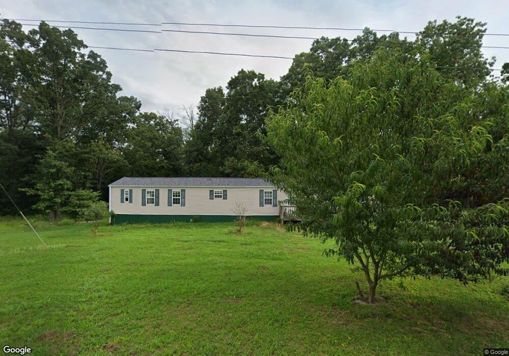
233 Cedar St West Plains, MO 65775
West Plains AreaEstimated Value: $156,000 - $260,000
About This Home
This home is located at 233 Cedar St, West Plains, MO 65775 and is currently estimated at $199,874, approximately $118 per square foot. 233 Cedar St is a home located in Howell County with nearby schools including Faith Assembly Christian School.
Ownership History
We collect this data history from publicly available records. To have your information removed, we recommend requesting removal directly through your county’s website.
Purchase Details
Home Financials for this Owner
Home Financials are based on the most recent Mortgage that was taken out on this home.Home Values in the Area
Average Home Value in this Area
Purchase History
We collect this data history from publicly available records. To have your information removed, we recommend requesting removal directly through your county’s website.
| Date | Buyer | Sale Price | Title Company |
|---|---|---|---|
| -- | None Available |
Mortgage History
We collect this data history from publicly available records. To have your information removed, we recommend requesting removal directly through your county’s website.
| Date | Status | Borrower | Loan Amount |
|---|---|---|---|
| Open | $12,500 |
Tax History
We collect this data history from publicly available records. To have your information removed, we recommend requesting removal directly through your county’s website.
| Year | Tax Paid | Tax Assessment Tax Assessment Total Assessment is a certain percentage of the fair market value that is determined by local assessors to be the total taxable value of land and additions on the property. | Land | Improvement |
|---|---|---|---|---|
| 2025 | $189 | $6,270 | $1,600 | $4,670 |
| 2024 | $189 | $5,600 | ||
| 2023 | $189 | $5,600 | $0 | $0 |
| 2022 | $188 | $5,590 | $0 | $0 |
| 2021 | $189 | $5,590 | $0 | $0 |
| 2020 | $189 | $5,590 | $0 | $0 |
| 2019 | $200 | $5,590 | $0 | $0 |
| 2018 | $166 | $4,650 | $0 | $0 |
| 2017 | $166 | $4,650 | $0 | $0 |
| 2015 | -- | $4,650 | $0 | $0 |
| 2014 | -- | $4,650 | $0 | $0 |
| 2013 | -- | $4,650 | $0 | $0 |
Map
- 266 Private Road 1778
- 373 Private Road 2016
- 1587 Highway 63
- 9648 Private Road 6543
- 2291 County Road 2010
- 000 U S 63
- 3440 U S 63
- 000 Porter Wagoner Blvd
- 000 Old Airport Rd
- 000 Freedom & Goodhard
- 000 Lee Anna Dr
- 1820 Wayhaven Dr
- 2610 Kody Dr
- 1609 Amy St
- 23 Burgoyne St
- 2502, 2503 Kody Melissa & Courtney
- 2823 Laurie Dr
- 2519 Courtney Place
- 1612 Luna Dr
- 000 County Road 2010
- 239 Cedar St
- 227 Cedar St
- 226 Cedar St
- 236 Cedar St
- 245 Cedar St
- 2012 Kenny Ave
- 2015 Clark Ave
- 2044 Ridge View Ave
- 0 Cedar St Unit 10821110
- 0 Cedar St Unit 10821138
- 209 Cedar St
- 229 Michael St
- 225 Michael St
- 208 Private Road 1782
- 8455 Private Road 6853
- 213 Cedar St
- 2007 Kenny Ave
- 2032 Clark Ave
- 2019 Kenny Ave
- 2021 Clark Ave
Ask me questions while you tour the home.