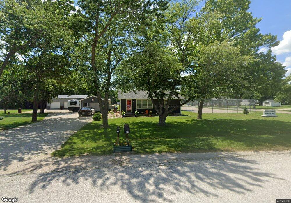
233 N Commercial St Neosho Rapids, KS 66864
Estimated Value: $66,000 - $95,322
2
Beds
1
Bath
792
Sq Ft
$104/Sq Ft
Est. Value
About This Home
This home is located at 233 N Commercial St, Neosho Rapids, KS 66864 and is currently estimated at $82,107, approximately $103 per square foot. 233 N Commercial St is a home located in Lyon County with nearby schools including Neosho Rapids Elementary School and Hartford/Neosho Rapids Junior/Senior High School.
Ownership History
Date
Name
Owned For
Owner Type
Purchase Details
Closed on
Jul 21, 2020
Sold by
Wagers Genevieve R
Bought by
Stump Douglas S
Current Estimated Value
Home Financials for this Owner
Home Financials are based on the most recent Mortgage that was taken out on this home.
Original Mortgage
$70,000
Outstanding Balance
$9,623
Interest Rate
3.2%
Mortgage Type
New Conventional
Estimated Equity
$72,484
Purchase Details
Closed on
Mar 16, 2017
Sold by
Martin Mark R and Martin Brenda F
Bought by
Wagers Genevieve R
Purchase Details
Closed on
Oct 1, 1990
Bought by
Martin Brenda F and Martin Mark R
Create a Home Valuation Report for This Property
The Home Valuation Report is an in-depth analysis detailing your home's value as well as a comparison with similar homes in the area
Home Values in the Area
Average Home Value in this Area
Purchase History
| Date | Buyer | Sale Price | Title Company |
|---|---|---|---|
| Stump Douglas S | $87,500 | -- | |
| Wagers Genevieve R | -- | -- | |
| Martin Brenda F | $20,000 | -- |
Source: Public Records
Mortgage History
| Date | Status | Borrower | Loan Amount |
|---|---|---|---|
| Open | Stump Douglas S | $70,000 |
Source: Public Records
Tax History Compared to Growth
Tax History
| Year | Tax Paid | Tax Assessment Tax Assessment Total Assessment is a certain percentage of the fair market value that is determined by local assessors to be the total taxable value of land and additions on the property. | Land | Improvement |
|---|---|---|---|---|
| 2025 | $1,091 | $9,775 | $408 | $9,367 |
| 2024 | $1,091 | $7,946 | $408 | $7,538 |
| 2023 | $1,155 | $7,947 | $368 | $7,579 |
| 2022 | $991 | $7,141 | $370 | $6,771 |
| 2021 | $932 | $6,417 | $446 | $5,971 |
| 2020 | $800 | $5,186 | $262 | $4,924 |
| 2019 | $800 | $5,221 | $204 | $5,017 |
| 2018 | $776 | $4,991 | $235 | $4,756 |
| 2017 | $744 | $4,715 | $298 | $4,417 |
| 2016 | $683 | $4,497 | $298 | $4,199 |
| 2015 | -- | $4,497 | $298 | $4,199 |
| 2014 | -- | $4,549 | $362 | $4,187 |
Source: Public Records
Map
Nearby Homes
- 2016 Road 170
- 0 Blackbird Rd
- 0 Park Ave Unit HMS2560137
- 315 E Park Ave
- 415 E Park Ave
- 1251 25th Rd
- 403 W Broadway St
- 417 W 5th St
- 0 Road N
- 214 W 5th St
- 0 S Davis Rd
- 000 Fauna Rd
- 1020 Wanamaka Rd
- 1830 E 6th Ave
- 500 Whildin St
- 1031 Sunrise Dr
- 520 Eveningside Dr
- 413 Eveningside Dr
- 924 E South Ave
- 918 E Logan Ave
- 234 N Main St
- 238 N Main St
- 210 N Commercial St
- 501 Commercial St
- 218 N Main St
- 510 Commercial St
- 240 N Commercial St
- 212 N Main St
- 502 Main St
- 229 N Main St
- 233 N Main St
- 516 Main St
- 501 Main St
- 519 Commercial St
- 211 N Main St
- 137 S Commercial St
- 528 Main St
- 203 N Main St
- 525 N Commercial St
- 501-A Fifth