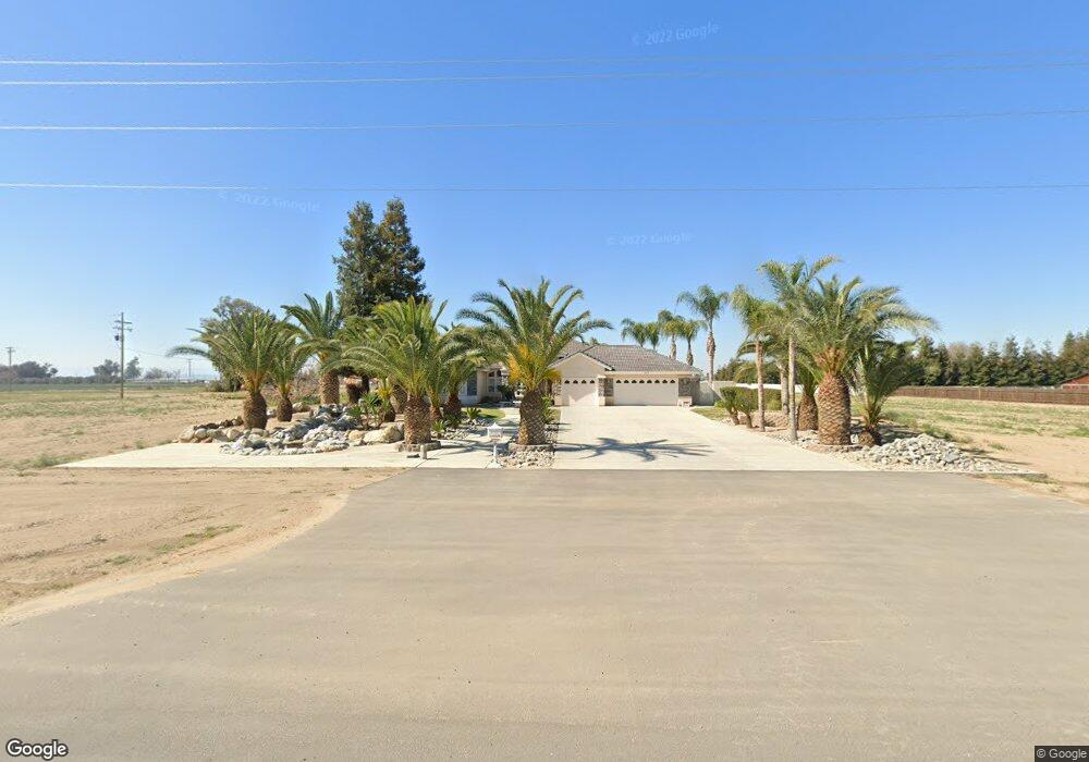
233 Nord Ave Bakersfield, CA 93314
Estimated Value: $712,000 - $847,380
3
Beds
2
Baths
2,503
Sq Ft
$315/Sq Ft
Est. Value
About This Home
This home is located at 233 Nord Ave, Bakersfield, CA 93314 and is currently estimated at $788,345, approximately $314 per square foot. 233 Nord Ave is a home located in Kern County with nearby schools including Rio Bravo-Greeley Elementary School, Rio Bravo Elementary School, and Liberty High School.
Ownership History
Date
Name
Owned For
Owner Type
Purchase Details
Closed on
Nov 29, 2018
Sold by
Barron Albert W
Bought by
Barron Albert W
Current Estimated Value
Purchase Details
Closed on
Jun 7, 2012
Sold by
Barron Albert W and Barron Anita Z
Bought by
Barron Albert W and Barron Anita Z
Purchase Details
Closed on
Oct 25, 2006
Sold by
Barron Albert W and Barron Anita Z
Bought by
Kelley James D and Kelley Teri L
Purchase Details
Closed on
Aug 5, 2004
Sold by
California Home Builders Inc
Bought by
Barron Albert W and Barron Anita Z
Create a Home Valuation Report for This Property
The Home Valuation Report is an in-depth analysis detailing your home's value as well as a comparison with similar homes in the area
Home Values in the Area
Average Home Value in this Area
Purchase History
| Date | Buyer | Sale Price | Title Company |
|---|---|---|---|
| Barron Albert W | -- | None Available | |
| Barron Albert W | -- | None Available | |
| Barron Albert W | -- | None Available | |
| Kelley James D | -- | None Available | |
| Barron Albert W | $275,000 | Ticor Title |
Source: Public Records
Tax History Compared to Growth
Tax History
| Year | Tax Paid | Tax Assessment Tax Assessment Total Assessment is a certain percentage of the fair market value that is determined by local assessors to be the total taxable value of land and additions on the property. | Land | Improvement |
|---|---|---|---|---|
| 2025 | $15,392 | $565,193 | $155,392 | $409,801 |
| 2024 | $8,004 | $1,202,580 | $896,580 | $306,000 |
| 2023 | $8,004 | $543,248 | $149,359 | $393,889 |
| 2022 | $8,037 | $532,597 | $146,431 | $386,166 |
| 2021 | $7,742 | $522,155 | $143,560 | $378,595 |
| 2020 | $7,383 | $516,801 | $142,088 | $374,713 |
| 2019 | $7,085 | $516,801 | $142,088 | $374,713 |
| 2018 | $6,817 | $496,734 | $136,571 | $360,163 |
| 2017 | $6,577 | $486,995 | $133,894 | $353,101 |
| 2016 | $5,933 | $477,447 | $131,269 | $346,178 |
| 2015 | $5,552 | $470,277 | $129,298 | $340,979 |
| 2014 | $5,464 | $461,066 | $126,766 | $334,300 |
Source: Public Records
Map
Nearby Homes
- 836 Nord Ave
- 18510 Stockdale Hwy
- 119 Spottswoode Ln
- 59 Spottswoode Ln
- Residence 1 Plan at Sycamore
- Residence 4 Plan at Sycamore
- Residence 4A Plan at Sycamore
- Residence 3 Plan at Sycamore
- Residence 2 Plan at Sycamore
- 16459 Paraduxx Ct
- 407 Roper Ct
- 16720 Muscatine Ln
- 16715 Muscatine Ln
- 17633 Legend Oaks Ln
- 16722 Chloe Ct
- 16716 Chloe Ct
- 16807 Chloe Ct
- 16803 Chloe Ct
- 16723 Chloe Ct
- 16608 Chloe Ct
- 17610 Harvest Grove Ct
- 17615 Harvest Grove Ct
- 326 Romance Ct
- 323 Romance Ct
- 17607 Harvest Grove Ct
- 17600 Harvest Grove Ct
- 348 Romance Ct
- 17571 Harvest Grove Ct
- 17564 Harvest Grove Ct
- 18130 Tiata Ave
- 351 Romance Ct
- 17561 Harvest Grove Ct
- 17558 Harvest Grove Ct
- 18003 Johnson Rd
- 254 Nord Ave
- 18150 Tiata Ave
- 17460 Harvest Grove Ct
- 17479 Harvest Grove Ct
- 18135 Tiata Ave
- 17456 Harvest Grove Ct