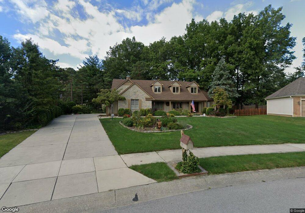
233 Paddock Cir W Powell, OH 43065
Estimated Value: $593,336 - $660,000
4
Beds
3
Baths
3,198
Sq Ft
$196/Sq Ft
Est. Value
About This Home
This home is located at 233 Paddock Cir W, Powell, OH 43065 and is currently estimated at $626,084, approximately $195 per square foot. 233 Paddock Cir W is a home located in Delaware County with nearby schools including Wyandot Run Elementary School, Olentangy Liberty Middle School, and Olentangy High School.
Ownership History
Date
Name
Owned For
Owner Type
Purchase Details
Closed on
Sep 30, 2013
Sold by
Miller Neal L and Miller Diana C
Bought by
Reading Elaine
Current Estimated Value
Purchase Details
Closed on
Oct 20, 1999
Sold by
Casey Paul J
Bought by
Park Neal L Miller Diana C
Home Financials for this Owner
Home Financials are based on the most recent Mortgage that was taken out on this home.
Original Mortgage
$200,000
Interest Rate
7.55%
Mortgage Type
New Conventional
Create a Home Valuation Report for This Property
The Home Valuation Report is an in-depth analysis detailing your home's value as well as a comparison with similar homes in the area
Home Values in the Area
Average Home Value in this Area
Purchase History
| Date | Buyer | Sale Price | Title Company |
|---|---|---|---|
| Reading Elaine | -- | None Available | |
| Park Neal L Miller Diana C | $294,000 | -- |
Source: Public Records
Mortgage History
| Date | Status | Borrower | Loan Amount |
|---|---|---|---|
| Closed | Park Neal L Miller Diana C | $200,000 |
Source: Public Records
Tax History
| Year | Tax Paid | Tax Assessment Tax Assessment Total Assessment is a certain percentage of the fair market value that is determined by local assessors to be the total taxable value of land and additions on the property. | Land | Improvement |
|---|---|---|---|---|
| 2024 | $8,304 | $168,290 | $38,330 | $129,960 |
| 2023 | $8,370 | $168,290 | $38,330 | $129,960 |
| 2022 | $8,192 | $132,230 | $28,770 | $103,460 |
| 2021 | $8,333 | $132,230 | $28,770 | $103,460 |
| 2020 | $8,363 | $132,230 | $28,770 | $103,460 |
| 2019 | $6,937 | $114,980 | $25,030 | $89,950 |
| 2018 | $7,017 | $114,980 | $25,030 | $89,950 |
| 2017 | $3,245 | $109,380 | $20,550 | $88,830 |
| 2016 | $7,132 | $109,380 | $20,550 | $88,830 |
| 2015 | $6,490 | $109,380 | $20,550 | $88,830 |
| 2014 | $6,576 | $109,380 | $20,550 | $88,830 |
| 2013 | $6,448 | $105,150 | $20,550 | $84,600 |
Source: Public Records
Map
Nearby Homes
- 149 Trail Edge Cir
- 170 Barrington Place
- 130 Barrington Place
- 92 Barrington Place
- 22 Brookehill Dr
- 22 Liberty Ridge Ave
- 156 Meadow Ridge Ct
- 104 Encore Park Bend
- Irving Plan at Encore Park of Powell - Uptown Collection
- Oakley Plan at Encore Park of Powell - Uptown Collection
- 120 S Liberty St
- 5552 Jessica Ln W
- 1937 Liberty St
- 86 Cressingham Ln
- 18 Murphys View Place Unit I18
- 2710 Silverleaf Dr
- 0 Bunker Ln
- 901 Bovee Ln
- 0 Liberty Rd N Unit Lot 4
- 0 Liberty Rd N Unit Lot 6
- 225 Paddock Cir W
- 237 Paddock Cir W
- 231 Ridge Side Dr
- 223 Ridge Side Dr
- 266 Muladore Dr
- 254 Muladore Dr
- 278 Muladore Dr
- 223 Paddock Cir W
- 228 Paddock Cir W
- 246 Muladore Dr
- 245 Ridge Side Dr
- 238 Paddock Cir E
- 290 Muladore Dr
- 227 Paddock Cir E
- 247 Ridge Side Dr
- 215 Paddock Cir W
- 218 Paddock Cir W
- 228 Ridge Side Dr
- 228 Muladore Dr
- 236 Ridge Side Dr
Your Personal Tour Guide
Ask me questions while you tour the home.