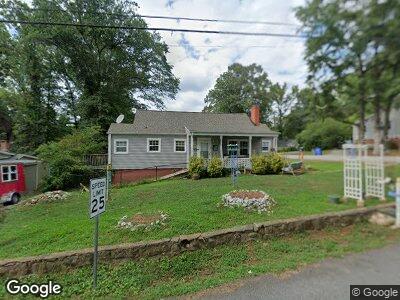
233 Roger Ave Greenville, SC 29617
Sans Souci NeighborhoodEstimated Value: $165,000 - $250,000
2
Beds
1
Bath
1,125
Sq Ft
$195/Sq Ft
Est. Value
About This Home
This home is located at 233 Roger Ave, Greenville, SC 29617 and is currently estimated at $219,140, approximately $194 per square foot. 233 Roger Ave is a home located in Greenville County with nearby schools including Duncan Chapel Elementary, Lakeview Middle, and Berea High School.
Ownership History
Date
Name
Owned For
Owner Type
Purchase Details
Closed on
Jan 4, 2019
Sold by
Hall Lawrence L
Bought by
Hall Stokes Sarah Elizabeth
Current Estimated Value
Purchase Details
Closed on
Dec 31, 2013
Sold by
Lail Kenneth
Bought by
Hall Lawrence L and Hall Stokes Sarah Elizabeth
Purchase Details
Closed on
May 26, 2011
Sold by
Suntrust Bank
Bought by
Lail Kenneth
Purchase Details
Closed on
Feb 14, 2011
Sold by
Beard William E
Bought by
Suntrust Bank
Create a Home Valuation Report for This Property
The Home Valuation Report is an in-depth analysis detailing your home's value as well as a comparison with similar homes in the area
Home Values in the Area
Average Home Value in this Area
Purchase History
| Date | Buyer | Sale Price | Title Company |
|---|---|---|---|
| Hall Stokes Sarah Elizabeth | -- | None Available | |
| Hall Lawrence L | $84,000 | -- | |
| Lail Kenneth | $32,500 | -- | |
| Suntrust Bank | $44,733 | -- |
Source: Public Records
Mortgage History
| Date | Status | Borrower | Loan Amount |
|---|---|---|---|
| Previous Owner | Lail Kenneth H | $50,000 |
Source: Public Records
Tax History Compared to Growth
Tax History
| Year | Tax Paid | Tax Assessment Tax Assessment Total Assessment is a certain percentage of the fair market value that is determined by local assessors to be the total taxable value of land and additions on the property. | Land | Improvement |
|---|---|---|---|---|
| 2024 | $879 | $3,840 | $920 | $2,920 |
| 2023 | $879 | $3,840 | $920 | $2,920 |
| 2022 | $866 | $3,840 | $920 | $2,920 |
| 2021 | $987 | $3,840 | $920 | $2,920 |
| 2020 | $917 | $3,350 | $540 | $2,810 |
| 2019 | $899 | $3,350 | $540 | $2,810 |
| 2018 | $792 | $3,350 | $540 | $2,810 |
| 2017 | $792 | $3,350 | $540 | $2,810 |
| 2016 | $750 | $83,650 | $13,500 | $70,150 |
| 2015 | $750 | $83,650 | $13,500 | $70,150 |
| 2014 | $959 | $83,650 | $13,500 | $70,150 |
Source: Public Records
Map
Nearby Homes
- 311 E Blue Ridge Dr
- 317 Rogers Ave
- 104 Langston Dr
- 5 E Blue Ridge Dr
- 700 N Franklin Rd
- 510 N Franklin Rd
- 9 Callahan Ave
- 405 Perry Rd
- 9 Glenmore Dr
- 222 Berkley Ave
- 103 Mount Pleasant Ave
- 11 Woodland Dr
- 825 N Franklin Rd
- 2501 Poinsett Hwy
- 827 N Franklin Rd
- 2507 Poinsett Hwy
- 14 Circle Dr
- 107 Berkley Ave
- 314 Hillandale Rd
- 218 Beth Dr