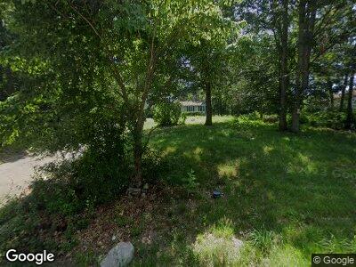
233 S Main St Assonet, MA 02702
Assonet Bay NeighborhoodEstimated Value: $552,966 - $684,000
--
Bed
3
Baths
2,184
Sq Ft
$286/Sq Ft
Est. Value
About This Home
This home is located at 233 S Main St, Assonet, MA 02702 and is currently estimated at $625,492, approximately $286 per square foot. 233 S Main St is a home located in Bristol County with nearby schools including Freetown Elementary School, George R Austin Intermediate School, and Freetown-Lakeville Middle School.
Ownership History
Date
Name
Owned For
Owner Type
Purchase Details
Closed on
Dec 31, 1985
Bought by
Miranda Manuel A and Miranda Patricia A
Current Estimated Value
Create a Home Valuation Report for This Property
The Home Valuation Report is an in-depth analysis detailing your home's value as well as a comparison with similar homes in the area
Home Values in the Area
Average Home Value in this Area
Purchase History
| Date | Buyer | Sale Price | Title Company |
|---|---|---|---|
| Miranda Manuel A | $22,000 | -- |
Source: Public Records
Mortgage History
| Date | Status | Borrower | Loan Amount |
|---|---|---|---|
| Open | Miranda Manuel A | $277,500 | |
| Closed | Miranda Manuel A | $51,000 | |
| Closed | Miranda Manuel A | $277,000 | |
| Closed | Miranda Manuel A | $207,000 | |
| Closed | Miranda Manuel A | $168,000 |
Source: Public Records
Tax History Compared to Growth
Tax History
| Year | Tax Paid | Tax Assessment Tax Assessment Total Assessment is a certain percentage of the fair market value that is determined by local assessors to be the total taxable value of land and additions on the property. | Land | Improvement |
|---|---|---|---|---|
| 2025 | $5,212 | $525,900 | $172,700 | $353,200 |
| 2024 | $5,177 | $496,400 | $162,900 | $333,500 |
| 2023 | $4,996 | $466,500 | $146,700 | $319,800 |
| 2022 | $4,762 | $394,900 | $124,300 | $270,600 |
| 2021 | $4,567 | $359,600 | $113,000 | $246,600 |
| 2020 | $4,360 | $334,900 | $103,000 | $231,900 |
| 2019 | $4,113 | $312,800 | $98,100 | $214,700 |
| 2018 | $3,867 | $290,500 | $98,100 | $192,400 |
| 2017 | $3,783 | $284,000 | $98,100 | $185,900 |
| 2016 | $3,719 | $284,100 | $105,800 | $178,300 |
| 2015 | $3,621 | $280,700 | $105,800 | $174,900 |
| 2014 | $3,468 | $275,000 | $103,600 | $171,400 |
Source: Public Records
Map
Nearby Homes
- 5455 N Main St Unit 17E
- 5455 N Main St Unit 12F
- 5455 N Main St Unit 6B
- 5239 N Main St Unit 7
- 5239 N Main St Unit 4
- 562 Main St
- 247 Main St
- 0 Palmer St
- 16 Riverside Dr
- 51 Forge Rd
- 3850 N Main St Unit 3850
- 138 Bourn Ave
- 3652 N Main St Unit 4
- 75 Narrows Rd
- 217 Hathaway Commons Rd
- 912 Pleasant St
- 1978 County St
- 51 Sandra Dr
- 987 Wilson Rd
- 201 Bayview Ave
- 233 S Main St
- 235 S Main St
- 237 S Main St
- 229 S Main St
- 239 S Main St
- 241 S Main St
- 217 S Main St
- 213 S Main St
- 5455 N Main St Unit 1
- 5455 N Main St Unit 20F
- 5455 N Main St Unit 21E
- 5455 N Main St Unit 21D
- 5455 N Main St Unit 21C
- 5455 N Main St Unit 21B
- 5455 N Main St Unit 21A
- 5455 N Main St Unit 20E
- 5455 N Main St Unit 20D
- 5455 N Main St Unit 20C
- 5455 N Main St Unit 20B
- 5455 N Main St Unit 20A
