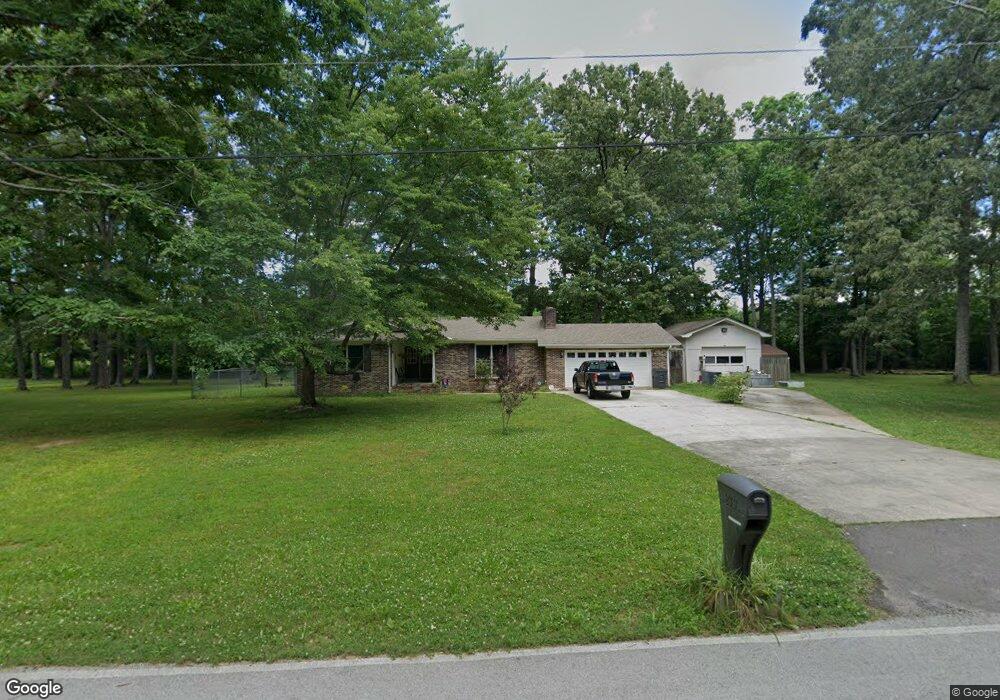
233 Sherwood Dr Manchester, TN 37355
Estimated Value: $316,000 - $344,642
3
Beds
2
Baths
1,567
Sq Ft
$208/Sq Ft
Est. Value
About This Home
This home is located at 233 Sherwood Dr, Manchester, TN 37355 and is currently estimated at $325,161, approximately $207 per square foot. 233 Sherwood Dr is a home located in Coffee County with nearby schools including Westwood Middle School and Temple Baptist Christian School.
Ownership History
Date
Name
Owned For
Owner Type
Purchase Details
Closed on
Dec 26, 2014
Sold by
Ros Nereida
Bought by
Mccoy Donald K
Current Estimated Value
Home Financials for this Owner
Home Financials are based on the most recent Mortgage that was taken out on this home.
Original Mortgage
$100,000
Outstanding Balance
$77,157
Interest Rate
4.04%
Mortgage Type
New Conventional
Estimated Equity
$248,004
Purchase Details
Closed on
Jul 28, 2005
Bought by
Coffee County Bank
Create a Home Valuation Report for This Property
The Home Valuation Report is an in-depth analysis detailing your home's value as well as a comparison with similar homes in the area
Home Values in the Area
Average Home Value in this Area
Purchase History
| Date | Buyer | Sale Price | Title Company |
|---|---|---|---|
| Mccoy Donald K | $125,000 | -- | |
| Coffee County Bank | $115,000 | -- |
Source: Public Records
Mortgage History
| Date | Status | Borrower | Loan Amount |
|---|---|---|---|
| Open | Mccoy Donald K | $100,000 |
Source: Public Records
Tax History Compared to Growth
Tax History
| Year | Tax Paid | Tax Assessment Tax Assessment Total Assessment is a certain percentage of the fair market value that is determined by local assessors to be the total taxable value of land and additions on the property. | Land | Improvement |
|---|---|---|---|---|
| 2024 | $2,184 | $51,800 | $14,625 | $37,175 |
| 2023 | $2,184 | $51,800 | $0 | $0 |
| 2022 | $1,880 | $51,800 | $14,625 | $37,175 |
| 2021 | $1,823 | $39,800 | $11,250 | $28,550 |
| 2020 | $1,823 | $39,800 | $11,250 | $28,550 |
| 2019 | $1,823 | $39,800 | $11,250 | $28,550 |
| 2018 | $1,823 | $39,800 | $11,250 | $28,550 |
| 2017 | $1,961 | $37,375 | $11,250 | $26,125 |
| 2016 | $1,961 | $37,375 | $11,250 | $26,125 |
| 2015 | $1,961 | $37,375 | $11,250 | $26,125 |
| 2014 | $1,960 | $37,367 | $0 | $0 |
Source: Public Records
Map
Nearby Homes
- 0 Sherwood Dr
- 600 Indian Springs Cir
- 645 Doak Rd
- 564 Indian Springs Cir
- 538 Indian Springs Cir
- Lot 54 Interstate
- 108 Belmar Cir
- 401 Doak Rd
- Lot 76 Philips
- 31 Spring House Dr
- 383 Doak Rd
- 913 Indian Springs Cir
- 310 Indian Springs Cir
- 874 Doak Rd
- 272 Belmar Cir
- 75 Belmar Rd
- 58 Brooklyn Ave
- 31 Brooklyn Ave
- 42 Brooklyn Ave
- 57 Brooklyn Ave
- 193 Sherwood Dr
- 228 Sherwood Dr
- 253 Briarwood Dr
- 210 Sherwood Dr
- 179 Sherwood Dr
- 270 Briarwood Dr
- 190 Sherwood Dr
- 227 Briarwood Dr
- 46 Briarwood Ln
- 155 Sherwood Dr
- 168 Sherwood Dr
- 64 Briarwood Ln
- 90 Briarwood Ln
- 228 Briarwood Dr
- 148 Sherwood Dr
- 139 Sherwood Dr
- 263 John Mark Ct
- 253 John Mark Ct
- 189 Briarwood Dr
- 208 Briarwood Dr