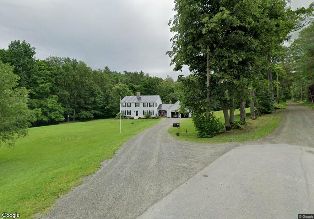
233 Stanton Rd Monroe, NH 03771
Estimated Value: $691,409 - $1,021,000
5
Beds
5
Baths
4,326
Sq Ft
$207/Sq Ft
Est. Value
About This Home
This home is located at 233 Stanton Rd, Monroe, NH 03771 and is currently estimated at $893,803, approximately $206 per square foot. 233 Stanton Rd is a home with nearby schools including Monroe Consolidated School.
Ownership History
Date
Name
Owned For
Owner Type
Purchase Details
Closed on
Jan 18, 2018
Sold by
Regis Robert T and Regis Deborah A
Bought by
Regis Paul T and Regis Brittany K
Current Estimated Value
Purchase Details
Closed on
Aug 18, 2017
Sold by
Regis Robert T and Regis Deborah A
Bought by
Regis Robert T and Regis Deborah A
Home Financials for this Owner
Home Financials are based on the most recent Mortgage that was taken out on this home.
Original Mortgage
$250,509
Interest Rate
3.86%
Mortgage Type
Stand Alone Refi Refinance Of Original Loan
Create a Home Valuation Report for This Property
The Home Valuation Report is an in-depth analysis detailing your home's value as well as a comparison with similar homes in the area
Home Values in the Area
Average Home Value in this Area
Purchase History
| Date | Buyer | Sale Price | Title Company |
|---|---|---|---|
| Regis Paul T | $50,000 | -- | |
| Regis Robert T | -- | -- | |
| Reigs Deborah A | -- | -- |
Source: Public Records
Mortgage History
| Date | Status | Borrower | Loan Amount |
|---|---|---|---|
| Previous Owner | Reigs Deborah A | $250,509 | |
| Previous Owner | Reigs Deborah A | $117,000 |
Source: Public Records
Tax History Compared to Growth
Tax History
| Year | Tax Paid | Tax Assessment Tax Assessment Total Assessment is a certain percentage of the fair market value that is determined by local assessors to be the total taxable value of land and additions on the property. | Land | Improvement |
|---|---|---|---|---|
| 2024 | $7,840 | $735,500 | $54,700 | $680,800 |
| 2023 | $7,156 | $735,500 | $54,700 | $680,800 |
| 2022 | $5,098 | $418,200 | $46,500 | $371,700 |
| 2020 | $5,010 | $418,200 | $46,500 | $371,700 |
| 2019 | $4,742 | $418,200 | $46,500 | $371,700 |
| 2018 | $4,471 | $418,200 | $46,500 | $371,700 |
| 2016 | $3,887 | $342,800 | $42,000 | $300,800 |
| 2015 | $3,606 | $342,800 | $42,000 | $300,800 |
| 2014 | $4,110 | $342,800 | $42,000 | $300,800 |
| 2012 | $4,412 | $389,400 | $51,100 | $338,300 |
Source: Public Records
Map
Nearby Homes
- 1952 Monroe Rd
- 1950 Monroe Rd
- Lot 6 N Skinny Ridge Rd
- 0 Denio Rd Unit 5059200
- 0 Denio Rd Unit 5059211
- 0 Denio Rd Unit 5059215
- 0 Denio Rd Unit 24587948
- 0 Denio Rd
- 0 Denio Rd Unit 5059206
- 0 Denio Rd Unit 24587953
- - Denio Rd
- 128 Valley View Rd
- 205 Hurd Hill Rd
- 441 Tower Rd
- 1374 Old Silo Rd
- 35 Langway Rd
- 396 Nelson Rd
- 48 Wetherbee Rd
- 00 Coppermine Rd Unit 59
- 201 Under the Mountain Rd
- 366 Stanton Rd
- 179 Stanton Rd
- 191 Stanton Rd
- 3850 Littleton Rd
- 3824 Littleton Rd
- 3814 Littleton Rd
- 2061 Monroe Rd
- 3807 Littleton Rd
- 2005 Monroe Rd
- 3588 Littleton Rd
- 3736 Littleton Rd
- 3604 Littleton Rd
- 3630 Littleton Rd
- 3619 Littleton Rd
- 1996 Monroe Rd
- 1857 Monroe Rd
- 160 Hilltop Rd
- 3480 Littleton Rd
- 3486 Littleton Rd