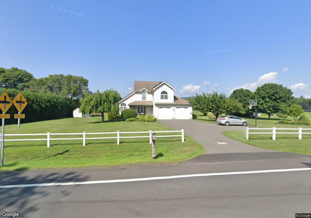
233 State Rd South Deerfield, MA 01373
Estimated Value: $320,000 - $497,000
3
Beds
3
Baths
1,608
Sq Ft
$252/Sq Ft
Est. Value
About This Home
This home is located at 233 State Rd, South Deerfield, MA 01373 and is currently estimated at $404,489, approximately $251 per square foot. 233 State Rd is a home located in Franklin County with nearby schools including Whately Elementary School and Frontier Regional School.
Ownership History
Date
Name
Owned For
Owner Type
Purchase Details
Closed on
Jul 23, 2002
Sold by
Rup Joseph R and Rup Mary R
Bought by
Camp Adam E and Camp Megan L
Current Estimated Value
Home Financials for this Owner
Home Financials are based on the most recent Mortgage that was taken out on this home.
Original Mortgage
$36,335
Interest Rate
6.73%
Mortgage Type
Purchase Money Mortgage
Create a Home Valuation Report for This Property
The Home Valuation Report is an in-depth analysis detailing your home's value as well as a comparison with similar homes in the area
Home Values in the Area
Average Home Value in this Area
Purchase History
| Date | Buyer | Sale Price | Title Company |
|---|---|---|---|
| Camp Adam E | $55,900 | -- |
Source: Public Records
Mortgage History
| Date | Status | Borrower | Loan Amount |
|---|---|---|---|
| Open | Camp Adam E | $175,700 | |
| Closed | Camp Adam E | $180,000 | |
| Closed | Camp Adam E | $36,335 |
Source: Public Records
Tax History Compared to Growth
Tax History
| Year | Tax Paid | Tax Assessment Tax Assessment Total Assessment is a certain percentage of the fair market value that is determined by local assessors to be the total taxable value of land and additions on the property. | Land | Improvement |
|---|---|---|---|---|
| 2025 | $5,077 | $380,600 | $114,000 | $266,600 |
| 2024 | $4,922 | $359,500 | $98,100 | $261,400 |
| 2023 | $4,737 | $333,600 | $93,400 | $240,200 |
| 2022 | $4,574 | $333,600 | $93,400 | $240,200 |
| 2021 | $4,437 | $297,400 | $93,400 | $204,000 |
| 2020 | $4,425 | $282,400 | $90,800 | $191,600 |
| 2019 | $4,381 | $282,300 | $90,800 | $191,500 |
| 2018 | $4,330 | $282,300 | $90,800 | $191,500 |
| 2017 | $4,404 | $282,300 | $90,800 | $191,500 |
| 2016 | $4,041 | $270,100 | $90,800 | $179,300 |
| 2015 | $4,300 | $265,900 | $86,600 | $179,300 |
| 2014 | $4,193 | $265,900 | $86,600 | $179,300 |
Source: Public Records
Map
Nearby Homes
- 32 Swamp Rd
- 0 North St Unit 73407299
- 24 Elm St
- Lot C Mountain Rd
- Lot A Mountain Rd
- Lot B Mountain Rd
- 24 Graves St
- 15 Crestview Dr
- 33 Eastern Ave
- 40 Eastern Ave
- 320 West St
- 151 Pantry Rd
- LOT D Mountain Rd
- 147 Pantry Rd
- 110 Old Amherst Rd
- 146 Old Amherst Rd
- 3 Depot Rd
- 13 Capt Lathrop Dr
- 238 N Main St
- 0 Pantry Rd Unit 73430264