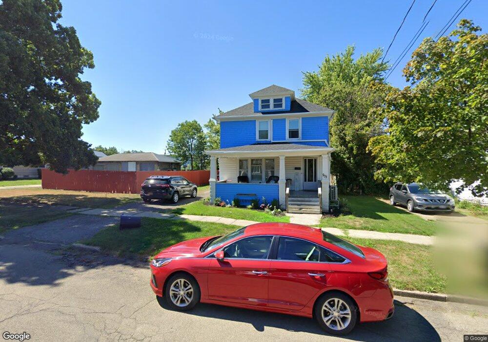
233 Townsend St Dunkirk, NY 14048
Estimated Value: $98,000 - $120,000
4
Beds
2
Baths
2,024
Sq Ft
$54/Sq Ft
Est. Value
About This Home
This home is located at 233 Townsend St, Dunkirk, NY 14048 and is currently estimated at $109,867, approximately $54 per square foot. 233 Townsend St is a home located in Chautauqua County with nearby schools including Dunkirk Intermediate School, Northern Chautauqua Catholic School, and Central Christian Academy.
Ownership History
Date
Name
Owned For
Owner Type
Purchase Details
Closed on
Mar 3, 2021
Sold by
Bankoski Robert K and Bankoski Tammy M
Bought by
Jagoda Frank A
Current Estimated Value
Home Financials for this Owner
Home Financials are based on the most recent Mortgage that was taken out on this home.
Original Mortgage
$62,400
Outstanding Balance
$55,937
Interest Rate
2.7%
Mortgage Type
FHA
Estimated Equity
$53,930
Purchase Details
Closed on
Apr 30, 1999
Sold by
Wojtkowiak Allen M
Bought by
Bankoski Robert K and Bankoski Tammy M
Create a Home Valuation Report for This Property
The Home Valuation Report is an in-depth analysis detailing your home's value as well as a comparison with similar homes in the area
Home Values in the Area
Average Home Value in this Area
Purchase History
| Date | Buyer | Sale Price | Title Company |
|---|---|---|---|
| Jagoda Frank A | $78,000 | None Available | |
| Bankoski Robert K | $52,000 | -- |
Source: Public Records
Mortgage History
| Date | Status | Borrower | Loan Amount |
|---|---|---|---|
| Open | Jagoda Frank A | $62,400 |
Source: Public Records
Tax History
| Year | Tax Paid | Tax Assessment Tax Assessment Total Assessment is a certain percentage of the fair market value that is determined by local assessors to be the total taxable value of land and additions on the property. | Land | Improvement |
|---|---|---|---|---|
| 2024 | $1,570 | $39,000 | $2,500 | $36,500 |
| 2023 | $1,537 | $39,000 | $2,500 | $36,500 |
| 2022 | $1,354 | $39,000 | $2,500 | $36,500 |
| 2021 | $1,356 | $39,000 | $2,500 | $36,500 |
| 2020 | $1,345 | $39,000 | $2,500 | $36,500 |
| 2019 | $1,362 | $39,000 | $2,500 | $36,500 |
| 2018 | $1,362 | $39,000 | $2,500 | $36,500 |
| 2017 | $1,336 | $39,000 | $2,500 | $36,500 |
| 2016 | $1,300 | $39,000 | $2,500 | $36,500 |
| 2015 | -- | $39,000 | $2,500 | $36,500 |
| 2014 | -- | $39,000 | $2,500 | $36,500 |
Source: Public Records
Map
Nearby Homes
- 250 Townsend St
- 49 E Courtney St
- 146 Hoyt St
- 306 Lord St
- 30 Saint Hedwigs Ave
- 316 Lord St
- 115 Nevins St
- 0 W Benton & Ruggles St Unit R1631836
- 447 Hoyt St
- 241 Lincoln Ave Unit 1
- 228 King St
- 58 Ruggles St
- 59 E Front St
- 116 S Roberts Rd
- 140 S Martin St
- 172 S Margay St
- 103 E 7th St
- 707 Monroe St
- 113 S Martin St
- 638 Deer St
- 231 Townsend St
- 239 Townsend St
- 229 Townsend St
- 238 Nevins St
- 234 Nevins St
- 242 Nevins St
- 230 Nevins St
- 227 Townsend St
- 247 Townsend St
- 238 Townsend St
- 221 Townsend St
- 232 Townsend St
- 224 Nevins St
- 240 Townsend St
- 219 Townsend St Unit Upper
- 219 Townsend St
- 246 Townsend St
- 251 Townsend St
- 225 Nevins St
- 229 Nevins St
Your Personal Tour Guide
Ask me questions while you tour the home.