Estimated Value: $148,000 - $190,397
4
Beds
3
Baths
2,360
Sq Ft
$70/Sq Ft
Est. Value
About This Home
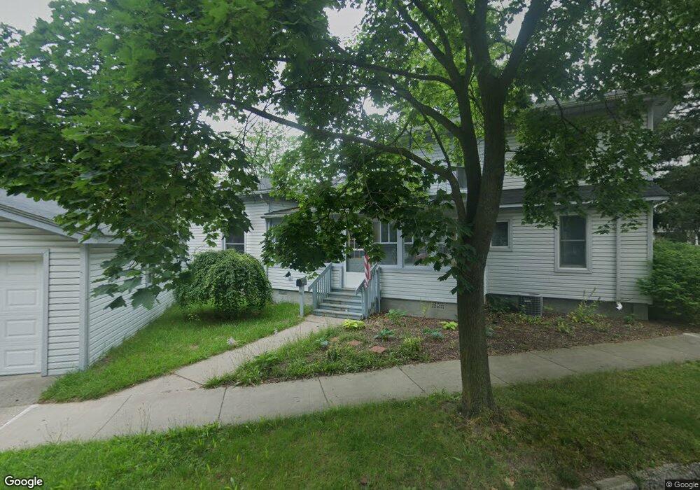
This home is located at 233 W Burnside St, Caro, MI 48723 and is currently estimated at $165,849, approximately $70 per square foot. 233 W Burnside St is a home with nearby schools including McComb Elementary School, Schall Elementary School, and Caro Middle School.
Ownership History
Date
Name
Owned For
Owner Type
Purchase Details
Closed on
Feb 8, 2019
Sold by
Krug Irene and Gilbert Welda
Bought by
Harsell Adrien
Current Estimated Value
Home Financials for this Owner
Home Financials are based on the most recent Mortgage that was taken out on this home.
Original Mortgage
$63,750
Outstanding Balance
$56,048
Interest Rate
4.5%
Mortgage Type
Purchase Money Mortgage
Estimated Equity
$109,801
Create a Home Valuation Report for This Property
The Home Valuation Report is an in-depth analysis detailing your home's value as well as a comparison with similar homes in the area
Home Values in the Area
Average Home Value in this Area
Purchase History
| Date | Buyer | Sale Price | Title Company |
|---|---|---|---|
| Harsell Adrien | $75,000 | -- |
Source: Public Records
Mortgage History
| Date | Status | Borrower | Loan Amount |
|---|---|---|---|
| Open | Harsell Adrien | $63,750 |
Source: Public Records
Tax History Compared to Growth
Tax History
| Year | Tax Paid | Tax Assessment Tax Assessment Total Assessment is a certain percentage of the fair market value that is determined by local assessors to be the total taxable value of land and additions on the property. | Land | Improvement |
|---|---|---|---|---|
| 2025 | $3,941 | $93,000 | $0 | $0 |
| 2024 | $3,941 | $87,700 | $0 | $0 |
| 2023 | $2,671 | $80,800 | $0 | $0 |
| 2022 | $2,547 | $69,500 | $0 | $0 |
| 2021 | $2,466 | $59,100 | $0 | $0 |
| 2020 | $2,432 | $54,900 | $0 | $0 |
| 2019 | $1,380 | $51,700 | $0 | $0 |
| 2018 | $1,352 | $57,400 | $0 | $0 |
| 2017 | $1,324 | $51,800 | $0 | $0 |
| 2016 | $1,272 | $49,900 | $0 | $0 |
| 2015 | $6 | $48,000 | $0 | $0 |
| 2014 | $6 | $48,500 | $0 | $0 |
| 2013 | $7 | $47,800 | $0 | $0 |
Source: Public Records
Map
Nearby Homes
- 120 W Adams St
- 112 Alexander St
- 91 W Gilford Rd
- 621 Meek St
- 323 Green St
- 1164 Mary Jane Ct
- 17 N Hooper St
- 1565 Parkway Dr
- 1081 Cleaver Rd
- 140 2nd St
- 0000 E Dayton Rd
- 1303 Sugar Tree Ct Unit 141
- 1333 E Caro Rd
- 0 Weeden Rd
- 1429 E Caro Rd
- 1600 E Dayton Rd
- 1685 E Dayton Rd
- 1548 E Caro Rd
- 1616 Willow Creek Dr
- 160 Wire Line Rd
- 220 N Almer St
- 232 W Burnside St
- 226 W Burnside St
- 9165 Arbela Rd
- PAR C E Riley Rd
- 0000 Vacant Land
- 223 N Almer St
- 217 W Burnside St
- V/L Willow Creek
- V/L Willow Creek Dr
- 204 N Almer St
- 233 N Almer St
- 302 W Burnside St
- 218 W Burnside St
- V/L E Lanes Way Parcel G Rd
- V/L E Lanes Way Parcel H Rd
- V/L E Lanes Way Parcel F Rd
- 165 - 3rd Street Lot 120 W Unit 120
- 219 N Almer St
- 211 W Burnside St