Estimated Value: $393,104 - $467,000
3
Beds
--
Bath
2,082
Sq Ft
$203/Sq Ft
Est. Value
About This Home
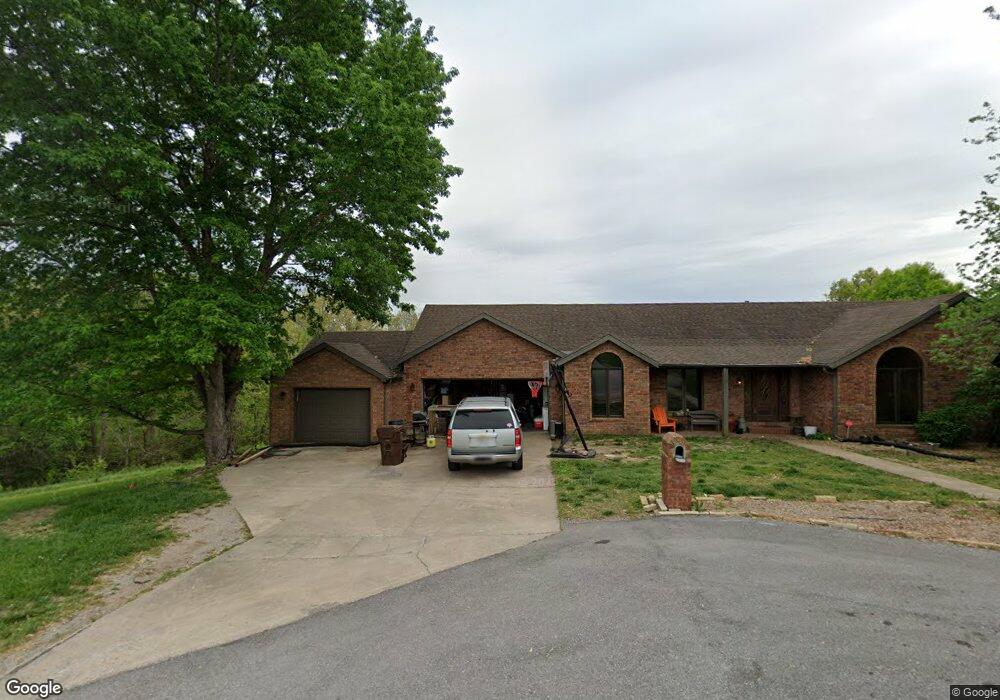
This home is located at 2332 Davis Dr, Nixa, MO 65714 and is currently estimated at $423,026, approximately $203 per square foot. 2332 Davis Dr is a home located in Stone County with nearby schools including Mathews Elementary School, Nicholas A. Inman Intermediate School, and Nixa Junior High School.
Ownership History
Date
Name
Owned For
Owner Type
Purchase Details
Closed on
Nov 25, 2011
Sold by
Connors Kirk A and Connors Allyn C
Bought by
Connors Kirk A and Connors Allyn C
Current Estimated Value
Home Financials for this Owner
Home Financials are based on the most recent Mortgage that was taken out on this home.
Original Mortgage
$172,772
Outstanding Balance
$15,605
Interest Rate
3.37%
Mortgage Type
FHA
Estimated Equity
$407,421
Purchase Details
Closed on
Aug 13, 2009
Sold by
Stevens Pat and Stevens Carolyn
Bought by
Connors Kirk A
Home Financials for this Owner
Home Financials are based on the most recent Mortgage that was taken out on this home.
Original Mortgage
$176,739
Interest Rate
5.31%
Mortgage Type
FHA
Create a Home Valuation Report for This Property
The Home Valuation Report is an in-depth analysis detailing your home's value as well as a comparison with similar homes in the area
Purchase History
| Date | Buyer | Sale Price | Title Company |
|---|---|---|---|
| Connors Kirk A | -- | -- | |
| Connors Kirk A | -- | -- |
Source: Public Records
Mortgage History
| Date | Status | Borrower | Loan Amount |
|---|---|---|---|
| Open | Connors Kirk A | $172,772 | |
| Previous Owner | Connors Kirk A | $176,739 |
Source: Public Records
Tax History
| Year | Tax Paid | Tax Assessment Tax Assessment Total Assessment is a certain percentage of the fair market value that is determined by local assessors to be the total taxable value of land and additions on the property. | Land | Improvement |
|---|---|---|---|---|
| 2025 | $1,764 | $30,130 | -- | -- |
| 2024 | $1,762 | $30,130 | -- | -- |
| 2023 | $1,762 | $30,130 | $0 | $0 |
| 2022 | $1,749 | $30,020 | $0 | $0 |
| 2021 | $1,764 | $30,020 | $0 | $0 |
| 2020 | $1,828 | $30,020 | $0 | $0 |
| 2019 | $1,827 | $30,020 | $0 | $0 |
| 2018 | $1,705 | $30,020 | $0 | $0 |
| 2017 | $1,691 | $30,020 | $0 | $0 |
| 2016 | $1,660 | $30,020 | $0 | $0 |
| 2015 | $1,665 | $30,020 | $0 | $0 |
| 2014 | $1,646 | $30,020 | $0 | $0 |
| 2012 | -- | $30,020 | $0 | $0 |
Source: Public Records
Map
Nearby Homes
- 1945 W Ranch Rd
- 000 Dollar St Unit Lot 2
- 000 Dollar St Unit Lot 1, 2
- 64 Pebble Beach Rd
- Lot 6 Seveno Ridge Rd
- 996 Seveno Ridge Rd
- 000 W Riverdale Dr Unit Lot 2
- 504 N Cheyenne Valley Rd
- 108 N Bison Ct
- 206 N Cheyenne Valley Rd
- 861 W Elmwood Cir
- 404 N Cheyenne Valley Rd
- 411 Lake Branch Rd
- 176 Shooting Star Ln
- 32 Freida Ln
- Lot 4 Riverpointe View
- 2097 W Big Bend Rd
- 1541 S Wild Oaks Dr
- 170 Riverpointe View
- 125 Riverpointe View
- 2327 Davis Dr
- 2328 Davis Dr
- 2328 Davis Rd
- 2326 Davis Dr
- 2103 Sheron Dr
- 2292 Sheron Dr
- 1820 W Finley River Dr
- 2319 Davis Dr
- 2314 Davis Dr
- 2351 S Robertson Mill Way
- 2347 Robertson Mill Way
- 2370 Sheron Dr
- 2355 Robertson Mill Way
- 2351 Robertson Mill Rd
- 1822 W Finley River Dr
- 1821 W Finley River Dr
- 2200 Alcey Way
- 2373 Sheron Dr
- 2361 Robertson Mill Rd
- 1800 W Finley River Dr
Your Personal Tour Guide
Ask me questions while you tour the home.