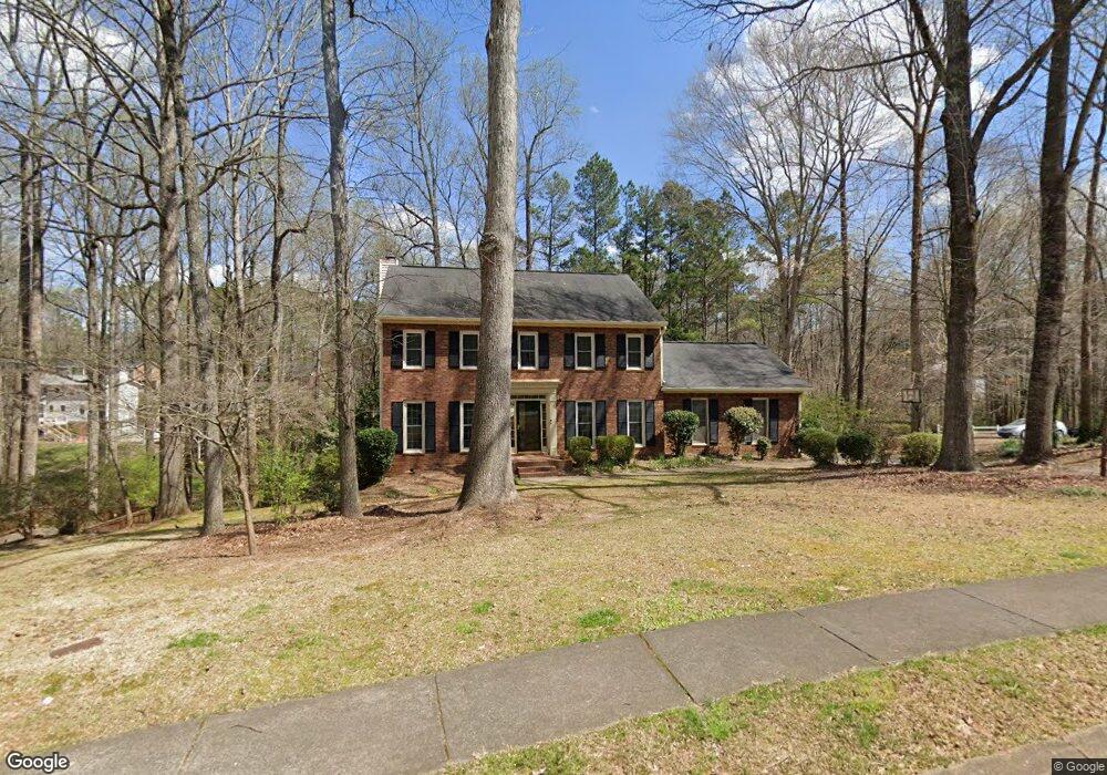
2332 Milstead Cir NE Marietta, GA 30066
Sandy Plains NeighborhoodEstimated Value: $523,935 - $561,000
4
Beds
3
Baths
2,367
Sq Ft
$229/Sq Ft
Est. Value
About This Home
This home is located at 2332 Milstead Cir NE, Marietta, GA 30066 and is currently estimated at $542,484, approximately $229 per square foot. 2332 Milstead Cir NE is a home located in Cobb County with nearby schools including Kincaid Elementary School, Daniell Middle School, and Sprayberry High School.
Ownership History
Date
Name
Owned For
Owner Type
Purchase Details
Closed on
Dec 17, 2008
Sold by
Verbanas Richard A and Verbanas Patti A
Bought by
Duvall Jonathan M and Duvall Laura M
Current Estimated Value
Home Financials for this Owner
Home Financials are based on the most recent Mortgage that was taken out on this home.
Original Mortgage
$231,990
Outstanding Balance
$152,434
Interest Rate
6.1%
Mortgage Type
FHA
Estimated Equity
$390,050
Purchase Details
Closed on
Jun 15, 2000
Sold by
Mccort Robert D and Mccort Jolynn A
Bought by
Verbanas Richard A and Verbanas Patti A
Home Financials for this Owner
Home Financials are based on the most recent Mortgage that was taken out on this home.
Original Mortgage
$160,000
Interest Rate
8.3%
Mortgage Type
New Conventional
Create a Home Valuation Report for This Property
The Home Valuation Report is an in-depth analysis detailing your home's value as well as a comparison with similar homes in the area
Home Values in the Area
Average Home Value in this Area
Purchase History
| Date | Buyer | Sale Price | Title Company |
|---|---|---|---|
| Duvall Jonathan M | $240,000 | -- | |
| Verbanas Richard A | $200,000 | -- |
Source: Public Records
Mortgage History
| Date | Status | Borrower | Loan Amount |
|---|---|---|---|
| Open | Duvall Jonathan M | $231,990 | |
| Previous Owner | Verbanas Richard A | $160,000 |
Source: Public Records
Tax History Compared to Growth
Tax History
| Year | Tax Paid | Tax Assessment Tax Assessment Total Assessment is a certain percentage of the fair market value that is determined by local assessors to be the total taxable value of land and additions on the property. | Land | Improvement |
|---|---|---|---|---|
| 2025 | $5,002 | $206,196 | $40,000 | $166,196 |
| 2024 | $4,823 | $197,756 | $27,200 | $170,556 |
| 2023 | $3,967 | $183,316 | $38,000 | $145,316 |
| 2022 | $4,140 | $164,828 | $27,200 | $137,628 |
| 2021 | $3,281 | $125,596 | $27,200 | $98,396 |
| 2020 | $3,281 | $125,596 | $27,200 | $98,396 |
| 2019 | $3,007 | $113,084 | $27,200 | $85,884 |
| 2018 | $3,007 | $113,084 | $27,200 | $85,884 |
| 2017 | $2,635 | $102,208 | $24,000 | $78,208 |
| 2016 | $2,437 | $93,664 | $24,000 | $69,664 |
| 2015 | $2,499 | $93,664 | $24,000 | $69,664 |
| 2014 | $2,221 | $83,584 | $0 | $0 |
Source: Public Records
Map
Nearby Homes
- 2839 Pine Meadow Dr
- 2642 Morgan Rd NE
- 1597 Sprayberry Dr
- 1748 Brown Cir
- 2314 Sandy Oaks Dr
- 2742 Bob Bettis Rd
- 2116 Morgan Rd NE
- 1756 Brown Cir
- 2725 Stillwater Lake Ln Unit 2
- 2729 Stillwater Lake Ln Unit 1
- 1814 Chasewood Park Dr
- 1386 Valmont Trace NE
- 1730 MacBy Dr
- 1924 Wilkenson Crossing
- 1829 Chasewood Park Dr
- 1100 Sallete Ct
- 1780 Kinridge Rd
- Robie Plan at The Village at Sandy Plains
- Harbor Plan at The Village at Sandy Plains
- Hanover Plan at The Village at Sandy Plains
- 1500 Paxford Overlook NE
- 2325 Milstead Cir NE
- 2421 Annandale Dr
- 1151 Paxford Overlook NE Unit 1
- 1151 Paxford Overlook NE
- 2328 Milstead Cir NE
- 1311 Milstead Trace NE
- 1511 Paxford Overlook NE
- 1509 Paxford Overlook NE
- 1507 Paxford Overlook NE
- 1505 Paxford Overlook NE
- 1503 Paxford Overlook NE
- 2327 Milstead Cir NE
- 2431 Annandale Dr
- 1501 Paxford Overlook NE Unit 1
- 1309 Milstead Trace NE
- 2326 Milstead Cir NE
- 2326 Milstead Cir NE Unit 33
- 2441 Annandale Dr
- 1307 Milstead Trace NE