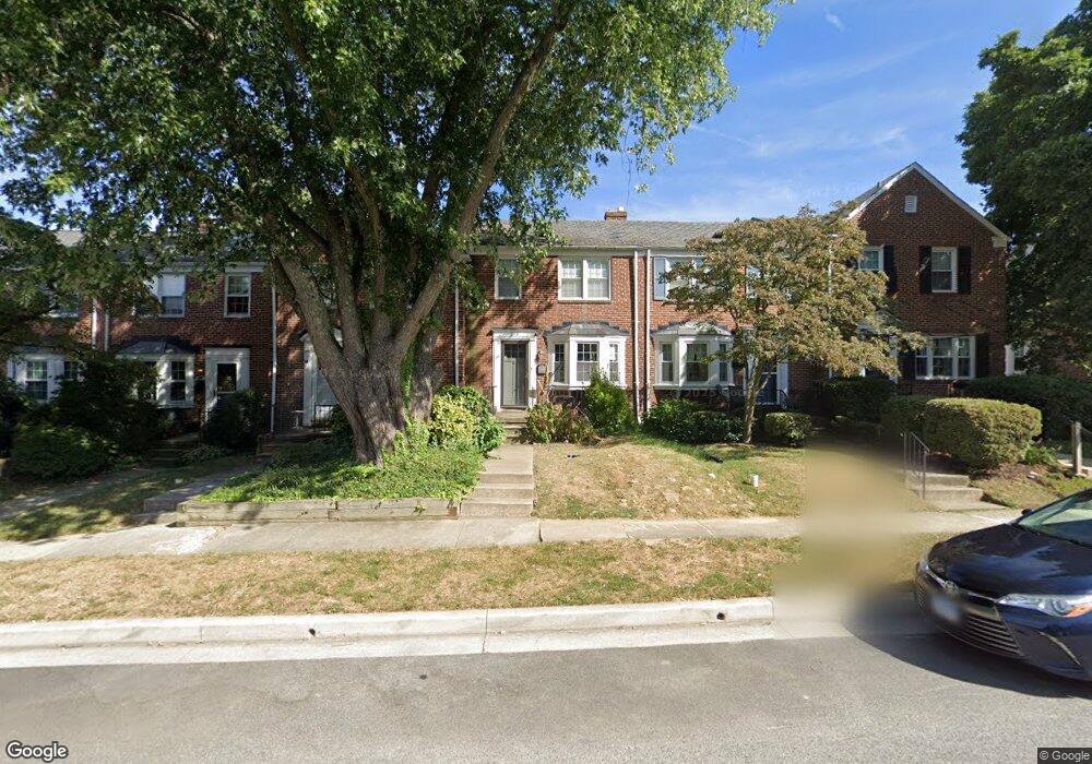
234 Brandon Rd Baltimore, MD 21212
Estimated Value: $379,433 - $424,000
3
Beds
2
Baths
1,216
Sq Ft
$333/Sq Ft
Est. Value
About This Home
This home is located at 234 Brandon Rd, Baltimore, MD 21212 and is currently estimated at $404,358, approximately $332 per square foot. 234 Brandon Rd is a home located in Baltimore County with nearby schools including Rodgers Forge Elementary School, Dumbarton Middle School, and Towson High Law & Public Policy.
Ownership History
Date
Name
Owned For
Owner Type
Purchase Details
Closed on
Aug 12, 2010
Sold by
Bell Dyer M
Bought by
Belt Michael A and Belt Elizabeth
Current Estimated Value
Purchase Details
Closed on
Sep 24, 2003
Sold by
Decker Lisa M
Bought by
Bell Dyer M and Bell Mary E
Purchase Details
Closed on
Dec 18, 2002
Sold by
Lucas Lisa D
Bought by
Lucas Lisa M
Purchase Details
Closed on
Dec 22, 1999
Sold by
Johnson Eleanor P
Bought by
Lucas Lisa D
Create a Home Valuation Report for This Property
The Home Valuation Report is an in-depth analysis detailing your home's value as well as a comparison with similar homes in the area
Home Values in the Area
Average Home Value in this Area
Purchase History
| Date | Buyer | Sale Price | Title Company |
|---|---|---|---|
| Belt Michael A | $289,900 | -- | |
| Bell Dyer M | $214,900 | -- | |
| Lucas Lisa M | -- | -- | |
| Lucas Lisa D | $134,000 | -- |
Source: Public Records
Tax History Compared to Growth
Tax History
| Year | Tax Paid | Tax Assessment Tax Assessment Total Assessment is a certain percentage of the fair market value that is determined by local assessors to be the total taxable value of land and additions on the property. | Land | Improvement |
|---|---|---|---|---|
| 2025 | $4,535 | $316,200 | $99,500 | $216,700 |
| 2024 | $4,535 | $303,767 | $0 | $0 |
| 2023 | $2,118 | $291,333 | $0 | $0 |
| 2022 | $4,074 | $278,900 | $99,500 | $179,400 |
| 2021 | $3,898 | $278,900 | $99,500 | $179,400 |
| 2020 | $3,898 | $278,900 | $99,500 | $179,400 |
| 2019 | $3,698 | $280,200 | $99,500 | $180,700 |
| 2018 | $3,494 | $263,033 | $0 | $0 |
| 2017 | $3,531 | $245,867 | $0 | $0 |
| 2016 | $3,263 | $228,700 | $0 | $0 |
| 2015 | $3,263 | $228,700 | $0 | $0 |
| 2014 | $3,263 | $228,700 | $0 | $0 |
Source: Public Records
Map
Nearby Homes
- 6509 Abbey View Way
- 6502 Abbey View Way
- 223 Regester Ave
- 207 Murdock Rd
- 418 Chumleigh Rd
- 229 Murdock Rd
- 6438 Cloister Gate Dr
- 136 Hopkins Rd
- 146 Villabrook Way
- 100 Villabrook Way
- 102 Villabrook Way
- 106 Villabrook Way
- 301 Overbrook Rd
- 415 Schwartz Ave
- 609 Stevenson Ln
- 614 Murdock Rd
- 443 Schwartz Ave
- 101 Thicket Rd
- 613 Anneslie Rd
- 0 Charlesway
- 236 Brandon Rd
- 232 Brandon Rd
- 230 Brandon Rd
- 238 Brandon Rd
- 228 Brandon Rd
- 240 Brandon Rd
- 226 Brandon Rd
- 242 Brandon Rd
- 224 Brandon Rd
- 243 Stanmore Rd
- 241 Stanmore Rd
- 244 Brandon Rd
- 245 Stanmore Rd
- 247 Stanmore Rd
- 237 Stanmore Rd
- 246 Brandon Rd
- 249 Stanmore Rd
- 235 Stanmore Rd
- 222 Brandon Rd
- 251 Stanmore Rd
