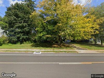
234 N Main St West Hartford, CT 06107
Estimated Value: $516,000 - $598,000
4
Beds
2
Baths
2,194
Sq Ft
$250/Sq Ft
Est. Value
About This Home
This home is located at 234 N Main St, West Hartford, CT 06107 and is currently estimated at $547,480, approximately $249 per square foot. 234 N Main St is a home located in Hartford County with nearby schools including Morley School, King Philip Middle School, and Hall High School.
Ownership History
Date
Name
Owned For
Owner Type
Purchase Details
Closed on
Sep 30, 1999
Sold by
Murphy Angeline R
Bought by
Marreu Gerald T and Marren Tammy M
Current Estimated Value
Home Financials for this Owner
Home Financials are based on the most recent Mortgage that was taken out on this home.
Original Mortgage
$120,000
Interest Rate
7.85%
Create a Home Valuation Report for This Property
The Home Valuation Report is an in-depth analysis detailing your home's value as well as a comparison with similar homes in the area
Home Values in the Area
Average Home Value in this Area
Purchase History
| Date | Buyer | Sale Price | Title Company |
|---|---|---|---|
| Marreu Gerald T | $165,000 | -- |
Source: Public Records
Mortgage History
| Date | Status | Borrower | Loan Amount |
|---|---|---|---|
| Open | Marren Tammy M | $375,000 | |
| Closed | Marren Gerald T | $250,000 | |
| Closed | Marreu Gerald T | $147,000 | |
| Closed | Marreu Gerald T | $40,000 | |
| Closed | Marreu Gerald T | $120,000 |
Source: Public Records
Tax History Compared to Growth
Tax History
| Year | Tax Paid | Tax Assessment Tax Assessment Total Assessment is a certain percentage of the fair market value that is determined by local assessors to be the total taxable value of land and additions on the property. | Land | Improvement |
|---|---|---|---|---|
| 2024 | $10,049 | $237,280 | $99,800 | $137,480 |
| 2023 | $9,709 | $237,280 | $99,800 | $137,480 |
| 2022 | $9,653 | $237,280 | $99,800 | $137,480 |
| 2021 | $9,216 | $217,260 | $99,800 | $117,460 |
| 2020 | $9,182 | $219,660 | $101,500 | $118,160 |
| 2019 | $8,913 | $213,220 | $101,500 | $111,720 |
| 2018 | $8,742 | $213,220 | $101,500 | $111,720 |
| 2017 | $8,751 | $213,220 | $101,500 | $111,720 |
| 2016 | $8,679 | $219,660 | $103,810 | $115,850 |
| 2015 | $8,415 | $219,660 | $103,810 | $115,850 |
| 2014 | $8,209 | $219,660 | $103,810 | $115,850 |
Source: Public Records
Map
Nearby Homes
- 2 High Point Ln
- 32 Brookside Blvd
- 1805 Asylum Ave
- 111 Montclair Dr
- 10 Wyndwood Rd
- 69 Linbrook Rd
- 3 Craigmoor Rd
- 88 Lawler Rd
- 1268 Trout Brook Dr
- 1404 Trout Brook Dr
- 132 Cliffmore Rd
- 30 Timrod Rd
- 118 Keeney Ave
- 140 Pioneer Dr
- 17 Tecumseh Rd
- 17 Fernridge Rd
- 310 Auburn Rd
- 341 Quaker Ln N
- 112 Whitman Ave
- 42 N Main St Unit 83