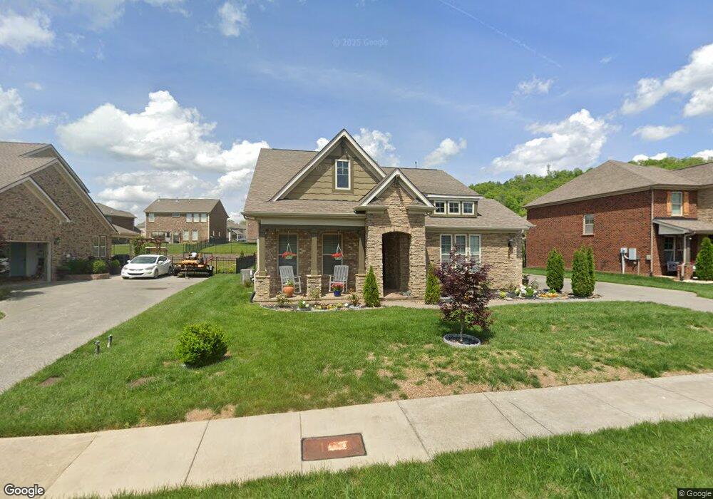
234 Whitestone Ln Unit 96 Gallatin, TN 37066
Estimated Value: $520,000 - $627,000
4
Beds
3
Baths
2,307
Sq Ft
$245/Sq Ft
Est. Value
About This Home
This home is located at 234 Whitestone Ln Unit 96, Gallatin, TN 37066 and is currently estimated at $566,095, approximately $245 per square foot. 234 Whitestone Ln Unit 96 is a home located in Sumner County with nearby schools including Station Camp High School.
Ownership History
Date
Name
Owned For
Owner Type
Purchase Details
Closed on
Mar 26, 2024
Sold by
Scott Family Trust and Scott Thomas E
Bought by
Scott Thomas E and Scott Mary Lynn
Current Estimated Value
Purchase Details
Closed on
May 27, 2016
Sold by
Lennar Homes Of Tennessee Llc
Bought by
Scott Thomas E and Scott Marylynn S
Home Financials for this Owner
Home Financials are based on the most recent Mortgage that was taken out on this home.
Original Mortgage
$75,000
Interest Rate
3.59%
Mortgage Type
New Conventional
Create a Home Valuation Report for This Property
The Home Valuation Report is an in-depth analysis detailing your home's value as well as a comparison with similar homes in the area
Home Values in the Area
Average Home Value in this Area
Purchase History
| Date | Buyer | Sale Price | Title Company |
|---|---|---|---|
| Scott Thomas E | -- | None Listed On Document | |
| Scott Thomas E | $313,490 | Foundation Title And Escrow |
Source: Public Records
Mortgage History
| Date | Status | Borrower | Loan Amount |
|---|---|---|---|
| Previous Owner | Scott Thomas E | $75,000 |
Source: Public Records
Tax History Compared to Growth
Tax History
| Year | Tax Paid | Tax Assessment Tax Assessment Total Assessment is a certain percentage of the fair market value that is determined by local assessors to be the total taxable value of land and additions on the property. | Land | Improvement |
|---|---|---|---|---|
| 2024 | $1,707 | $120,125 | $22,500 | $97,625 |
| 2023 | $2,594 | $84,975 | $12,000 | $72,975 |
| 2022 | $2,602 | $84,975 | $12,000 | $72,975 |
| 2021 | $2,568 | $83,875 | $12,000 | $71,875 |
| 2020 | $2,568 | $83,875 | $12,000 | $71,875 |
| 2019 | $2,568 | $0 | $0 | $0 |
| 2018 | $2,574 | $0 | $0 | $0 |
| 2017 | $2,574 | $0 | $0 | $0 |
| 2016 | $1,574 | $0 | $0 | $0 |
| 2015 | -- | $0 | $0 | $0 |
Source: Public Records
Map
Nearby Homes
- 337 Carellton Dr
- 137 Cavalcade Loop
- 319 Cloverbrook Way
- 360 Turfway Park
- 101 Santa Rosa Dr
- 172 Cavalcade Loop
- 315 Gulfstream Dr
- 249 Cavalcade Loop
- 70 Grindstone Dr
- 308 Cheval Dr
- 427 Deveron Dr
- 1670 Long Hollow Pike
- 2039 Liberty Ln
- 1616 Long Hollow Pike
- 402 Upper Station Camp Crk Rd
- 149 Upper Station Camp Crk Rd
- 1935 Liberty Ln
- 1087 Abberley Cir
- 1080 Abberley Cir
- 166 Jennings Rd
- 234 Whitestone Ln
- 238 Whitestone Ln Unit 97
- 238 Whitestone Ln
- 238 Whitestone Ln
- 230 Whitestone Ln Unit 95
- 230 Whitestone Ln
- 230 Whitestone Ln
- 218 Preston Ln Unit 173
- 218 Preston Ln
- 214 Preston Ln Unit 172
- 214 Preston Ln
- 226 Whitestone Ln Unit 94
- 226 Whitestone Ln
- 226 Whitestone Ln
- 231 Whitestone Ln
- 231 Whitestone Ln
- 222 Preston Ln Unit 174
- 222 Preston Ln
- 210 Preston Ln Unit 171
- 210 Preston Ln