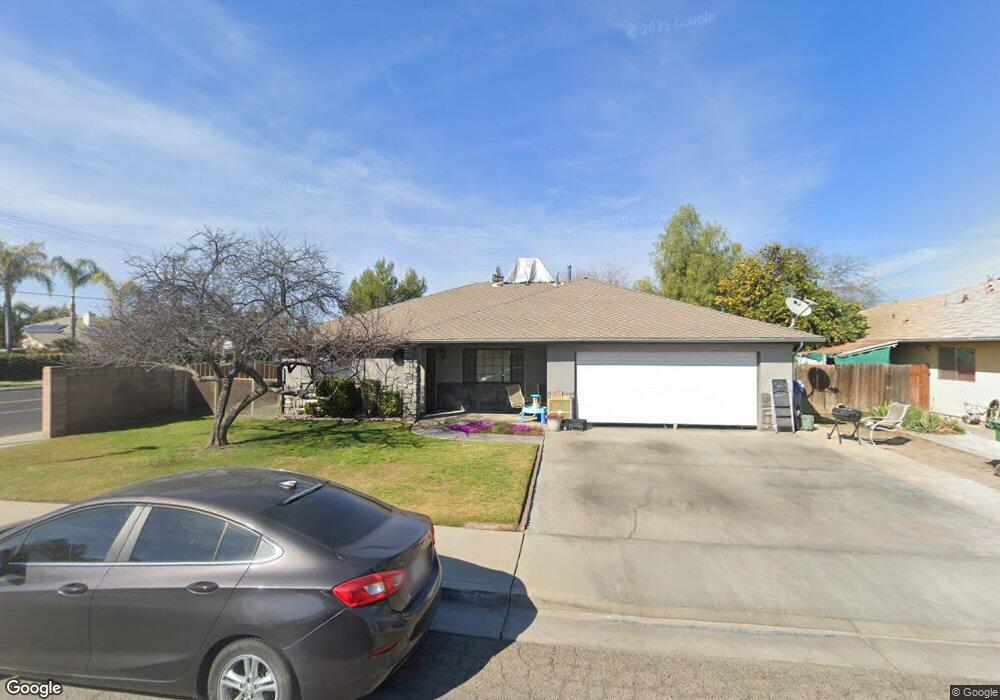
2340 W Kanai Ave Porterville, CA 93257
Porterville Northwest NeighborhoodEstimated Value: $305,000 - $382,000
3
Beds
2
Baths
1,463
Sq Ft
$235/Sq Ft
Est. Value
About This Home
This home is located at 2340 W Kanai Ave, Porterville, CA 93257 and is currently estimated at $344,226, approximately $235 per square foot. 2340 W Kanai Ave is a home located in Tulare County with nearby schools including Jim Maples Academy, Burton Middle School, and Monache High School.
Ownership History
Date
Name
Owned For
Owner Type
Purchase Details
Closed on
Feb 24, 1999
Sold by
Heisley Lyle
Bought by
Barrientos Jorge and Barrientos Pamela
Current Estimated Value
Home Financials for this Owner
Home Financials are based on the most recent Mortgage that was taken out on this home.
Original Mortgage
$94,850
Outstanding Balance
$22,858
Interest Rate
6.7%
Mortgage Type
VA
Estimated Equity
$321,368
Create a Home Valuation Report for This Property
The Home Valuation Report is an in-depth analysis detailing your home's value as well as a comparison with similar homes in the area
Home Values in the Area
Average Home Value in this Area
Purchase History
| Date | Buyer | Sale Price | Title Company |
|---|---|---|---|
| Barrientos Jorge | $93,000 | First American Title Co |
Source: Public Records
Mortgage History
| Date | Status | Borrower | Loan Amount |
|---|---|---|---|
| Open | Barrientos Jorge | $94,850 |
Source: Public Records
Tax History Compared to Growth
Tax History
| Year | Tax Paid | Tax Assessment Tax Assessment Total Assessment is a certain percentage of the fair market value that is determined by local assessors to be the total taxable value of land and additions on the property. | Land | Improvement |
|---|---|---|---|---|
| 2025 | $1,457 | $145,801 | $39,193 | $106,608 |
| 2024 | $1,457 | $142,943 | $38,425 | $104,518 |
| 2023 | $1,459 | $140,141 | $37,672 | $102,469 |
| 2022 | $1,401 | $137,394 | $36,934 | $100,460 |
| 2021 | $1,379 | $134,700 | $36,210 | $98,490 |
| 2020 | $1,352 | $133,319 | $35,839 | $97,480 |
| 2019 | $1,350 | $130,705 | $35,136 | $95,569 |
| 2018 | $1,289 | $128,142 | $34,447 | $93,695 |
| 2017 | $1,267 | $125,630 | $33,772 | $91,858 |
| 2016 | $1,206 | $123,167 | $33,110 | $90,057 |
| 2015 | $1,161 | $121,317 | $32,613 | $88,704 |
| 2014 | $1,161 | $118,940 | $31,974 | $86,966 |
Source: Public Records
Map
Nearby Homes
- 2434 W Kanai Ave
- 575 N Brandy Way
- 2300 W Morton Ave Unit 163
- 2300 W Morton Ave Unit 135
- 22346 W Thurman Ave
- 2219 W Theta Ave
- 22250 Avenue 154
- 2070 W Harrison Ave
- Sydney Plan at Laurelwood
- Carlton Plan at Laurelwood
- Carmel Plan at Laurelwood
- Aspen with Loft Plan at Laurelwood
- Aspen Plan at Laurelwood
- Hawthorne Plan at Brookside
- Walden Plan at Brookside
- Ashford Plan at Brookside
- Henley Plan at Brookside
- Kipling Plan at Brookside
- Naples Plan at Laurelwood
- 313 Balmoral Dr
- 2330 W Kanai Ave
- 2341 White Chapel Way
- 2331 White Chapel Way
- 2324 W Kanai Ave
- 571 Oxford Place
- 2321 White Chapel Way
- 2320 W Kanai Ave
- 570 Oxford Place
- 2404 W Kanai Ave
- 561 Oxford Place
- 2407 W Kanai Ave
- 2405 W White Chapel Ave
- 2311 White Chapel Way
- 601 Oxford St
- 2316 W Kanai Ave
- 2407 W Kanai Ave
- 2414 W Kanai Ave
- 2301 White Chapel Way
- 600 Oxford St
- 571 Wellington Place