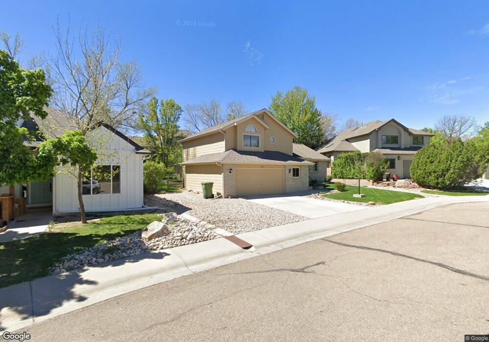
2342 Security Ct Loveland, CO 80538
Estimated Value: $527,427 - $612,000
4
Beds
4
Baths
1,762
Sq Ft
$322/Sq Ft
Est. Value
About This Home
This home is located at 2342 Security Ct, Loveland, CO 80538 and is currently estimated at $567,857, approximately $322 per square foot. 2342 Security Ct is a home located in Larimer County with nearby schools including Centennial Elementary School, Lucile Erwin Middle School, and Loveland High School.
Ownership History
Date
Name
Owned For
Owner Type
Purchase Details
Closed on
Aug 30, 1996
Sold by
Antell Robert S Josephine S
Bought by
Taylor Douglas A and Taylor Elizabeth O
Current Estimated Value
Home Financials for this Owner
Home Financials are based on the most recent Mortgage that was taken out on this home.
Original Mortgage
$20,000
Interest Rate
8.24%
Purchase Details
Closed on
Sep 1, 1992
Sold by
Biedron Michelle R
Bought by
Biedron Michelle R
Purchase Details
Closed on
Jun 1, 1992
Sold by
Antell Robert S
Bought by
Antell Robert S
Purchase Details
Closed on
Mar 1, 1992
Sold by
Northlands Ii Subdivision Joint Venture
Bought by
Antell Robert S
Create a Home Valuation Report for This Property
The Home Valuation Report is an in-depth analysis detailing your home's value as well as a comparison with similar homes in the area
Home Values in the Area
Average Home Value in this Area
Purchase History
| Date | Buyer | Sale Price | Title Company |
|---|---|---|---|
| Taylor Douglas A | $158,000 | -- | |
| Biedron Michelle R | -- | -- | |
| Antell Robert S | -- | -- | |
| Antell Robert S | $21,000 | -- |
Source: Public Records
Mortgage History
| Date | Status | Borrower | Loan Amount |
|---|---|---|---|
| Closed | Taylor Douglas A | $20,000 |
Source: Public Records
Tax History Compared to Growth
Tax History
| Year | Tax Paid | Tax Assessment Tax Assessment Total Assessment is a certain percentage of the fair market value that is determined by local assessors to be the total taxable value of land and additions on the property. | Land | Improvement |
|---|---|---|---|---|
| 2025 | $2,086 | $36,529 | $2,258 | $34,271 |
| 2024 | $2,012 | $36,529 | $2,258 | $34,271 |
| 2022 | $1,630 | $27,432 | $2,342 | $25,090 |
| 2021 | $1,675 | $28,222 | $2,410 | $25,812 |
| 2020 | $1,495 | $25,948 | $2,410 | $23,538 |
| 2019 | $1,469 | $25,948 | $2,410 | $23,538 |
| 2018 | $1,961 | $23,824 | $2,426 | $21,398 |
| 2017 | $1,688 | $23,824 | $2,426 | $21,398 |
| 2016 | $1,509 | $20,569 | $2,683 | $17,886 |
| 2015 | $1,496 | $20,570 | $2,680 | $17,890 |
| 2014 | $1,305 | $17,350 | $2,680 | $14,670 |
Source: Public Records
Map
Nearby Homes
- 3679 Wild Horse Ct Unit 3679
- 3890 Kremmling Dr
- 3902 Penrose Ave
- 2617 W 36th St
- 3477 Pinecliffe Ave
- 2465 Glen Isle Dr
- 3270 Nederland Dr
- 2070 Tonopas Ct
- 2920 Champion Cir
- 3016 Glendevey Dr
- 3131 Hiawatha Dr
- 2938 Glendevey Dr
- 2250 W 44th St
- 2554 W 44th St
- 2894 Empire Ave
- 3621 Adena Ct
- 1463 Caddoa Dr
- 4559 Keota Place
- 1532 Oak Creek Dr
- 3124 Williamsburg St
- 2330 Security Ct
- 3570 Granby Ct
- 2354 Security Ct
- 3569 Granby Ct
- 2318 Security Ct
- 3538 Granby Ct
- 2329 Security Ct
- 3571 Zinzer Ct
- 2306 Security Ct
- 3537 Granby Ct
- 3539 Zinzer Ct
- 2313 Security Ct
- 3504 Granby Ct
- 2294 Security Ct
- 3536 Delta Ct
- 3568 Delta Ct
- 3713 Minturn Dr
- 2383 Glen Haven Dr
- 2295 Security Ct
- 3574 Zinzer Ct