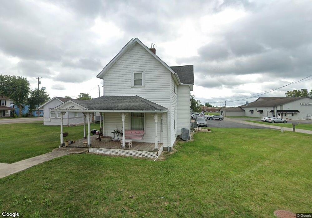
23484 State Route 739 Ave Raymond, OH 43067
Estimated Value: $176,788 - $236,000
2
Beds
1
Bath
1,604
Sq Ft
$131/Sq Ft
Est. Value
About This Home
This home is located at 23484 State Route 739 Ave, Raymond, OH 43067 and is currently estimated at $209,447, approximately $130 per square foot. 23484 State Route 739 Ave is a home with nearby schools including Raymond Elementary School, Creekview Intermediate Elementary School, and Bunsold Middle School.
Ownership History
Date
Name
Owned For
Owner Type
Purchase Details
Closed on
Oct 13, 2016
Sold by
Jackson Samuel D and Jackson Teresa L
Bought by
Jackson Samuel D and Jackson Teresa L
Current Estimated Value
Purchase Details
Closed on
Jun 21, 2007
Sold by
Johnson Ellen L and Johnson Randal Alan
Bought by
Scheiderer Nick P and Scheiderer Jeniffer L
Home Financials for this Owner
Home Financials are based on the most recent Mortgage that was taken out on this home.
Original Mortgage
$52,700
Interest Rate
6.2%
Mortgage Type
Purchase Money Mortgage
Create a Home Valuation Report for This Property
The Home Valuation Report is an in-depth analysis detailing your home's value as well as a comparison with similar homes in the area
Home Values in the Area
Average Home Value in this Area
Purchase History
| Date | Buyer | Sale Price | Title Company |
|---|---|---|---|
| Jackson Samuel D | -- | Attorney | |
| Scheiderer Nick P | $53,000 | None Available |
Source: Public Records
Mortgage History
| Date | Status | Borrower | Loan Amount |
|---|---|---|---|
| Closed | Scheiderer Nick P | $52,700 |
Source: Public Records
Tax History Compared to Growth
Tax History
| Year | Tax Paid | Tax Assessment Tax Assessment Total Assessment is a certain percentage of the fair market value that is determined by local assessors to be the total taxable value of land and additions on the property. | Land | Improvement |
|---|---|---|---|---|
| 2024 | $1,954 | $41,560 | $4,650 | $36,910 |
| 2023 | $1,954 | $41,560 | $4,650 | $36,910 |
| 2022 | $1,924 | $41,560 | $4,650 | $36,910 |
| 2021 | $1,777 | $32,860 | $3,590 | $29,270 |
| 2020 | $1,763 | $32,860 | $3,590 | $29,270 |
| 2019 | $1,751 | $32,860 | $3,590 | $29,270 |
| 2018 | $1,248 | $22,250 | $2,900 | $19,350 |
| 2017 | $1,180 | $22,250 | $2,900 | $19,350 |
| 2016 | $1,176 | $22,250 | $2,900 | $19,350 |
| 2015 | $1,045 | $18,370 | $2,900 | $15,470 |
| 2014 | $1,026 | $18,370 | $2,900 | $15,470 |
| 2013 | $941 | $18,370 | $2,900 | $15,470 |
Source: Public Records
Map
Nearby Homes
- 21630 Main St
- 23156 State Route 739
- 0 Powder Lick Rd Unit 1016484
- 21875 Liberty Rd W
- 20971 Peoria Loop Rd
- 0 Liberty Rd W Unit 225028227
- 25400 Storms Rd
- 24097 Lunda Rd
- 20499 Bear Swamp Rd
- 20350 Bear Swamp Rd
- 24805 Rapp Dean Rd
- 25883 Lunda Rd
- 0 Johnson Rd Unit 225027964
- 0 Johnson Rd Unit 222024368
- 0 Johnson Rd Unit Lot 2 222024351
- 0 Benton Rd Unit Lot B 225022637
- 0 Benton Rd Unit Lot A 225022636
- 1299 Forest Edge Dr
- 1322 Forest Edge Dr
- 19463 Bear Swamp Rd
- 21679 Ohio 739
- 28050 Ohio 739
- 22098 Ohio 739
- 21630 Ohio 347
- 21622 State Route 347
- 21652 Main St
- 21673 State Route 347
- 21614 Main St
- 23445 Dayton Ave
- 23445 Ohio 739
- 21614 Ohio 347
- 21664 Main St
- 23509 Shirk Ave
- 21608 State Route 347
- 21588 State Route 347
- 21588 Ohio 347
- 21581 Main St
- 23527 Shirk Ave
- 21644 Delaware St
- 21630 Raymond St